

Today’s Forecast:
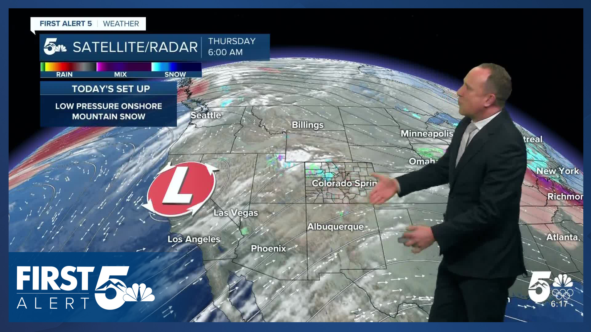
We're starting the day with west-southwest flow, leading to downslope warmth this morning across the Pikes Peak Region and eastern mountain slope regions. Some of us waking up to temperatures 15-20 degrees warmer than this time yesterday. Through the morning, you'll need a light jacket but no additional layers. Partly cloudy skies approaching the lunch hour. We're on the dry downslope side of our well-advertised storm system. Highs today on the Plains will warm into the upper 50s and 60s.
We'll track a very weak front this evening, bringing us a weak chance for an evening shower - if you see anything, it'd be a quick burst of moisture with low impacts.
Colorado Springs forecast: High: 59; Low: 30. Much like yesterday, our forecast will be warm this afternoon, with our high today around 10-15 degrees above average. A weak front that moves through the Pikes Peak Region tonight will bring a slight chance of showers to Colorado Springs. Snow level tonight looks to stay above 7,500 feet.
Pueblo forecast: High: 65; Low: 38. Instead of near average highs in the lower 50s, today will be dry and unseasonably warm, with our high today climbing into the middle 60s. Rain or snow is not expected for the next 24 hours.
Canon City forecast: High: 64; Low: 33. We'll likely stay dry in eastern Fremont County on Thursday as the bulk of the moisture stays in the mountains during the day and looks to skip over our area this evening.
Woodland Park forecast: High: 54; Low: 27. A mid-April looking forecast will be back in Teller County on Thursday, with highs in the mid 50s this afternoon. A weak disturbance arrives late this afternoon and evening, along with a small chance of showers.
Tri-Lakes forecast: High: 50s; Low: 20s. Dry skies during the day will give way to a few possible rain showers this evening. Temperatures will be well average this afternoon before turning cooler and unsettled on Friday.
Plains forecast: High: 60s; Low: 20s/30s. Dry weather and mild temperatures can be expected today on the Plains, with changes rolling in tomorrow as rain (not snow) picks up on the Plains Friday afternoon and evening. A few rogue showers will be possible this evening.
Walsenburg and Trinidad forecast: High: 50s/60s; Low: 20s/30s. Mild, dry and breezy conditions will continue on Thursday, with peak afternoon wind gusts up around 30 mph in the typical wind prone areas of Huerfano and Las Animas counties.
Mountains forecast: High: 40s/50s; Low: 20s/30s. While snow continues to fall this morning in our state's central and northern mountain ranges, it will mainly stay dry today for the Sangres and Wets. In the southeastern mountains, snow will increase region-wide during the day on Friday before wrapping up early Saturday morning.
Extended outlook forecast:
Friday will once again start off fairly mild and will be mainly cloudy. The main upper level low that's sending energy through the state today will pivot toward the Four Corners region by the afternoon. This will bring another round of snow to the mountains. Across Southern Colorado, the precipitation will arrive in the afternoon and evening. The cloud deck will slowly lower in the Pikes Peak Region Friday night. Precipitation will taper off Saturday morning. Snow levels will be quite high - in the 7,000-7,500 foot range. Some snow flakes could mix in with the rain as low as 6,500 feet during the evening hours.
Valentine's Day will bring clearing skies and highs in the middle 50s in Colorado Springs, and lower 60s in Pueblo and Canon City.
As has been the unfortunate theme this winter, ridging will return Sunday and Monday - which pushes temperatures back to the 60s and 70s Sunday and Monday.
It will be windy ahead of the next incoming storm system on Tuesday and Wednesday. Fire danger threats will become elevated across Southern Colorado, with snow for the mountains.
____
Curious about the First Alert 5 Weather Storm Impact Scale? Check out our cheatsheet explainer.
Watch KOAA News5 on your time, anytime with our free streaming app available for your Roku, FireTV, AppleTV and Android TV. Just search KOAA News5, download and start watching.
