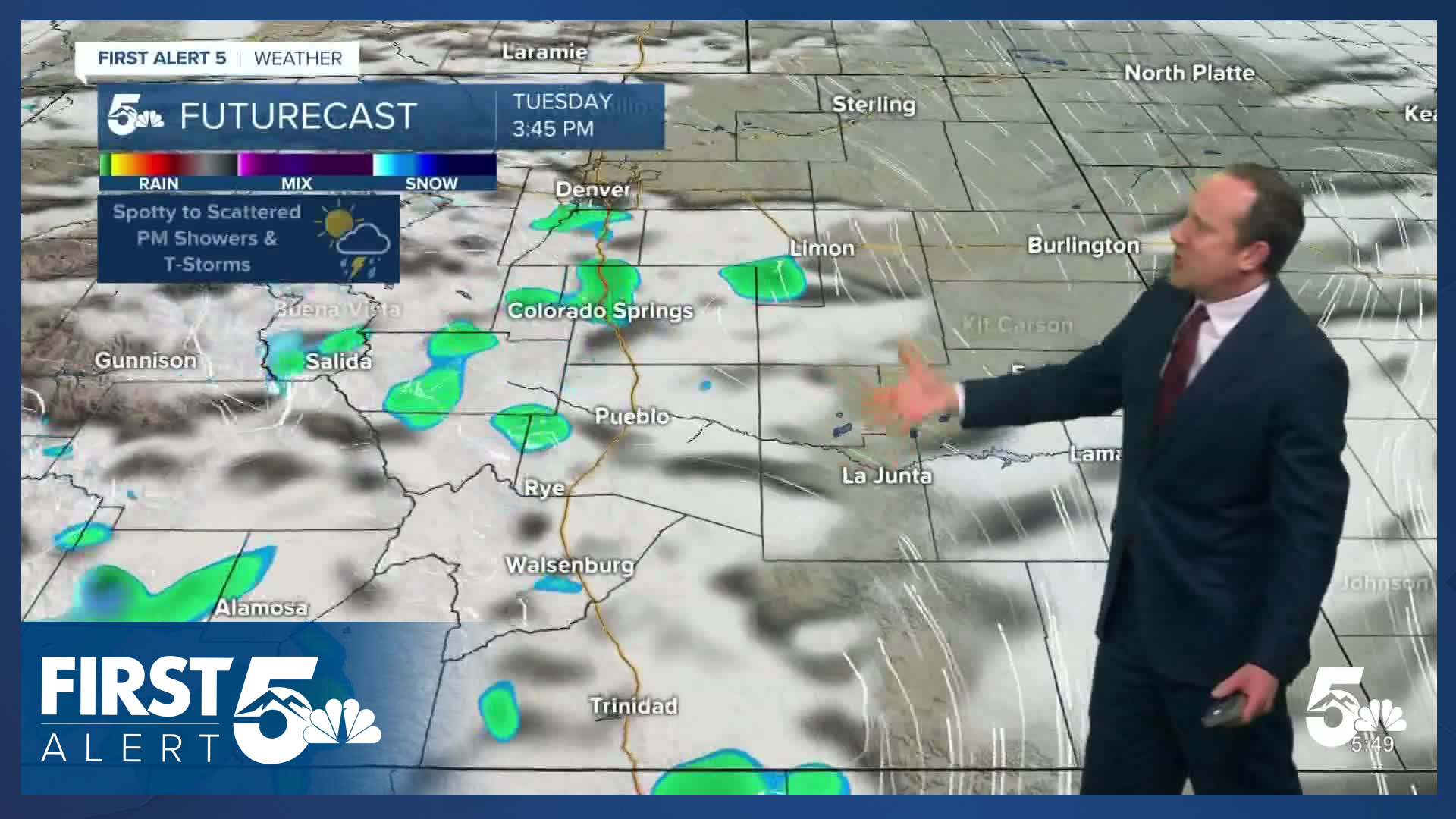


Today’s Forecast:
A weak area of low pressure tracking across New Mexico on Tuesday will send some moisture into Colorado, allowing for a chance for showers and thunderstorms. While the potential for a shower or thunderstorm could reach anyone from the San Luis Valley to the Plains, this will be a "rain for some, not for all" forecast. Showers will be spotty to scattered, and an isolated thunderstorm can't be ruled out. Best chances for rain today will be between the hours of 2-7 pm.
Highs today will be cooler, dropping back down to the 60s in Colorado Springs and Canon City, with upper 50s in Woodland Park, and lower 70s in Pueblo.
Colorado Springs forecast: High: 65; Low: 40. Cooling down to the mid 60s today after warming to 71 degrees on Monday. As moisture increases today, we'll see the possibility of showers and thunderstorms this afternoon, with any rain that falls wrapping up by sunset tonight.
Pueblo forecast: High: 70; Low: 38. Our weather on Tuesday will be May-like, driven by mild temperatures and a chance for showers and thunderstorms this afternoon. Rain chances in town will be around 30%.
Canon City forecast: High: 68; Low: 41. Partly cloudy skies early will give way to increasing clouds this afternoon and the potential for a few scattered showers and thunderstorms. Severe weather is not expected.
Woodland Park forecast: High: 58; Low: 33. Tuesday's highs will be around 5-8 degrees cooler than yesterday. Skies will turn unsettled this afternoon as showers and thunderstorms develop. Rain chances today will be around 50%.
Tri-Lakes forecast: High: 60s; Low: 30s/40s. Instead of snow this time of the year, we're tracking the potential for rain showers and thunderstorms this afternoon, with snow levels today expected to stay up above 9,000 feet.
Plains forecast: High: 60s/70s; Low: 30s/40s. Dry skies this morning will give way to a slight chance for showers and thunderstorms this afternoon on the Plains. Chances for rain today will be highest near I-25, rather than out east.
Walsenburg and Trinidad forecast: High: 60s/70s; Low: 30s/40s. Mild temperatures on Tuesday, with temperatures down slightly from what we saw yesterday afternoon. Skies will turn mostly cloudy this afternoon, with around a 40% chance for rain.
Mountains forecast: High: 40s/50s; Low: 20s/30s. Watch the skies this afternoon as a weak system traveling south of Colorado will bring an increased chance for rain showers, snow showers and thunderstorms to the southeastern mountains. Snow levels today will be at or above 9,000 feet.
Extended outlook forecast:
Drier weather will move in on Wednesday, giving temperatures a bump. Our high in Colorado Springs will rebound back to the lower 70s.
A strong storm pushing into California late this week will provide a boost in moisture to Colorado. Spotty showers and thunderstorms will be possible again by Thursday, with increasing chances for showers and thunderstorms from Friday into Saturday.
With daily highs in the 60s and 70s in Colorado Springs, and overnight lows in the upper 30s and 40s, snow is not expected this week or this weekend.
____
Curious about the First Alert 5 Weather Storm Impact Scale? Check out our cheatsheet explainer.
Watch KOAA News5 on your time, anytime with our free streaming app available for your Roku, FireTV, AppleTV and Android TV. Just search KOAA News5, download and start watching.
