

Today’s Forecast:
A combination of gusty downslope winds and a strong ridge of high pressure will lead to our hottest day of the year for Southern Colorado. Highs will soar into the upper 90s and lower 100s on the Plains, with 80s and lower 90s in Teller County and our mountain valleys.
A Heat Advisory will remain in effect today from 11 am to 7 pm for parts of El Paso, Pueblo and Fremont counties.

We also have a Red Flag Warning today from noon to 9 pm.

Colorado Springs forecast: High: 98; Low: 55. A HEAT ADVISORY has been issued today for El Paso County, and will remain in effect from 11 am to 7 pm. With our high in the upper 90s in Colorado Springs, you'll want to find a way to keep cool by avoiding strenuous outdoor activities during the hottest part of the day.
Pueblo forecast: High: 104; Low: 60. A HEAT ADVISORY will remain in effect from 11 am to 7 pm on Wednesday for Pueblo County, with today's highs expected to soar into the lower 100s. Today's record of 103° is likely to fall. It was last set in 2021. A RED FLAG WARNING will also be in effect today from noon to 9 pm.
Canon City forecast: High: 102; Low: 60. Eastern parts of Fremont County will be included in today's HEAT ADVISORY, with a RED FLAG WARNING also in effect this afternoon and evening. Highs today will top out in the lower triple digits.
Woodland Park forecast: High: 87; Low: 44. A RED FLAG WARNING will remain in effect today from noon to 9 pm. Driven by wind gusts to 35 mph, highs today will be our hottest of the year so far, topping out in the upper 80s.
Tri-Lakes forecast: High: 90s; Low: 50s. A HEAT ADVISORY will remain in effect today from 11 am to 7 pm as temperatures will rise into the lower to middle 90s. NW winds will pick up this afternoon, gusting around 30-35 mph.
Plains forecast: High: 90s/100s; Low: 50s/60s. With many locations warming into the triple digits on Wednesday, this will easily be our hottest day of the year so far. If you're spending time outdoors today, stay hydrated and take breaks to avoid any heat related illnesses.
Walsenburg and Trinidad forecast: High: 90s/100s; Low: 50s. It will be a really toasty day today along the southern I-25 corridor as some areas could crack into the triple digits this afternoon. We'll also see a RED FLAG WARNING today, in effect from noon to 9 pm.
Mountains forecast: High: 80s; Low: 40s. A RED FLAG WARNING will remain in effect in the high country today from noon to 9 pm. Driven by peak wind gusts to 45 mph, relative humidity will drop into the single digits at times this afternoon. Remember to avoid outdoor burning on any and all high fire danger days.
Extended outlook forecast:
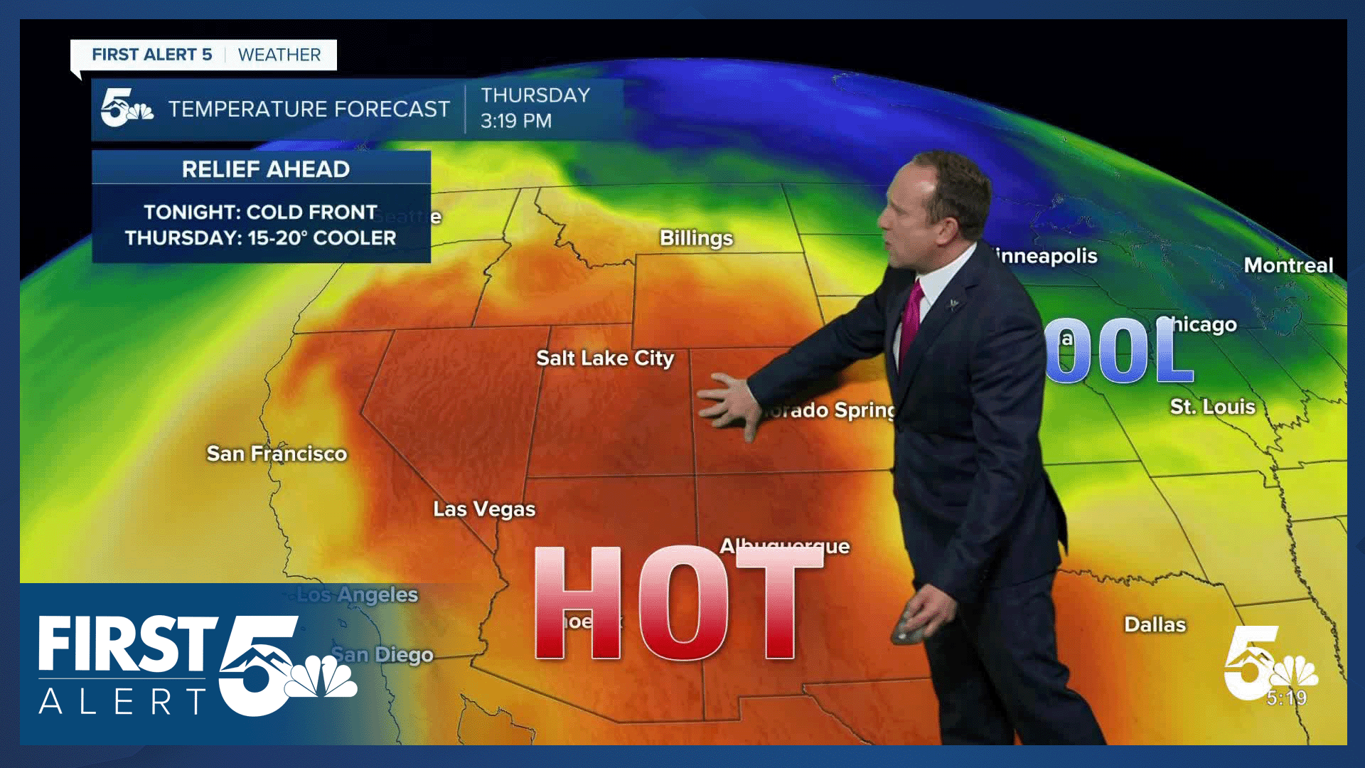
A cold front this evening will bring some relief to our forecast on Thursday. Our high in the Springs will go from 98°F today to a high of 81°F on Thursday, a change of nearly 20 degrees. Pueblo and Canon City will both see highs drop back down to the 80s on Thursday.
The cool down won't last long as highs shoot back up to the upper 80s Friday, and the lower to middle 90s by Saturday. Each day will feature mostly sunny to partly cloudy skies. On the eastern Plains, some areas could see triple digits back again by Saturday afternoon.
Warm temperatures will remain in place with upper 80s and 90s on the Plains on Sunday, and a chance for showers and thunderstorms by Sunday evening. Highs will continue to cool into early next week, with a daily chance of afternoon showers and thunderstorms across Southern Colorado.
____
Curious about the First Alert 5 Weather Storm Impact Scale? Check out our cheatsheet explainer.
Watch KOAA News5 on your time, anytime with our free streaming app available for your Roku, FireTV, AppleTV and Android TV. Just search KOAA News5, download and start watching.
