

Today’s Forecast:
Red Flag Warnings continue today in Colorado Springs — while it will be a rather cold day, the air will be very dry, and winds once again remain gusty. They won't be as strong as on Tuesday.
This morning you'll need to pack the layers --something that has not been needed much this February. In fact, as of this morning, the average temperature so far this February is the warmest on record...those records date back to 1894. The average temperature in Colorado Springs has been 43.3 degrees from the 1st to the 18th. That's partly driven by warm lows due to consistent downslope overnight winds. We've had our second warmest start by average highs: 57.3 is the average high month to date. The only time we had a warmer first 18 days with high temperatures was in 1954, when the average was 58.6 degrees in that time span.
Today, highs will only climb to the low 40s in the Pikes Peak Region. This will be only the 3rd day this month with a high in the 40s in Colorado Springs. In fact, this will be our coldest high so far this month. Region-wide on Thursday, highs will only warm into the 30s and 40s.
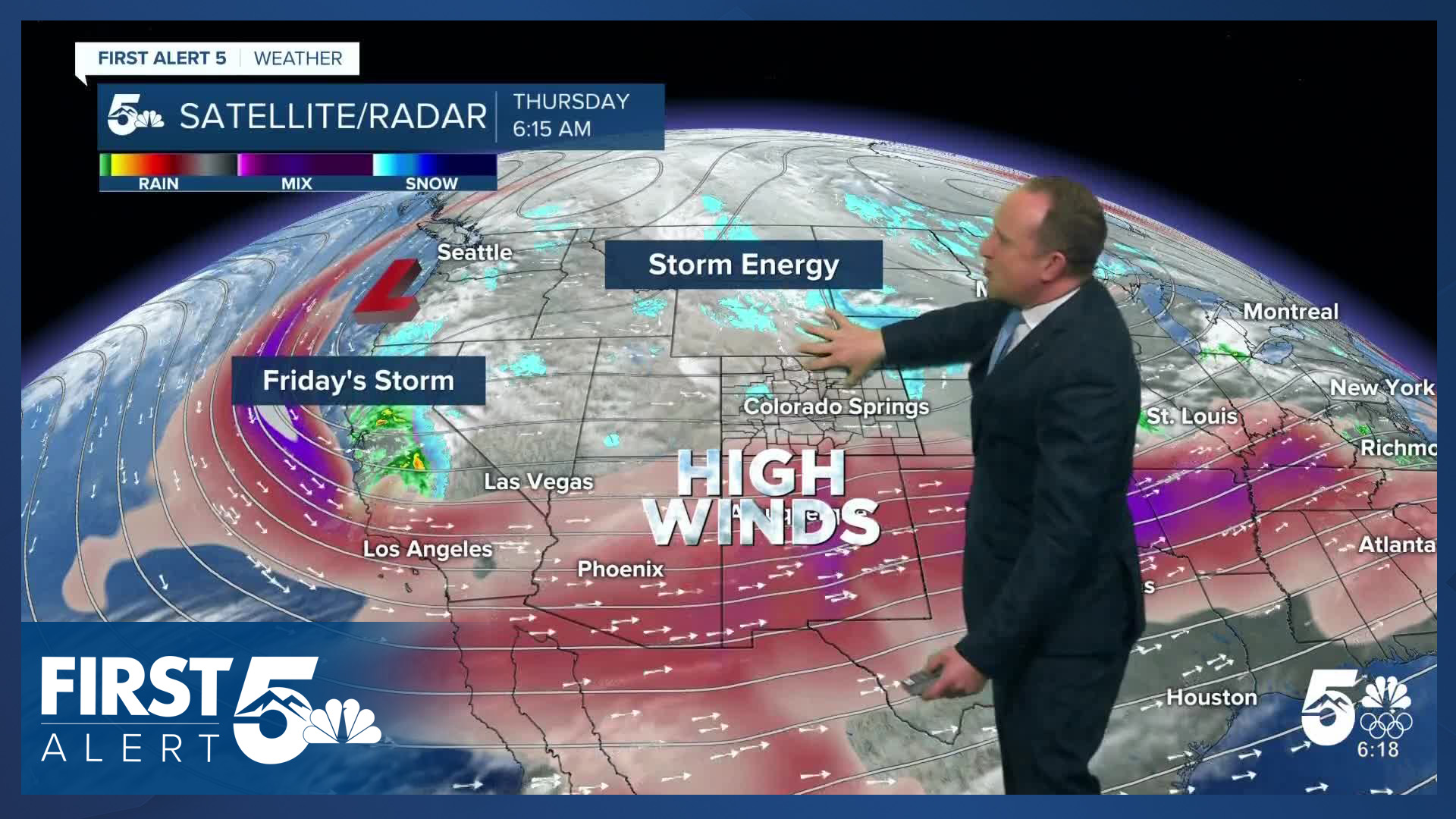
Despite the cold day, fire danger remains high, because the air stays dry and we stay gusty. Red Flag Warnings will be in effect from 10:00 AM - 7:00 PM. Expect humidity values this afternoon to drop below 15%, and winds from the west at 15-20 mph gusting to 30 mph in the Pikes Peak Region. Wind prone areas could see some gusts in the 40-45 mph range. Please continue to avoid outdoor burning and activities that could start a wildfire.
Colorado Springs forecast: High: 40; Low: 14. After warmer than average temperatures each afternoon this week so far, a colder airmass will nudge into the Pikes Peak Region on Thursday. Our high of 40 degrees this afternoon will be our coldest day of the month so far, and only our third time in the 40s. Fire danger will return as well, with a Red Flag Warning in effect from 10 am to 7 pm.
Pueblo forecast: High: 47; Low: 14. Below average highs, with more wind expected on Thursday. A Red Flag Warning will be into effect starting at 10 am, with occasional gusts today up to 40 mph.
Canon City forecast: High: 44; Low: 18. Red Flag Warnings are expected to return by last this morning over eastern Fremont County, with gusts today peaking at 40 mph. The wind will be cooler today, with our highs only in the lower to middle 40s.
Woodland Park forecast: High: 30; Low: 19. Roads are icy this morning in Woodland Park due to last night's quick burst of snow, and the Woodland Park School District is running on 2-hour delay. This afternoon, highs will stay below freezing, only warming to near 30 degrees.
Tri-Lakes forecast: High: 30s; Low: 10s. After a mild start to the week, colder temperatures can be expected late this week. Highs today will only climb into the middle to upper 30s, with W/NW wind gusts to 35 mph.
Plains forecast: High: 40s; Low: 10s/20s. Skies will clear to sunshine throughout the morning hours, with breezy to gusty NW wind today peaking at around 40 mph. Areas close to I-25 will be under a Red Flag Warning from 10 am to 7 pm, while areas out east will see high enough humidity to not meet criteria.
Walsenburg and Trinidad forecast: High: 30s/40s; Low: 10s/20s. A Red Flag Warning has been issued once again for the southern I-25 corridor, and will remain in effect from 10 am to 7 pm. Peak gusts today could top 45 mph in wind prone areas.
Mountains forecast: High: 10s/20s; Low: 0s. We'll see a break from snow in the mountains today, but not from the wind. Peak gusts in the Sangres may top 50 mph. By tonight, our chances for snow will increase, with more snow falling into the day on Friday.
Extended outlook forecast:
Another winter weather maker will arrive into the San Juans overnight heading into Friday morning. This system follows a similar track out of the Pacific Northwest to the departing system that provided significant mountain snowfall - and has led to Avalanche Warnings in many mountain zones today. Snow will become widespread in the mountains during the day on Friday. The system won't provide the same snow accumulations as the last system, and will not contain as much wind either. Nonetheless it will create slick road conditions.
In the Pikes Peak Region, Friday will be even chillier than today as a surface low pivots into the southeastern tier and we get upslope flow. Highs will only reach the mid 30s, wind chills in the 20s. There's a chance for light scattered snow showers due to the upslope flow, but moisture is poor across the plains. Accumulations of less than 1" are mainly expected in El Paso and Teller counties, with higher amounts for the southeastern mountains.
There is a chance for some low clouds and freezing fog on Friday night into Saturday morning - which could create minor travel issues.
High pressure begins to rebuild this weekend. Highs will be in the 40s Saturday on the Plains, with 40s to lower 50s by Sunday. The wind this weekend will be much lighter.
Conditions warm further early next week, with 60s and low 70s by Tuesday. That will come with another round of downslope breezes so fire risks will once again climb.
Stronger winds may return mid-week, as another jet streak pivots over Colorado.
____
Curious about the First Alert 5 Weather Storm Impact Scale? Check out our cheatsheet explainer.
Watch KOAA News5 on your time, anytime with our free streaming app available for your Roku, FireTV, AppleTV and Android TV. Just search KOAA News5, download and start watching.
