

Incoming Snow:
A WINTER STORM WATCH has been issued for northern El Paso County, Teller County, the Wet Mountains, Huerfano County, and Las Animas County. A WINTER WEATHER ADVISORY has been issued for the Sangre De Cristo Mountains. These will be in effect from Thursday afternoon through Friday morning.

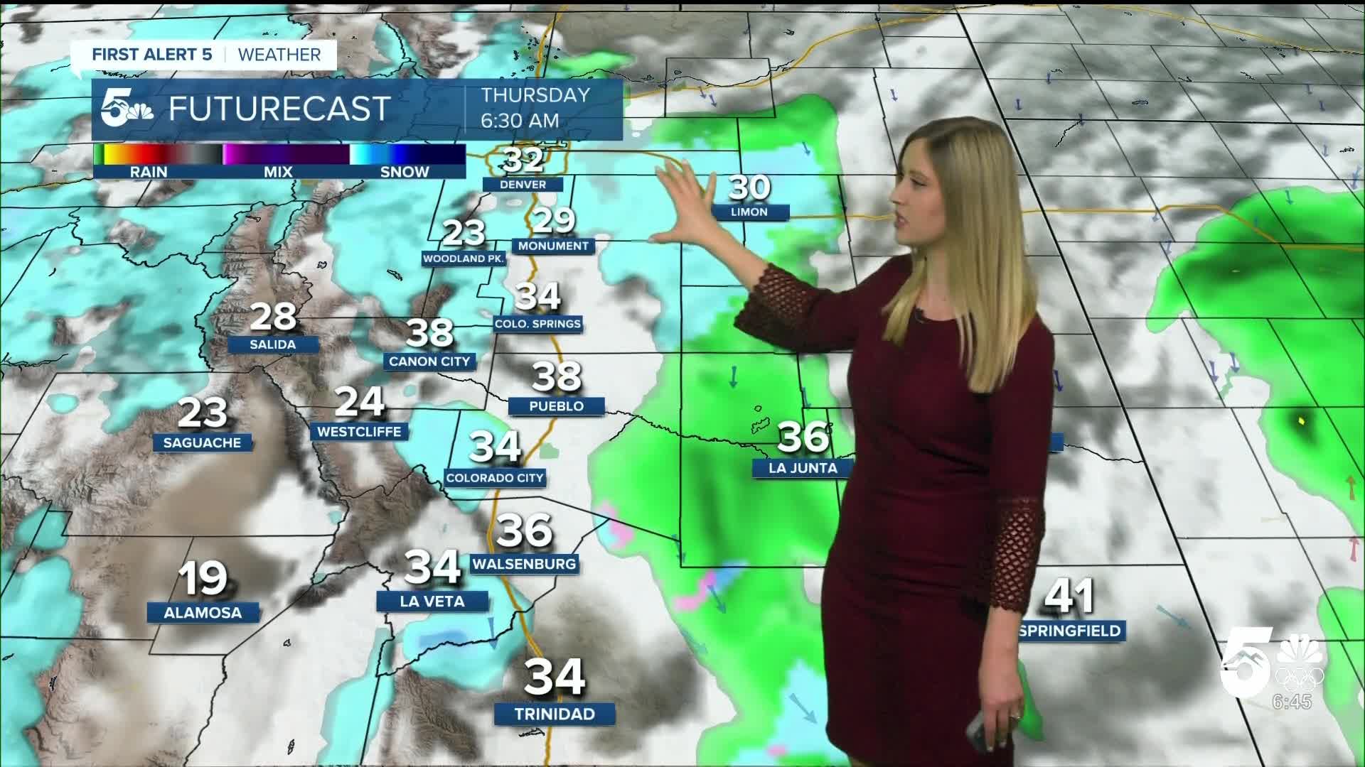
Colorado Springs forecast: Low: 31; High: 40;
It will be mostly cloudy on Thursday with a chance of light snow showers in the morning and early afternoon. Snow will be heavier in the evening as a cold front blows through the region.
Pueblo forecast: Low: 31; High: 47;
A rain-snow mix is possible late Thursday morning through the afternoon. A transition to snow, which may be heavy at times, is expected in the evening and overnight.
Canon City forecast: Low: 33; High: 44;
It will be cloudy with off-and-on snow showers on Thursday. The heaviest snow is expected in the evening and overnight.
Woodland Park forecast: Low: 23; High: 34;
There will be off-and-on snow showers throughout the day on Thursday with cold temperatures and cloudy conditions.
Tri-Lakes forecast: Low: 28; High: 36;
Snow showers are expected off and on throughout the day on Thursday. It will be cloudy and cold with a breeze.
Plains forecast: Low: 20s-30s; High: 40s-50s;
It will be mostly cloudy on Thursday with spotty rain and wintry mix showers, transitioning fully to snow in the evening, which may be heavy at times.
Walsenburg and Trinidad forecast: Low: 33/31; High: 46/51;
Thursday will be mostly cloudy with spotty light rain or a wintry mix during the day, with heavy snow arriving overnight.
Mountains forecast: Low: teens-20s; High: 30s-40s;
Light to moderate snow showers are expected off and on throughout the day on Thursday. Some of the heaviest snow will arrive at night into Friday morning.
Extended Outlook:
Friday will be cold with morning snow showers. The snow will end by early afternoon, but it remains cold and blustery. Wind will be out of the N at 10-20 mph, gusting 30-40 mph. Temperatures remain below freezing on Friday.
This weekend, the sun will be out, and temperatures will begin to rebound with near-average highs expected in the 40s.
Snow forecast through Friday afternoon:

____
Curious about the First Alert 5 Weather Storm Impact Scale? Check out our cheatsheet explainer.
Watch KOAA News5 on your time, anytime with our free streaming app available for your Roku, FireTV, AppleTV and Android TV. Just search KOAA News5, download and start watching.
