

Today’s Forecast:
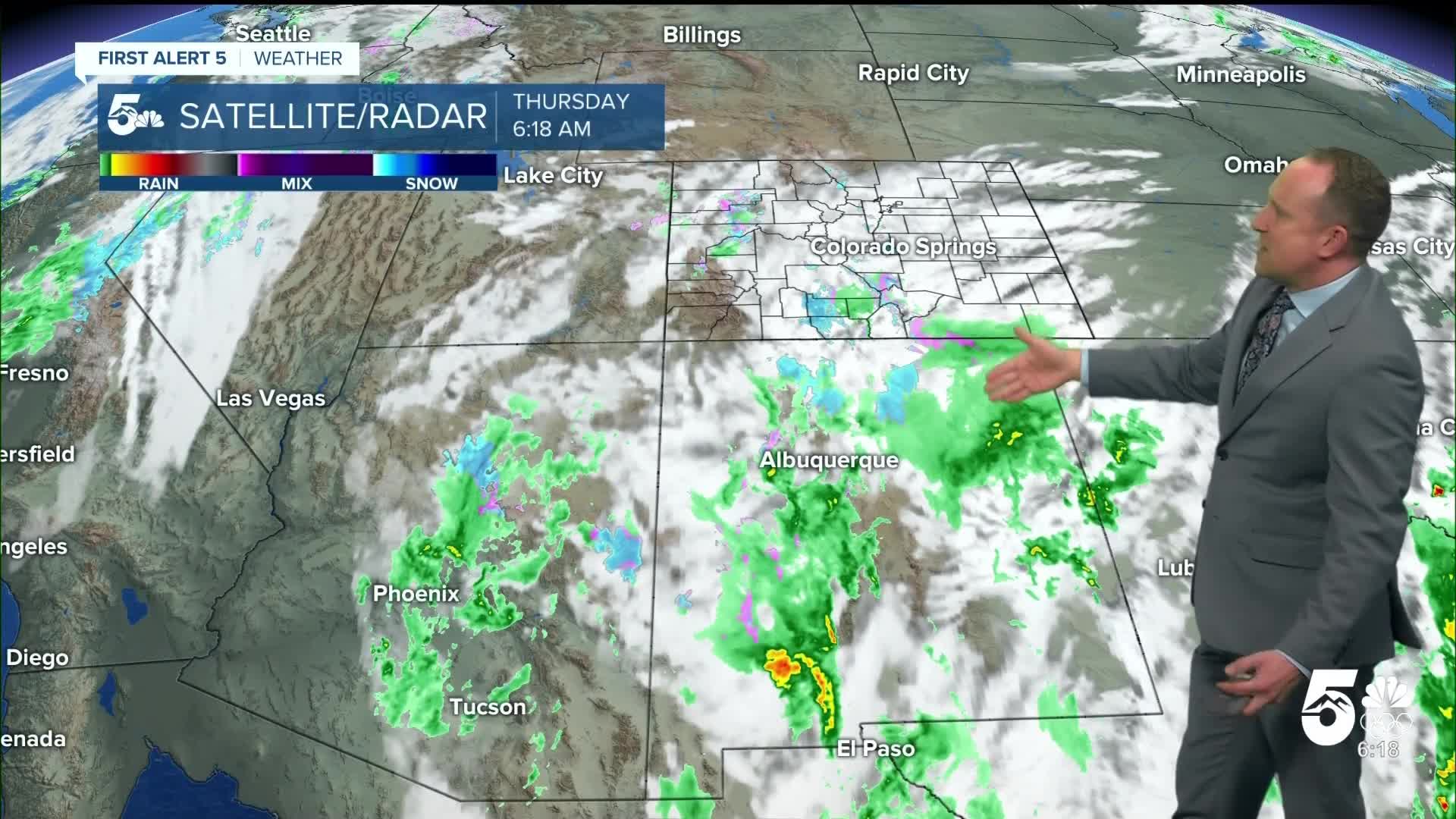
Our long-advertised storm system is arriving in Colorado. Rain and snow showers are spreading across the southern mountains this morning. A Winter Weather Advisory is in effect until 5 AM Friday for the Sangre de Cristo mountains, and the upper slopes of Pikes Peak. In these zones, 5-10" of snow is possible, mainly above 11,000 feet. Parts of the San Juan Mountains are also under a Winter Weather Advisory through late this evening.
Across the Pikes Peak Region, high and mid-level clouds will continue to stream in through the morning hours. The low is pivoting through Arizona, and will slowly track northeast. Isolated showers are possible through early this afternoon, with the chance of rain increasing this evening. The bulk of the rainfall, and any flakes, will fall tonight into Friday morning.
Temperatures today will top out cooler than earlier this week, warming into the 40s and 50s across Southern Colorado.
Tonight, upslope flow will develop as the storm system continues its slow progression through Arizona. This leads to steadier rainfall tonight into the overnight. Rain may be moderate at times, which has the potential to change the rain over to snow - primarily at higher elevations above about 6,500-7,000 feet, favoring the Palmer Divide, Black Forest, Air Force Academy, and other areas north of downtown. Flakes may fall overnight into the Pikes Peak Region, but it will be difficult for the snow to stick to road surfaces.
Colorado Springs forecast: High: 53; Low: 35. After a super dry November so far, the first of two storms will move into the Pikes Peak Region on Thursday. A slight chance of showers this morning will give way to better chances of rain by late this afternoon and evening. As cooler air arrives after sunset, snow level could drop down below 6,500 to 7,000 feet, but for most of the metro area, we are not expecting any accumulations.
Pueblo forecast: High: 55; Low: 34. Cooling highs on Thursday will come with increasing chances for rain this afternoon and evening. The heaviest rain will fall after sunset tonight, with rain showers ending early Friday morning.
Canon City forecast: High: 54; Low: 36. With today's cool down and showery weather, we will see a return to near average highs this afternoon. Rain will increase in coverage towards the afternoon hours, and due to the warmer nature of today's storm, snow is not likely in our area.
Woodland Park forecast: High: 44; Low: 27. A few flurries will be possible this morning in Woodland Park, but it looks like the bulk of today's storm won't arrive until this afternoon or this evening. Accumulations through tomorrow morning are expected to range between 1-4".
Tri-Lakes forecast: High: 40s/50s; Low: 20s/30s. Precipitation will increase in northern El Paso County this afternoon and evening, with snow levels expected to drop down to 7,000 feet or lower after sunset tonight. Due to the warm nature of the storm, this will be a slushy and wet snow, mainly sticking to grassy surfaces. Snow totals from a trace to 3".
Plains forecast: High: 50s; Low: 30s. Rain will continue to fall this morning south of Highway 50 and expand to the north during the day. The heaviest rain will fall this evening, with some areas seeing more than 1" of rain through Friday morning.
Walsenburg and Trinidad forecast: High: 40s/50s; Low: 20s/30s. Rain has already been falling in many areas this morning, with periods of rain and cooler temperatures expected to continue through this evening, with a low end chance of snow mixing with the rain after sunset.
Mountains forecast: High: 30s; Low: 20s. Winter Weather Advisories will remain in effect until 5 am Friday for the summit of Pikes Peak and the Sangres de Cristos. Accumulations of 5-10". Snow totals for the Wet Mountains will be around 1-3".
Extended outlook forecast:
Friday morning's commute will be impacted as rain and snow continue across the area. The Palmer Divide, and upper U.S. 24 corridor are the likeliest zones to be impacted by wet, slushy conditions. The warm nature of this storm suggests that any snow that does fall will be wet, heavy, and dense. Overall accumulations are not looking that impressive - with a few inches possible in Woodland Park, and a couple of inches possible in northern El Paso county. We cannot totally rule out a small amount of snow in Colorado Springs, but the majority of the precipitation will be rain. The mountains will get snow, and it is very sorely needed.
Conditions slowly improve heading into Friday afternoon as the system continues off to the east. It will be cool Friday, with highs in the upper 40s in Colorado Springs.
Saturday looks like the pick day this weekend with a brief ridge of high pressure moving overhead. Skies stay mainly sunny.
Another very similar system to today's approaches Sunday. This is likely to bring another round of rain and snow to Southern Colorado by Sunday afternoon, lingering into Monday morning. There is slightly more cold air with this next system, which slightly increases the chance of accumulating snow in Colorado Springs but timing will still be quite important. At the moment, it looks like another mainly rain set up.
Showers will wrap up Monday morning and conditions will clear in the afternoon. A blast of modified arctic and canadian air will head our way in the second half of next week and Thanksigiving is looking quite chilly.
____
Curious about the First Alert 5 Weather Storm Impact Scale? Check out our cheatsheet explainer.
Watch KOAA News5 on your time, anytime with our free streaming app available for your Roku, FireTV, AppleTV and Android TV. Just search KOAA News5, download and start watching.
