



Today’s Forecast:
High pressure will have a lock on our forecast today, and the result will be a healthy 5-8 degree boost to our highs. Temperatures will return to the lower 90s this afternoon in Colorado Springs, with middle to upper 90s for the eastern Plains.
Thunderstorms will be less numerous today, and while coverage will be highest in the mountains and foothills, a few sneaker storms could reach I-25 towards the mid to late afternoon hours. Storms will fizzle out pretty quickly as they move into the Plains this evening, with rain chances dropping off quickly east of I-25.
Colorado Springs forecast: High: 91; Low: 60. High temperatures will be much hotter than yesterday in the Pikes Peak Region, with a return to the lower 90s this afternoon. As storms move out of the mountains late this afternoon, some neighborhoods could see a quick passing shower.
Pueblo forecast: High: 97; Low: 62. Hot and mainly dry as temperatures soar into the upper 90s on Thursday. Rain chances will be low today, only around 20%.
Canon City forecast: High: 95; Low: 63. While showers and thunderstorms will be possible today in the surrounding mountains, rain chances across eastern Fremont County and the middle Arkansas River Valley will be fairly low this afternoon.
Woodland Park forecast: High: 82; Low: 53. Sunshine early will give way to spotty to scattered thunderstorms this afternoon. Storms today are not expected to turn severe.
Tri-Lakes forecast: High: 80s/90s; Low: 50s/60s. You probably won't need your umbrella today or tomorrow as rain chances will lower late this week as the heat builds. Highs today will top out in the upper 80s to near 90 degrees.
Plains forecast: High: 90s; Low: 60s. Thursday will usher in a break from storms, but the trade off will be some serious heat. Highs today will warm into the middle to upper 90s ahead of triple digits on Friday.
Walsenburg and Trinidad forecast: High: 80s/90s; Low: 50s/60s. While a few storms will be possible this afternoon along and near the southern I-25 corridor, rain chances will be lower today than what we saw on Wednesday.
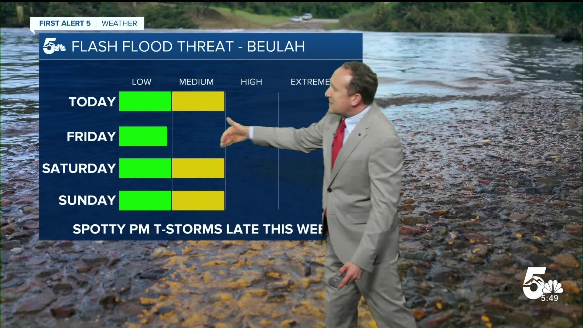
Mountains forecast: High: 70s/80s; Low: 40s/50s. Storms will favor the mountains today as topography favors thunderstorms development here compared to the Plains. Flood threats will be on the lower to moderate side today and tomorrow before increasing once again this weekend.
Extended outlook forecast:
Friday will be even hotter! Our forecast high in Colorado Springs of 94 degrees could be hot enough to tie the current record, which dates back to 2003. Much like today, storms will favor the mountain zones, with lower-end thunderstorm chances for the Pikes Peak Region and eastern Plains. Highs on the Plains will hit the 100s in the hottest areas.
Moisture will increase this weekend, which will allow for a return to scattered thunderstorms each afternoon from the mountains to the Plains. Although it will be slightly cooler, highs will remain above average, with highs in the 90s.
A daily chance of thunderstorms will remain in our forecast next week, with highs in the upper 80s in Colorado Springs.
____
Curious about the First Alert 5 Weather Storm Impact Scale? Check out our cheatsheet explainer.
Watch KOAA News5 on your time, anytime with our free streaming app available for your Roku, FireTV, AppleTV and Android TV. Just search KOAA News5, download and start watching.
