



COLORADO SPRINGS, Colo. (KOAA) — Today’s Forecast:
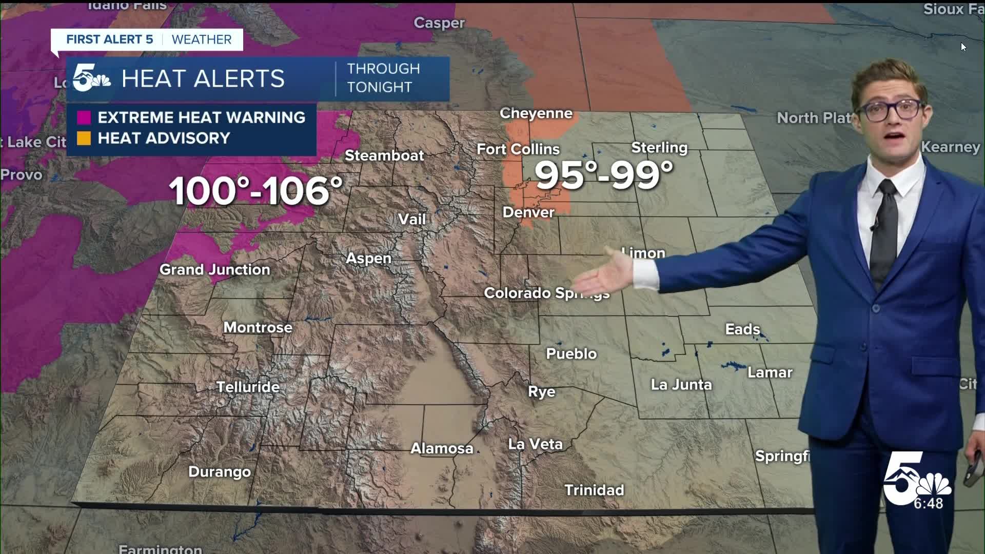
Sunny and hot today in southern Colorado, with our friend the big blue H, high pressure centered well to the north of the centennial state in the Dakotas, but the ridge still influencing the pattern locally. The hottest temperatures today will be in the northern Front Range from Denver north to Cheyenne, as well as in the northwestern corner of the state. A Heat Advisory is in place today for the Denver metro and northern Colorado, with an Extreme Heat Warning for the northwestern low elevations where triple digit heat is possible.
In southern Colorado, highs will be about 5 degrees above average today with sunshine through the day. It will be breezy this afternoon, with southeasterly winds, gusting to 25-30 mph in the mid-afternoon through tonight. The evening breeze will slow temperature drops tonight slightly as they keep the air mixed up. Combined with the already hot daytime highs.. if you've got an evening stroll in the plans...expect it to still feel notably warm after sunset.
Colorado Springs forecast: High: 90; Low: 59.
Sunny and hot today - worth keeping in mind this is on average when our hottest temperatures of the year are - so today's high of 90 is only 3 degrees above average. Still, that doesn't lessen the impact. Seek shade when you can! Breezy southeast winds at 10-20 mph, gusting 25-30 mph this afternoon.
Pueblo forecast: High: 95; Low: 64.
Sunny and hot, hot, hot. It's also supposed to be hot, hot, hot...today's average high is 94. East winds in the AM and not too notable. In the PM, they shift southeast and it'll be gusty with 10-20 mph sustained winds, and gusts to 30 mph.
Canon City forecast: High: 95; Low: 64.
Sunny and sizzling. Southeast winds at 5-10 mph in the AM, and 10-15 mph in the afternoon, gusting to 25 mph. A few clouds in the mid to late PM are your only non-tree or building related break from the sun today. They'll be coming from convection off to your west, so don't expect them to stick around if they do reach town.
Woodland Park forecast: High: 85; Low: 53.
Sunny, warm, and breezy. Southeast winds in the afternoon at 5-15 mph, gusting to 20 mph. You're somewhat wind sheltered today by the Pikes Peak Massif due to the wind direction.
Tri-Lakes forecast: High: 80s; Low: 50s.
Sunny, hot, and gusty. South winds at 10-20 mph, with gusts to 35 mph starting in the mid afternoon and continuing into the early overnight! It will remain fairly warm tonight as a result until the wind relaxes early on Tuesday morning.
Plains forecast: High: 90s; Low: 60s.
Sunny and hot with southeast winds at 15-25 mph, gusting to 35 mph this afternoon.
Walsenburg and Trinidad forecast: High: 92/94; Low: 62/61.
Sunny with south winds at 5-10 mph, gusting off-and-on to 20 mph this afternoon as some gravity waves periodically mix down slightly stronger wind further up in the sky.
Mountains forecast: High: 80s; Low: 50s.
Sunny with light easterly winds in the morning, but a bit breezy in the afternoon with sustained 10-15 mph wind and gusts of 20 to as much as 25 mph particularly in the late afternoon and evening.
Extended outlook forecast:
The pattern is fairly cut and dry...literally...this week. The ridge remains the dominant weather pattern, as it slowly meanders around the northern half of the country (taking a scenic tour). It will begin to weaken and shift southward in the second half of the week but it remains strong enough to still keep us warm and mostly sunny.
Monsoon-ish moisture is doing its best to work into the state, and will bring some good rainfall this week to the San Juans, and eventually to the central mountains. I say "ish" because it's still not quite the classic monsoon flow directionally - with the ridge axis in this case a little too far north. The origin of the moisture though is close to the monsoon pattern with flow close to the Gulf of California pulling in the subtropical moisture to the southwest. That moisture won't make it here to southern Colorado though for a bit. It's coming though.
In the mean time, expect each day to be very similar: upper 80s to mid 90s highs, mainly sunny, and breezy each afternoon this week.
____
Curious about the First Alert 5 Weather Storm Impact Scale? Check out our cheatsheet explainer.
Watch KOAA News5 on your time, anytime with our free streaming app available for your Roku, FireTV, AppleTV and Android TV. Just search KOAA News5, download and start watching.
