


Today’s Forecast:
A cool, cloudy start to Thursday sets the stage for another active day. Skies will partially clear by the end of the morning commute and the sunshine will allow for better surface heating compared to yesterday. This will destabilize the atmosphere by early in the afternoon. Upper-level energy will approach this afternoon too.
Severe thunderstorms require a recipe of sorts in the atmosphere - just like baking a cake. If you have some ingredients but not all, you're not going to get what you expect. Today we have every ingredient needed for strong storms in southern Colorado. It's important to note, though, that the strongest storms are likely to be east of I-25. Along I-25, storms will be more isolated storms, capable of small hail and frequent lightning. An isolated strong storm is still possible.
I expect storms will first fire off south of highway 50 this afternoon, in the wet mountains and over the Raton Mesa and track east northeast. Additional storms should fire over the Palmer Divide, and also track northeast. This activity will occur in the early to mid-afternoon (12 PM - 5 PM). These storms should be isolated, but will quickly gain strength as they tap into the available moisture and energy. If you live on the plains, today is a good day to stay weather aware - and if you have a carport or garage, be prepared to move your car inside if a severe thunderstorm warning is issued for your area.
A second batch of energy will move in from the northwest this evening, providing a second chance of storms north of highway 50.
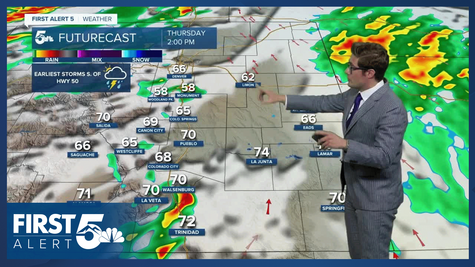
Colorado Springs forecast: High: 67; Low: 41.
Mostly cloudy skies early with fog dissipating, eventually we should see mostly clear skies by noon. You'll see clouds bubble up over the Palmer Divide and Pikes Peak in the early afternoon with the storms then pushing across I-25 and then east by 5:00 PM. Due to moisture limitations, storm chances are much better east of Colorado Springs today.
Pueblo forecast: High: 73; Low: 44.
Clearing skies through the morning, with a bit of an upslope breeze developing by noon. Isolated thunderstorms are possible this afternoon. The chance overall hinges on something called the dryline - a boundary between wet and dry air that will be oriented N-S in southern Colorado. It's debatable it will be far enough west to give Pueblo good moisture, so storm coverage should be isolated. However, the isolated storms will still be capable of small hail and gusty wind.
Canon City forecast: High: 71; Low: 45.
Partly cloudy becoming mostly sunny with isolated afternoon thunderstorms. Severe thunderstorm potential is low, but lightning will still be possible. Be prepared to seek shelter if you're planning outside activities today after 1:00 PM and before 7:00 PM.
Woodland Park forecast: High: 61; Low: 33.
Clearing skies this morning, but you shouldn't clear out completely - with partly cloudy skies at noon. Isolated afternoon thunderstorms.
Tri-Lakes forecast: High: 60s; Low: 30s.
The cloud deck will continue to move upward and clear through the morning. Isolated afternoon thunderstorms - with the potential for a strong to severe storm. These storms could contain up to quarter sized hail, and 60 mph wind gusts. The most likely storm timing is 2-7 PM, with a shower possible in the late evening.
Plains forecast: High: 70s; Low: 40s.
Severe thunderstorms are possible this afternoon, with large hail and strong wind gusts. Stay weather aware today with multiple ways to receive weather warnings. Be prepared to go inside if a warning is issued.
Walsenburg and Trinidad forecast: High: 72/76; Low: 43.
Isolated strong thunderstorms are possible this afternoon, with the potential for quarter sized hail and strong winds. The chance of severe weather is much lower than areas east, but it is non-zero. Storm timing is from 12 PM - 6 PM.
Mountains forecast: High: 60s; Low: 30s.
Partly cloudy this morning with isolated afternoon thunderstorms. Avoid being above treeline after 12 PM today.
Extended outlook forecast:
Upper level low pressure continues to pivot across the west over the next few days. A cold front will move across Colorado before sunrise on Friday. As a result, highs Friday will be slightly cooler - but the impact of the front is fairly minimal with temperatures. The front will dry out the air a bit though.
Thunderstorms remain possible on Friday afternoon, but they are less likely to be severe than today due to lower moisure - they could still contain frequent lightning, and gusty wind.
Storm chances continue on Saturday, with highs similar to today.
Sunday and Monday are drier and much warmer days, as high pressure builds. Highs will be in the upper 70s to low 80s. There will be mountain thunderstorm chances, with Monday having a higher chance than Sunday.
By Tuesday, another chance of storms will return to the plains, but they will be isolated.
____
Curious about the First Alert 5 Weather Storm Impact Scale? Check out our cheatsheet explainer.
Watch KOAA News5 on your time, anytime with our free streaming app available for your Roku, FireTV, AppleTV and Android TV. Just search KOAA News5, download and start watching.
