

Tonight's Forecast:
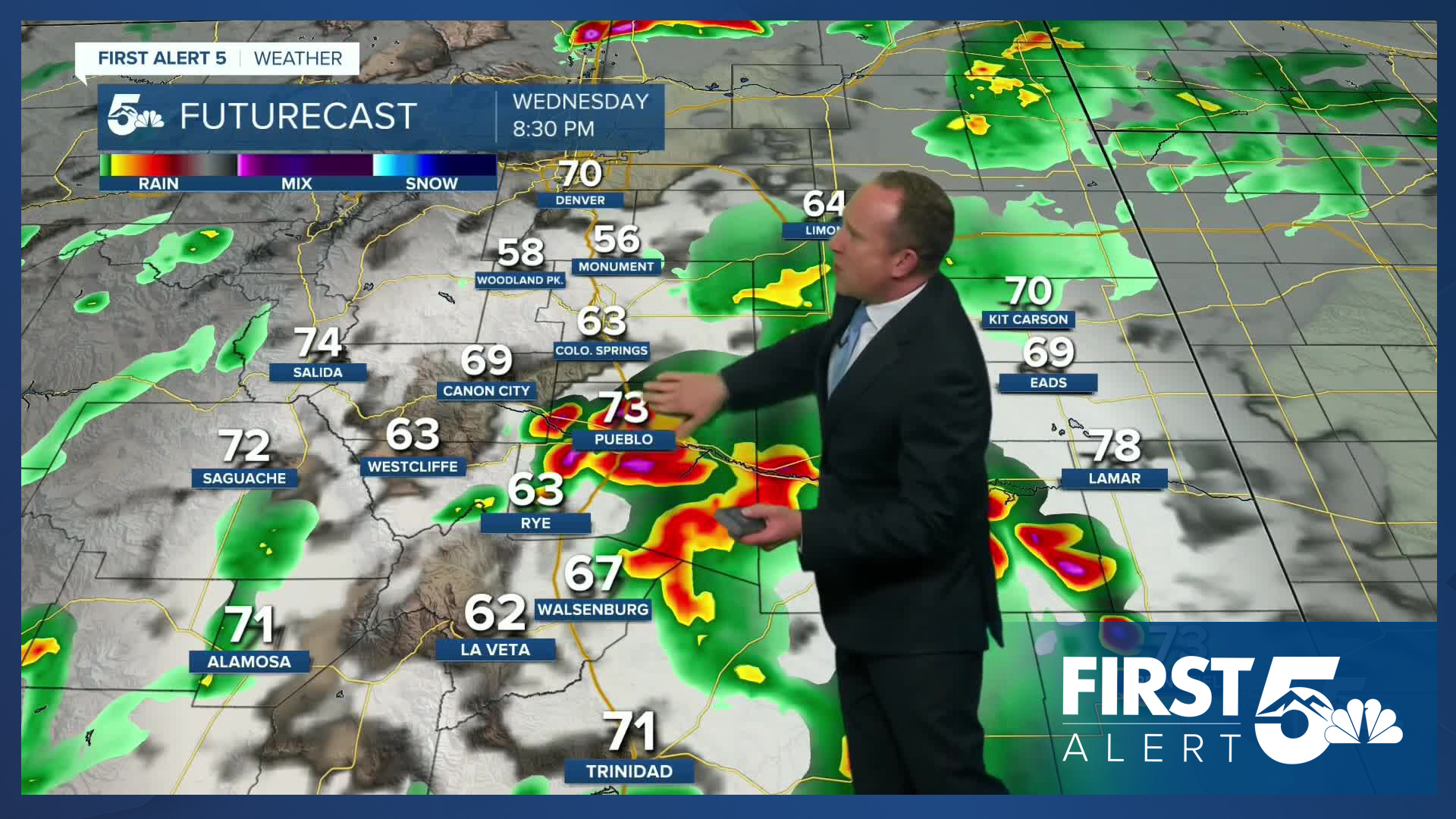
Our forecast will remain stormy and unsettled until late this evening, with much of eastern Colorado under a Severe Thunderstorm Watch until 10 pm. On top of the potential for very large hail and damaging wind gusts this evening, slow moving storms will also bring additional threats of flooding to Southern Colorado. Areas that saw flooding earlier today will be most susceptible to flooding tonight and tomorrow. This includes places like Fountain and Manitou Springs.
As the rain comes to an end later tonight, skies will turn partly cloudy by Thursday morning, with lows tonight cooling down to the 40s, 50s and 60s.
Colorado Springs forecast: Low: 54; High: 79; With plentiful moisture in place on Thursday, we're expecting an encore round of showers and thunderstorms in the Pikes Peak Region. While severe threats will be much lower than today, periods of heavy rain will once again be possible in some areas, along with a small risk of flooding.
Pueblo forecast: Low: 59; High: 85; Another round of showers and thunderstorms can be expected on Thursday, along with the potential for heavy downpours across Southern Colorado.
Canon City forecast: Low: 61; High: 83; On Thursday, we're expecting a second round of showers and thunderstorms across eastern Fremont County. Although severe threats will be lower than today, pockets of heavy rain will need to watched closely for flooding.
Woodland Park forecast: Low: 47; High: 74; Dry skies in the morning will give way to another round of showers and thunderstorms on Thursday, with storms capable of heavy rain, small hail and gusty winds. Storms will begin to form by the end of the lunch hour.
Tri-Lakes forecast: Low: 40s/50s; High: 70s; Cooling highs on Thursday, with temperatures dropping back down to the 70s in the afternoon. With an ample supply of moisture in place, scattered showers will return by early to mid afternoon.
Plains forecast: Low: 50s/60s; High: 70s/80s; After some pretty nasty storms on Wednesday, Thursday's storms should stay on the lower end of any severe threats. Flooding will be the main risk on the Plains, especially for areas that saw a lot of rain today.
Walsenburg and Trinidad forecast: Low: 50s; High: 70s/80s; Storms that form south of Highway 50 on Thursday are expected to bring the possibility of flooding. These storms will need to be watched closely, especially between 2-8 pm.
Mountains forecast: Low: 40s; High: 60s/70s; After the rain comes to an end this evening, dry skies will follow into Thursday morning. By late morning to early afternoon, storms will begin to fire off in the high country, with storms capable of heavy rainfall, small hail, gusty winds and a lot of lightning. The potential for flash flooding will be highest on Thursday in the southern Sangres and Raton Pass.
Extended outlook forecast:
Things will be much calmer by Friday, with only a few isolated storms expected across Southern Colorado, but still the potential for afternoon thunderstorms in the mountains and valleys. Our highs will rebound significantly, with temperatures climbing back into the 80s and 90s on the Plains.
Weekend storms will remain likely as subtropical moisture sits across the area. This will allow for a daily chance of scattered showers and thunderstorms, with highs each afternoon climbing into the 80s and 90s. By early next week, moisture looks to retreat back towards the mountains, bringing fewer storms to the Plains while boosting highs into the 90s and 100s.
____
Curious about the First Alert 5 Weather Storm Impact Scale? Check out our cheatsheet explainer.
Watch KOAA News5 on your time, anytime with our free streaming app available for your Roku, FireTV, AppleTV and Android TV. Just search KOAA News5, download and start watching.
