

Today’s Forecast:
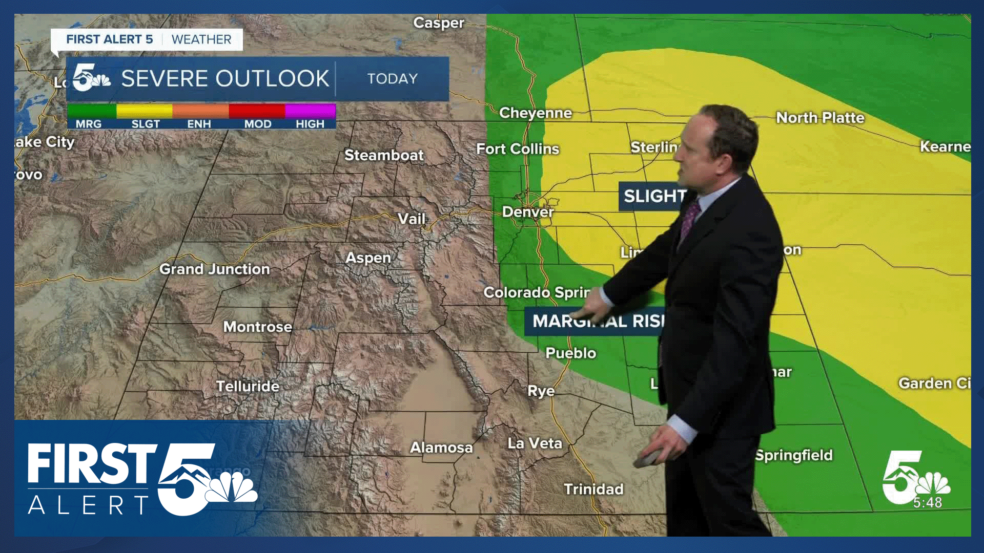
The first day of June will begin stormy and unsettled for parts of Colorado. Storms look to initiate between 1-2 pm along the Palmer Divide. With good terrain enhanced shear, these storms could bring 1-2" hail to areas east of I-25 this afternoon, with the best chances for severe weather on the eastern Plains. Other threats include: Gusty outflow winds, frequent lightning, heavy rain, and isolated tornadoes.
South of Colorado Springs, rain is not expected today from Canon City into Pueblo. These areas will warm into the 80s and lower 90s. In the Springs, we'll warm back into the lower 80s today, with a chance of a shower or thunderstorm during the afternoon or evening hours.
Colorado Springs forecast: High: 81; Low: 52. The start of June will begin warm, with a chance of showers and thunderstorms across the Pikes Peak Region this afternoon. Storms could pulse up today as early as 1-2 pm, with a low end chance of severe hail, mainly up near the Palmer Divide.
Pueblo forecast: High: 90; Low: 57. After a warm weekend, today's high will be even hotter as we top out in the lower 90s. Rain is not expected this afternoon, but that is likely to change in the mid-week period.
Canon City forecast: High: 86; Low: 56. The first week of June will begin warm and dry in eastern Fremont County, with today's highs expected to climb into the middle 80s.
Woodland Park forecast: High: 72; Low: 44. Showers and thunderstorms will be possible today in Teller County, forming as early as 12-1 pm. Although storms will be scattered today, any storms that do form will be capable of 1" hail and gusty outflow winds.
Tri-Lakes forecast: High: 70s; Low: 40s/50s. The Palmer Divide will be ground zero today for storms to form. Storm threats will increase as storms move into the Plains and away from I-25 and the mountains. Storms in eastern El Paso County could produce hail up to 2" in diameter, with an isolated tornado also possible.
Plains forecast: High: 80s/90s; Low: 50s. Storms that form early this afternoon near the mountains/Plains interface will move into a more favorable environment for severe weather. Storms on the eastern Plains will be capable of 1-2" hail, wind gusts to 60 mph, heavy rainfall, and an isolated tornado.
Walsenburg and Trinidad forecast: High: 80s/90s; Low: 50s. We should stay on the dry side of today's forecast, with showers not likely for areas south of Highway 50 on Monday.
Mountains forecast: High: 60s/70s; Low: 30s/40s. Mountain weather today should be nice, bright and breezy, with only a slight risk of showers and thunderstorms around Pikes Peak and throughout the southeaster mountains.
Extended outlook forecast:
Showers and thunderstorms will become more widespread in the mid-week period, with an increased risk of flooding both Tuesday and Wednesday. Afternoon thunderstorms will remain on the strong to severe side, especially on the eastern Plains.
During this more active period, highs will cool down to the 70s in Colorado Springs.
An isolated storm will be possible on Thursday ahead of a warm and dry Friday and weekend. Highs this weekend in Colorado Springs will warm into the middle to upper 80s.
____
Curious about the First Alert 5 Weather Storm Impact Scale? Check out our cheatsheet explainer.
Watch KOAA News5 on your time, anytime with our free streaming app available for your Roku, FireTV, AppleTV and Android TV. Just search KOAA News5, download and start watching.
