


Today’s Forecast:
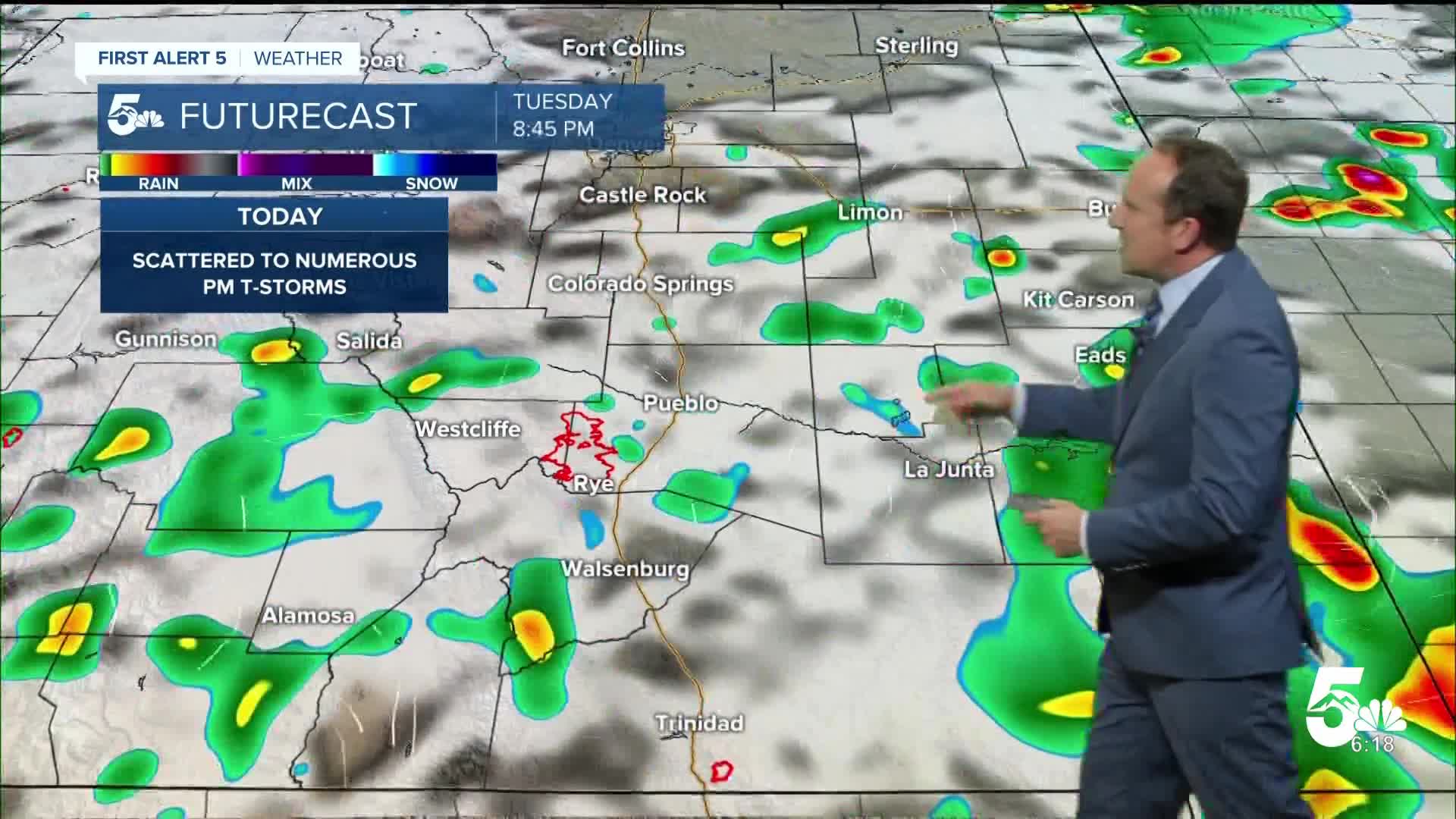
The monsoon will remain in place through the middle of the week, which will keep thunderstorm chances going strong in Southern Colorado.
Skies will start out bright and sunny again this morning before turning overcast and stormy this afternoon. Storms will fire off earlier than they did on Monday, first forming towards the high country around the lunch hour. I think that we could see storms reach the Pikes Peak Region and I-25 as early as 1-2 pm. Severe threats will be highest today on the far east Plains, with lower threats towards I-25. Any severe storms that do form today will be capable of large hail, gusty winds and heavy rainfall.
In the Aspen Acres burn scar, a FLASH FLOOD WATCH will remain in effect from 2-8 pm. These threats are likely to continue for at least the next few days.
Colorado Springs forecast: High: 87; Low: 57. Today will be a near carbon copy of what we saw on Monday, with a slightly higher risk of severe thunderstorms. Storms today look to form around 1-2 pm, and should wrap up around sunset this evening.
Pueblo forecast: High: 92; Low: 60. Temperatures today will be down a few notches from what we saw yesterday, but still above average. Scattered thunderstorms will try to form today by mid-afternoon, and could produce gusty winds, large hail, and heavy rainfall.
Canon City forecast: High: 90; Low: 61. Sunshine and pleasant temperatures this morning will give way to a hot and humid afternoon, with monsoon driven thunderstorms returning to our forecast today.
Woodland Park forecast: High: 79; Low: 49. Tuesday's forecast will be warm, with scattered afternoon and early evening thunderstorms. Keep an eye on the sky today anytime after 12-1 pm.
Tri-Lakes forecast: High: 80s; Low: 50s. Cool and calm conditions this morning will once again give way to another round of thunderstorms this afternoon. Storms today could produce larger hail and strong wind gusts, along with periods of heavy rain.
Plains forecast: High: 90s; Low: 60s. Hot and humid on Tuesday, with threats of strong to severe thunderstorms late this afternoon and evening. Storms today will be capable of ping pong ball sized hail and wind gusts to 60+ mph.
Walsenburg and Trinidad forecast: High: 80s/90s; Low: 50s. Tuesday's forecast will offer up more of the same, with scattered strong to severe thunderstorms possible by mid to late afternoon.
Mountains forecast: High: 70s; Low: 40s. Storms will pulse up early in the mountains, with some areas seeing rain as early as the lunch hour. Storms today will be capable of heavy rain and flash flooding, as well as frequent lightning. A FLASH FLOOD WATCH has been issued again today for the Aspen Acres burn scar.
Extended outlook forecast:
Behind a late day cold front on Tuesday, we'll see a few changes follow in the mid-week period. Highs on Wednesday will only warm into the 80s on the Plains, which is in line with seasonal averages. Strong to severe thunderstorms will be possible again on Wednesday, including a risk of large hail and strong wind gusts.
As high pressure builds back towards Arizona late this week, the monsoon flow will turn to "low", meaning less numerous showers and storms in the Pikes Peak Region and Southern Colorado. While we could still see a few storms on Thursday, shower chances will lower to around 20% by Friday and Saturday.
Highs will warm into the middle 80s on Thursday in Colorado Springs, with 90s returning Friday and Saturday.
____
Curious about the First Alert 5 Weather Storm Impact Scale? Check out our cheatsheet explainer.
Watch KOAA News5 on your time, anytime with our free streaming app available for your Roku, FireTV, AppleTV and Android TV. Just search KOAA News5, download and start watching.
