



Today’s Forecast:
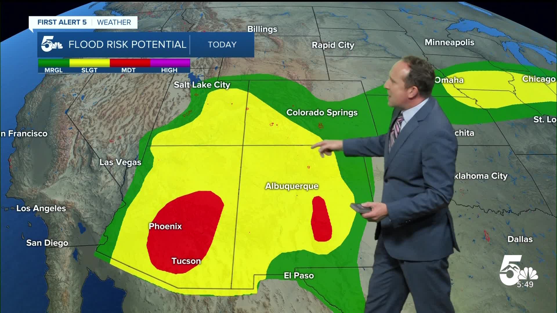
A strong disturbance coming out of New Mexico will bring the potential for heavy rain to reach southwestern Colorado throughout the day on Wednesday, where Flood Watches will remain in effect until midnight tomorrow night. Closer to home, showers and thunderstorms will be possible late this afternoon and evening, but will be more on the spotty to scattered side.
After highs in the low 70s in Colorado Springs and Pueblo on Tuesday, highs will rebound by as much as 5-10 degrees today, with a return to 70s and 80s region-wide. Temperatures this afternoon will be near average for this time of the year.
Colorado Springs forecast: High: 79; Low: 55. After only warming into the lower 70s on Tuesday, highs will rebound into the upper 70s this afternoon as we re-introduce a chance for showers and thunderstorms today to the Pikes Peak Region.
Pueblo forecast: High: 82; Low: 58. Tuesday's high of 71°F was our coolest daytime high in more than three months. Today's highs will rebound to the lower 80s, with a chance of late afternoon and evening thundershowers.
Canon City forecast: High: 81; Low: 59. Tuesday's fall-like weather will give way to a warm-up on Wednesday and a better chance for rain showers and scattered thunderstorms this afternoon and evening.
Woodland Park forecast: High: 74; Low: 46. After Tuesday's cool down and a couple of calmer weather days, our chances for rain will increase starting today, with a daily threat for rain continuing into the weekend.
Tri-Lakes forecast: High: 70s; Low: 50s. Tuesday's weather was great, with Wednesday's weather turning warmer and more unsettled. A chance of showers and storms will return to our forecast late this afternoon and evening.
Plains forecast: High: 80s; Low: 50s/60s. Dry skies this morning will give way to spotty to scattered thunderstorms this afternoon, with rain for some, not for all.
Walsenburg and Trinidad forecast: High: 70s/80s; Low: 50s/60s. Starting today, moisture will surge northward into Colorado, leading to better chances for rain and perhaps some help from our state's ongoing drought.
Mountains forecast: High: 60s/70s; Low: 40s. The San Juan Mountains will be under a Flood Watch until late Thursday night, with the heaviest rain late this week along and west of the Continental Divide. In the southeastern mountains, storms will be scattered throughout the day, with a small risk of flash flooding in the Aspen Acres burn scar.
Extended outlook forecast:
Flood Watches will continue on Thursday in southwestern Colorado, with spotty to scattered storms once again possible in the Pikes Peak Region. Our high on Thursday will warm back into the upper 70s.
Rain chances will stay around 30-40% on Friday, with little change to our highs. By the weekend, rain chances will increase as a trough of low pressure translates across the northern Rockies. This will send a cold front into Southern Colorado, dropping highs back down to the lower 70s by Sunday.
Next week's forecast maintains at least a small chance for showers, with highs warming into the low to mid 70s.
____
Curious about the First Alert 5 Weather Storm Impact Scale? Check out our cheatsheet explainer.
Watch KOAA News5 on your time, anytime with our free streaming app available for your Roku, FireTV, AppleTV and Android TV. Just search KOAA News5, download and start watching.
