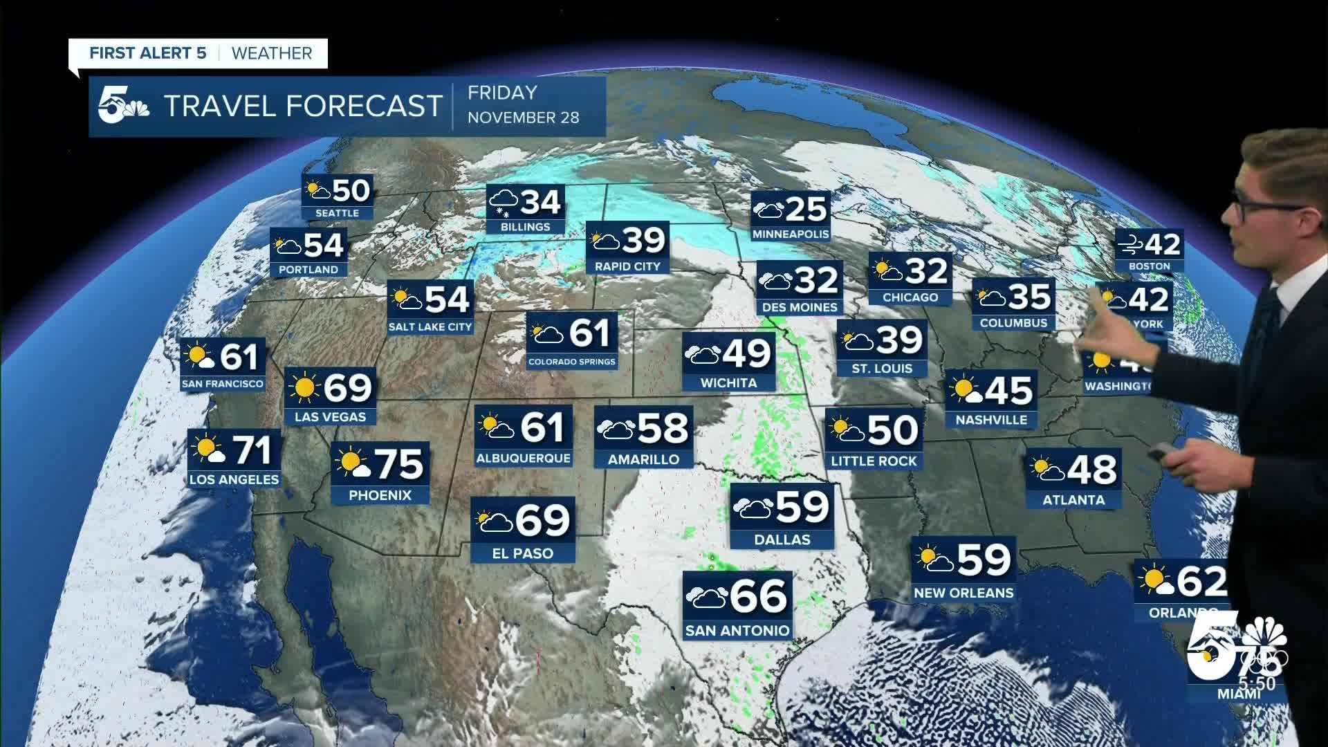
Today’s Forecast:
Thanksgiving brings seasonal temperatures to southern Colorado - which will feel cool, mostly because of how mild November has been.
You can expect a few early high clouds, that clear out heading into late morning. Most of the day is sunny to mostly sunny, with some clouds returning this evening. Breezy this morning over the Palmer Divide, and it stays breezy in the mountains today - but otherwise, winds stay fairly light in the rest of southern Colorado.
Colorado Springs forecast: High: 49; Low: 27.
Mostly sunny and pleasant this Thanksgiving! Southeast winds this afternoon at 5-10 mph. Winds will be more variable closer to the mountains west of I-25, but still generally light. Today's average high is 49, and my forecast is right on that mark.
Pueblo forecast: High: 53; Low: 25.
Sunny and mild - crisp and pleasant. East winds at 5-10 mph.
Canon City forecast: High: 53; Low: 31.
Mostly sunny, with high clouds late in the afternoon. Southeast winds at 5-10 mph.
Woodland Park forecast: High: 50; Low: 28.
Sunny and mild with southwest winds at 5-10 mph.
Tri-Lakes forecast: High: 50s; Low: 20s.
Sunny and quiet with south winds at 5-15 mph. In the Black Forest area you may notice some slightly stronger gusts in the mid-afternoon, otherwise - a very nice day!
Plains forecast: High: 50s; Low: 20s.
Sunny with northwest winds at 5-10 mph shifting east at 5-10 mph this afternoon.
Walsenburg and Trinidad forecast: High: 55/57; Low: 28/31.
West winds at 5-10 mph in the morning, becoming variable but generally easterly this afternoon. Overall - quiet and pleasant.
Mountains forecast: High: 30s/40s; Low: 10s/20s.
Sunny with northwest winds at 5-10 mph, shifting southwest this afternoon at 5-15 mph. Gusty above 9,000 feet of elevation.
Extended outlook forecast:
Friday is a great day to get outside - if you can - ahead of a big-time chill on the way this weekend. Downslope breezes will crank up out of the west southwest, particularly during the afternoon. They'll be noticeable west of I-25 where a few gusts in the 20-25 mph range seem possible...enough to notice if you're recreating outside. Further east, you won't notice the wind as much but the compressional warming, and a weak boundary moving east, will contribute to a noticeable jump in highs - to the upper 50s to low 60s.
A potent arctic cold front sweeps through before sunrise Saturday. It may bring snow showers, mainly north of highway 24 - some slick spots are quite possible over the Palmer Divide. Otherwise, it brings gusty winds and clouds to the sky Saturday and temperatures will only be in the 30s across southern Colorado.
Another system will arrive on Sunday. It will remain cold on Sunday with highs in the upper 20s to low 30s. Clouds increase in the afternoon with snow showers possible Sunday night to Monday morning. In Colorado Springs, there are a few first snowfalls in December on record, but filtering for only years in which records are considered reliable, we only have 2: December 2nd, 2016, and December 31st, 2021. The third latest is November 28th, 2010. If we get accumulating snow this weekend, it will be the third latest reliable-record first snowfall on record. If we don't before Tuesday, we'd be slotting in at number 2.
Temperatures stay chilly through Monday, with a bit of a warm up Tuesday before more arctic air grazes the area mid-week.
____
Curious about the First Alert 5 Weather Storm Impact Scale? Check out our cheatsheet explainer.
Watch KOAA News5 on your time, anytime with our free streaming app available for your Roku, FireTV, AppleTV and Android TV. Just search KOAA News5, download and start watching.


