


Today’s Forecast:
An upper level low is again the main weather driver in southern Colorado on Friday. A cold front moved south overnight, and highs today will be cooler than on Thursday, but not by much. That front did reduce moisture in the air though.
Skies will be partly cloudy today, with energy moving in during the late afternoon and providing chances for an isolated shower or thunderstorm between then and dinnertime.
Severe weather is unlikely today.
Skies will be partly cloudy this evening.
Colorado Springs forecast: High: 63; Low: 42.
Decreasing morning clouds becoming partly cloudy by noon. Increasing clouds in the afternoon, with isolated showers and thunderstorms possible in the late afternoon to the evening hours. These storms won't be severe, just have an umbrella in your car if you've got evening plans. Mid-day plans should be fine (dry) though you'll notice the cooldown in temperatures compared to yesterday.
Pueblo forecast: High: 70; Low: 44.
Partly cloudy becoming mostly sunny by noon. Isolated late afternoon to evening thunderstorms and increasing evening clouds. Upslope easterly winds at 10-15 mph.
Canon City forecast: High: 66; Low: 47.
Mostly sunny with isolated late afternoon to evening weak showers and t-storms. Otherwise increasing clouds after 2 PM becoming mostly cloudy by sunset.
Woodland Park forecast: High: 59; Low: 34.
Partly cloudy becoming mostly sunny by noon, then once again becoming mostly cloudy by sunset. Scattered thunderstorms this afternoon after 2 PM, non-severe. Fairly high probabilities though (70%)! Definitely keep an umbrella or rain jacket handy.
Tri-Lakes forecast: High: 50s; Low: 40s.
Partly cloudy through the AM hours, with increasing sunshine. Isolated sprinkles possible after 2PM, with shower and t-storm chances from 3-8 PM. No severe weather expected, but storm probabilities are high. So, some beneficial moisture for your lawn, keep an umbrella handy, and aim to get the early PM walk done before 3 if you can.
Plains forecast: High: 70s; Low: 40s.
After yesterday's hail, wind, and tornadoes...today sure is looking a lot nicer! Mostly sunny skies for the morning and early afternoon hours. You'll get a decent amount of evapotranspiration by noon, so if you're a farmer or live close to active farms you'll feel noticeable humidity in the air (a little bit sticky). By tonight, isolated showers and t-storms will push in from the west in a broken line. Severe weather is unlikely but storms as usual could contain gusty wind.
Walsenburg and Trinidad forecast: High: 65/69; Low: 42/41.
Mostly sunny through the mid-afternoon, then increasing clouds. Scattered late afternoon thunderstorms are possible.
Mountains forecast: High: 60s; Low: 30s.
Sunny until early afternoon, then increasing clouds. In the southern mountains, isolated to scattered late afternoon and evening thunderstorms.
Extended outlook forecast:
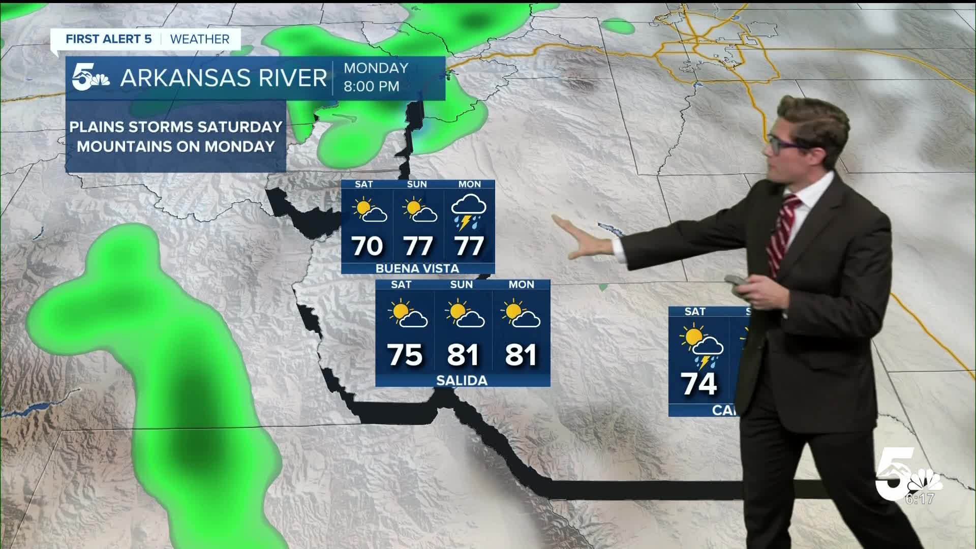
Isolated thunderstorms remain possible Saturday. Chances have trended down since yesterday due to an eastward shift in the main surface moisture axis. In other words, the wet air needed for storms to develop, looks to stay further east, limiting potential along I-25. Still, isolated storms are possible in the afternoon. Highs will begin a warming trend as upper level ridging nudges in from the south.
High pressure continues to build Sunday and Monday - and highs will flip above average. Highly isolated storms are possible Sunday afternoon in the mountain zones. Mountain showers and storms become scattered on Monday afternoon but it should remain dry on Memorial Day across the plains including in Colorado Springs, Pueblo, Walsenburg, and Trinidad.
It will be breezy on Tuesday, and a bit cooler, with afternoon thunderstorm chances returning. The chance continues on Wednesday with isolated showers mainly favoring higher terrain on Thursday. Highs will be near average in the mid 70s to low 80s next week (and fairly similar each day).
____
Curious about the First Alert 5 Weather Storm Impact Scale? Check out our cheatsheet explainer.
Watch KOAA News5 on your time, anytime with our free streaming app available for your Roku, FireTV, AppleTV and Android TV. Just search KOAA News5, download and start watching.
