

Today’s Forecast:
Rain has been a near constant in our forecast since last Friday and today, we can expect more of the same! Much like what we saw on Wednesday, storms will be scattered today, or hit and miss in nature. Showers will begin to pulse up as early as the lunch hour in the Pikes Peak Region. As storms move east, we will see the threat for storms to drop hail as big as 1" in diameter and bring wind gusts to 60 mph to some areas. Storms today will also bring areas of heavy rain and the risk of flooding to Southern Colorado.
Like the past few nights, thunderstorms will remain possible through late this evening, continuing well past midnight over the eastern Plains.
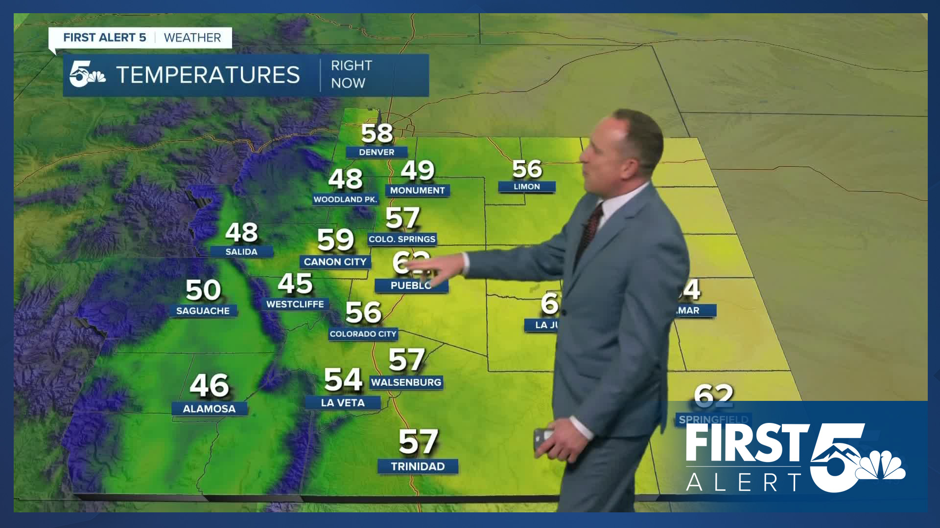
Colorado Springs forecast: High: 77; Low: 56. Sunshine this morning will give way to an earlier chance of storms for the Pikes Peak Region, especially compared to the past few days. Rain could develop as early as the lunch hour. Storms today will be capable of heavy rain, hail up to 1" in diameter, frequent lightning and strong wind gusts.
Pueblo forecast: High: 84; Low: 59. Pretty skies this morning will give way to spotty thunderstorms this afternoon and additional chances for rain late tonight. Storms will increase in coverage towards Friday and Saturday, along with ongoing threats of flooding.
Canon City forecast: High: 82; Low: 60. Showers and thunderstorms will follow this morning's sunshine as another round of wet weather can be expected this afternoon. Rain could be heavy at times today in eastern Fremont County.
Woodland Park forecast: High: 68; Low: 46. A slight cool down from yesterday, with highs today in the upper 60s. Showers and thunderstorms will start early, with periods of rain extending through late this evening.
Tri-Lakes forecast: High: 70s; Low: 50s. Clear skies this morning, with scattered showers and thunderstorms expected to develop as early as 12-1 pm. Much like the past few days, areas of heavy rain will be possible, along with a low end risk of severe weather.
Plains forecast: High: 80s; Low: 50s/60s. Storms look to reach the Plains earlier today compared to what we have seen so far this week. Storms will be capable of large hail and gusty winds today, with rain lingering in some areas well past midnight.
Walsenburg and Trinidad forecast: High: 70s/80s; Low: 50s. After a sunny morning, skies will turn mostly cloudy this afternoon as scattered thunderstorms will be possible again today. On the southern I-25 corridor, there will be a minimal risk of flooding today.
Mountains forecast: High: 60s; Low: 40s. Much needed moisture will continue across the mountains on Thursday as the monsoon remains active from Colorado down to New Mexico. A moderate to high risk of flooding will continue through the first half of the weekend.
Extended outlook forecast:
Tropical moisture streaming into Colorado from what was once Tropical Storm Juliette will bring further energy into the atmosphere on Friday. Storm chances will increase, and with more widespread rain in the forecast, heavy rain will remain a threat. Highs on Friday will warm into the 70s and 80s on the Plains.
A cold front Saturday will cool highs down by a few more degrees while maintaining a very unsettled weather pattern. The atmosphere begins to dry out by Sunday, with fewer storms compared to Friday and Saturday. Labor Day will be mostly sunny and warmer, with dry skies likely to last throughout the day on Tuesday before our next cold front arrives on Wednesday.
____
Curious about the First Alert 5 Weather Storm Impact Scale? Check out our cheatsheet explainer.
Watch KOAA News5 on your time, anytime with our free streaming app available for your Roku, FireTV, AppleTV and Android TV. Just search KOAA News5, download and start watching.
