

Today’s Forecast:
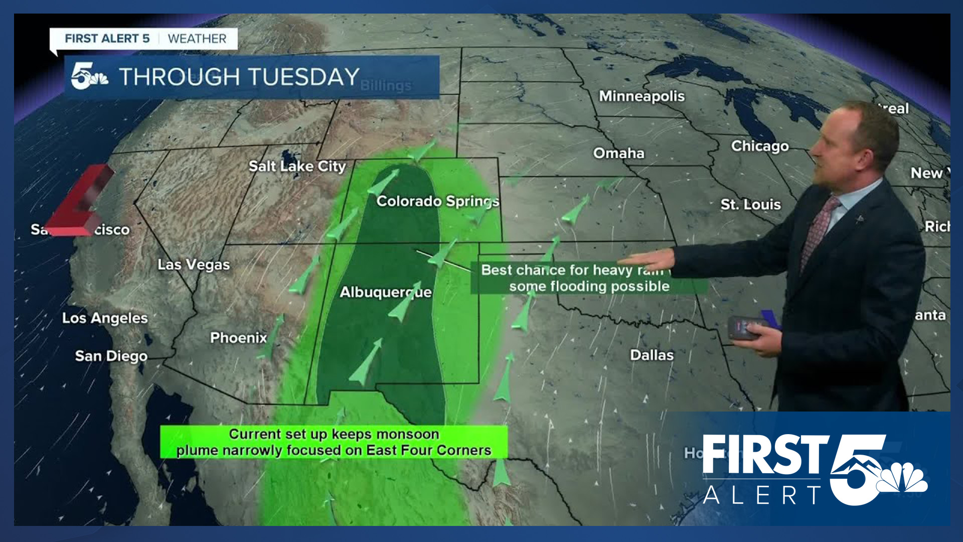
With high pressure to our east and a new disturbance pushing into the West Coast this morning, we'll continue to see a pipeline of moisture streaming into Colorado today and Tuesday. Storms will be most widespread over the mountains and valleys, with isolated to scattered thunderstorms along and east of I-25 late this afternoon and evening. Storms today will be capable of heavy rainfall, wind gusts to 50 mph and small hail.
Highs today will remain hot. Much like yesterday, highs in Colorado Springs will warm into the lower 90s. On the eastern Plains, highs on Monday will climb in the 90s, with a few spots expected to see near triple digit heat.
Colorado Springs forecast: High: 91; Low: 60. Our high today in the lower 90s will be around 5 degrees above average for this time of the year. Isolated to scattered thunderstorms will be possible again today, anytime between 3-8 pm.
Pueblo forecast: High: 98; Low: 63. Much like what we saw over the weekend, our work week will begin hot, with increasing clouds this afternoon and around a 20% chance of a passing shower or thunderstorm.
Canon City forecast: High: 94; Low: 64. On Monday, we'll see a return to above average highs in the lower to middle 90s. Clouds will increase this afternoon across the state as mountain showers and storms move off to the NE late this afternoon and evening.
Woodland Park forecast: High: 79; Low: 50. Warm, with afternoon and evening thunderstorms today across Teller County.
Tri-Lakes forecast: High: 80s; Low: 50s. Monday's forecast will feature a quick warm as highs are likely to be achieved by the lunch hour or early this afternoon. Showers that form over the mountains will move across the Tri Lake areas towards mid to late afternoon, dissipating towards sunset.
Plains forecast: High: 90s; Low: 60s. Sunshine early will heat us up into the 90s today, with a few spots in the Arkansas River Valley up near or at 100 degrees. Storms that form over the mountains will become more isolated by the time they reach the Plains, with hit or miss storms capable of small hail, strong gusts and locally heavy rainfall.
Walsenburg and Trinidad forecast: High: 80s/90s; Low: 50s/60s. Dry skies this morning will give way to scattered thunderstorms this afternoon. Storms look to fire off on the southern I-25 corridor as early as 2 pm, with storms winding down close to sunset tonight.
Mountains forecast: High: 60s/70s; Low: 40s. Our weather will start out unsettled this week before becoming even wetter into the mid week period. Showers and thunderstorms will first start to form in the mountains around the lunch hour before moving off to the NE into the I-25 corridor and Plains later today.
Extended outlook forecast:
Initially, we won't see much change on Tuesday as highs are expected to return to near 90 degrees in the Springs. Along with the heat, we'll continue to see isolated to scattered thunderstorms Tuesday afternoon in the Pikes Peak Region. Much like today, the bulk of the thunderstorms will continue to impact the mountains and valleys on Tuesday.
Moisture will expand across the state by Wednesday, with more numerous showers and thunderstorms for Southern Colorado. Highs in Colorado Springs will cool back down to the 80s from Wednesday to Thursday, with the cool down coming due to an uptick in storms. Friday will be a transition day with fewer storms, followed by a return to heat and mostly dry skies this weekend. Weekend temps on the Plains will soar into the 90s and 100s, with more heat into early next week.
____
Curious about the First Alert 5 Weather Storm Impact Scale? Check out our cheatsheet explainer.
Watch KOAA News5 on your time, anytime with our free streaming app available for your Roku, FireTV, AppleTV and Android TV. Just search KOAA News5, download and start watching.
