

Today’s Forecast:
Wednesday's forecast will remain on the warm side, with mostly sunny skies in most areas and highs that will be around 10 degrees above where we should be for this time of the year. Winds will remain light out at the St. Charles Fire today, a blaze that has scorched more than 260 acres in southwestern Pueblo County.
Colorado Springs forecast: High: 70; Low: 41. A beautiful, but slight cooler day ahead for the Pikes Peak Region today, with mostly sunny skies and a high near 70 degrees.
Pueblo forecast: High: 74; Low: 40. Mostly sunny and warm today, with light E/SE breezes around 10-15 mph.
Canon City forecast: High: 73; Low: 44. A quiet and warm Hump Day will give way to a windy day on Thursday, with spotty high fire danger possible in parts of Fremont County.
Woodland Park forecast: High: 63; Low: 34. Wednesday's forecast in Teller County will be great, with mostly sunny skies, light winds and mild daytime highs.
Tri-Lakes forecast: High: 60s; Low: 30s/40s. A mild and mostly sunny afternoon for the Tri-Lakes area, with light southerly winds today around 10-15 mph.
Plains forecast: High: 60s/70s; Low: 30s/40s. Most areas will be dry today on the Plains, with just a small chance of an isolated shower or two along the Colorado/Kansas border.
Walsenburg and Trinidad forecast: High: 60s/70s; Low: 30s/40s. Sunshine and light breezes today will give way to a windier day on Thursday, with Fire Weather Watches in effect from 11 am until 7 pm.
Mountains forecast: High: 50s/60S; Low: 30s. Other than a rogue shower this afternoon down across the southern Sangres, our mountains and mountain valleys should see a dry day, with light breezes and mild daytime highs.
Extended outlook forecast:
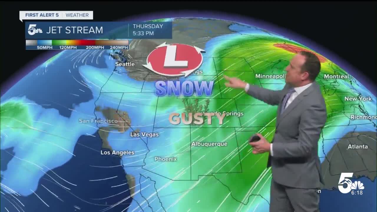
A large trough of low pressure moving across the northern Rockies and northern Plains will cause an increase in wind here in Southern Colorado on Thursday. With southwesterly wind gusts approaching 35 mph and relative humidity in the teens, fire danger concerns will be growing. A Fire Weather Watch has been issued for parts of Huerfano and Las Animas counties Thursday from 11 am until 7 pm.
The first in a series of cold fronts will drop highs down to the 50s Friday and Saturday. This front looks dry, but it will be breezy to gusty both days. A much more powerful front that arrives late Saturday will bring the potential for our first snow of the season to the I-25 corridor and Plains through midday Sunday, along with barely above freezing highs to close out the weekend.
____
Curious about the First Alert 5 Weather Storm Impact Scale? Check out our cheatsheet explainer.
Watch KOAA News5 on your time, anytime with our free streaming app available for your Roku, FireTV, AppleTV and Android TV. Just search KOAA News5, download and start watching.
