

Tonight's Forecast:
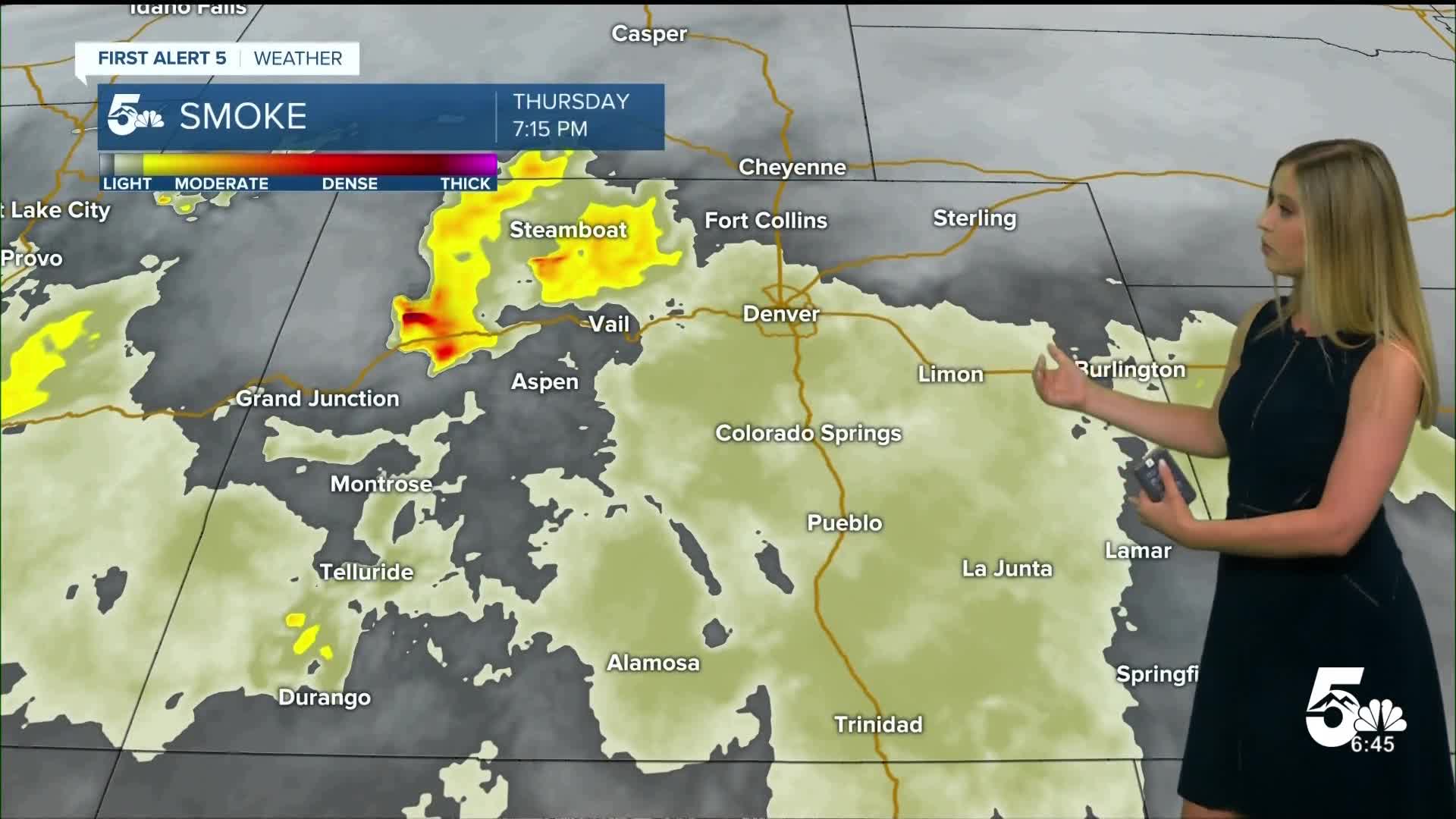
It will remain hazy overnight from wildfire smoke blown into eastern Colorado today from fires burning in western Colorado. Expect it to remain hazy throughout the day on Thursday. Overnight temperatures will be mild, and it will be a quick warm-up on Thursday, back to hot conditions by late morning.
Thursday Fire Danger in the Mountains:
There is a risk of dry thunderstorms adding to the fire danger on Thursday in Colorado. There will be enough moisture in the middle of the atmosphere for thunderstorms to develop. The surface will still be very dry, leading to much of the rain evaporating as it falls. Lightning strikes could start new wildfires without rain to put them out.
A RED FLAG WARNING is in effect from noon until 10 pm.

Colorado Springs forecast: Low: 62; High: 95;
It will be partly cloudy and hazy on Thursday. The high temperature forecast is just 1 degree shy of tying the record of 96 set in 2020. Wind will be out of the SE at 5-10 mph, gusting to 15 mph.
Pueblo forecast: Low: 61; High: 100;
It will be hot and hazy in Pueblo. The record stands at 102 on Thursday, so we may be just a few degrees shy of it. Wind will be out of the SSW at 5-10 mph, gusting to 20 mph.
Canon City forecast: Low: 60; High: 97;
Thursday will be hot and hazy with a partly cloudy sky and SW wind at 10 mph gusting to 20 mph.
Woodland Park forecast: Low: 55; High: 84;
It will be partly cloudy with a hazy sky on Thursday. Temperatures will be very warm, and the wind will be light. There is a low chance of an afternoon shower.
Tri-Lakes forecast: Low: 58; High: 90;
Hot, partly cloudy and hazy on Thursday. Wind will be out of the S at 5-10 mph gusting to 20 mph.
Plains forecast: Low: 50s-60s; High: 90s-100s;
It will be a very hot day with mostly sunny conditions and a bit of haze from wildfire smoke. Highs in the plains will be in the mid-90s to low 100s.
Walsenburg and Trinidad forecast: Low: 61/61; High: 93/95;
It will be hot on Thursday with partly cloudy conditions and a light breeze from the SSW at 5-10 mph gusting to 20 mph.
Mountains forecast: Low: 40s-50s; High: 80s-90s;
The mountain valleys will be hot with fire danger. Dry thunderstorms are possible; see the explanation above. Temperatures will be well above average in the low 80s to low 90s.
Extended outlook forecast:
Friday will be another hot day, my forecast for Colorado Springs at 93 would tie the record of 93 set in 2015. On Friday, we will have an isolated thunderstorm chance in the afternoon, which could help cool us down in the evening.
The best chances of storms ahead will be on Saturday, with isolated thunderstorm chances lingering through the first half of next week.
____
Curious about the First Alert 5 Weather Storm Impact Scale? Check out our cheatsheet explainer.
Watch KOAA News5 on your time, anytime with our free streaming app available for your Roku, FireTV, AppleTV and Android TV. Just search KOAA News5, download and start watching.
