

Today’s Forecast:
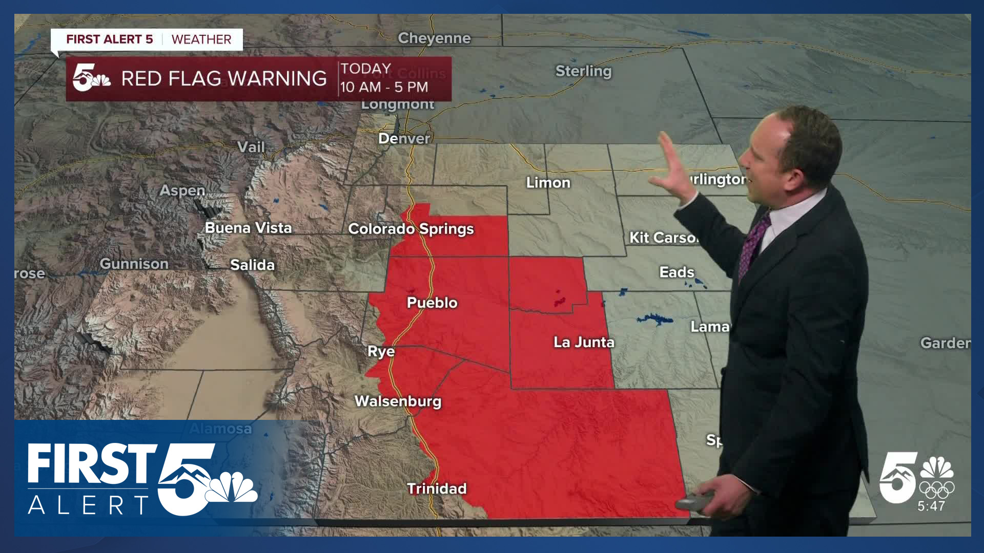
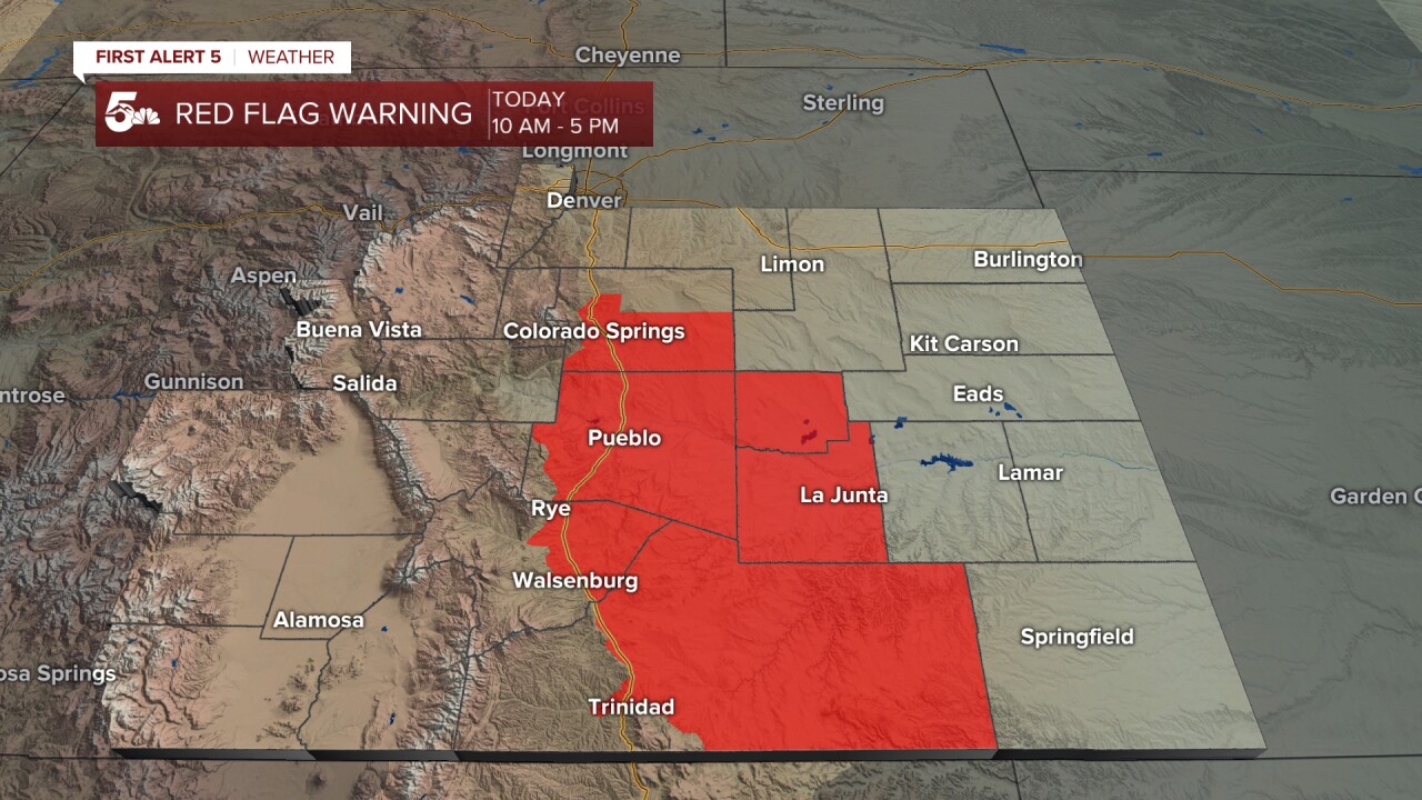
In the short term, our work week will begin with increasing fire danger threats and another Red Flag Warning for parts of Southern Colorado. Gusts today should be down a few notches from Sunday, with peak gusts in the warning area up around 40 mph. Gusts to 50 mph will be possible in the mountains.
The downslope wind will lead to another warm afternoon, with highs today in the 50s and 60s. Skies will be partly cloudy to mostly sunny.
Colorado Springs forecast: High: 61; Low: 29. Skies will turn mostly sunny this afternoon, with a Red Flag Warning in effect from 10 am until 5 pm. Peak gusts today in the Pikes Peak Region could top 40 mph in some wind prone areas, with foothill and mountain gusts to 50 mph.
Pueblo forecast: High: 66; Low: 27. Windy, warm and dry (again) on Monday, with a Red Flag Warning in effect from 10 am until 5 pm. Wind gusts from the west today are expected to range between 30-40 mph.
Canon City forecast: High: 62; Low: 33. The wind will drive up temperatures today, with lower 60s in our forecast this afternoon in eastern Fremont County. Peak gusts will range between 30-40 mph.
Woodland Park forecast: High: 49; Low: 25. Westerly wind gusts to 45 mph will deliver another day of unseasonably mild temperatures to Teller County on Monday, with our high today expected to top out near 50 degrees.
Tri-Lakes forecast: High: 50s/60s; Low: 20s/30s. The first full week of January will begin with dry skies and unseasonably warm temperatures. The warmth will be driven by downslope wind gusts to 40 mph.
Plains forecast: High: 60s; Low: 20s/30s. We'll see dry skies and A windy start to the week, with a Red Flag Warning for Crowley, Otero and Las Animas counties from 10 am until 5 pm.
Walsenburg and Trinidad forecast: High: 50s/60s; Low: 20s/30s. Driven by strong downslope wind gusts to 50 mph, a Red Flag Warning will remain in effect today from 10 am until 5 pm.
Mountains forecast: High: 30s/40s; Low: 10s/20s. From strong wind to snow, it's going to be a busy week of weather for the southeastern mountains. While we'll stay dry today, snow will fall in the central and northern mountains on Monday.
Extended outlook forecast:
It will remain breezy on Tuesday, with temperatures in the middle to upper 50s in Colorado Springs and Canon City, and lower 60s in Pueblo. Wednesday's highs will remain the 50s and low 60s on the Plains, with dry skies expected through the mid-week period.
Things begin to change late this week as a few storms merge over the Rockies. While exact details still need to be worked out, this pattern change looks to bring the Pikes Peak Region and Southern Colorado its first snow of the year. Right now, we're seeing a chance for snow from Thursday into Friday morning, with a few inches of accumulation. Highs will be in the upper 30s and lower 40s late this week, with lows in the teens.
____
Curious about the First Alert 5 Weather Storm Impact Scale? Check out our cheatsheet explainer.
Watch KOAA News5 on your time, anytime with our free streaming app available for your Roku, FireTV, AppleTV and Android TV. Just search KOAA News5, download and start watching.
