

Today’s Forecast:
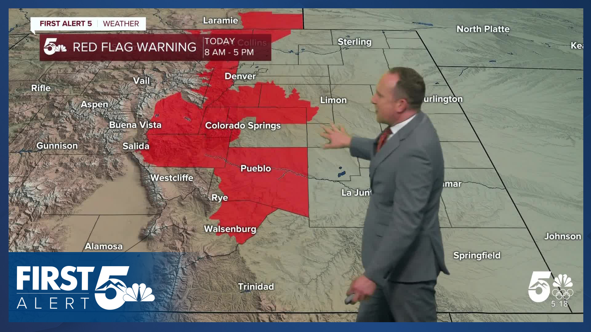
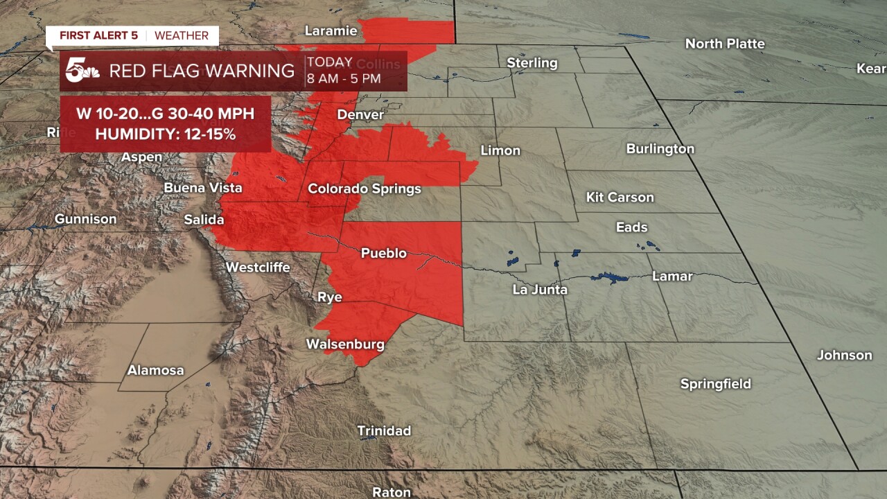
Christmas week will begin with more of the same...dry skies, gusty winds, and above average highs. Thanks to a persistent weather pattern this month, any chances for snow in the state today are not expected. Instead, downslope breezes and low humidity will lead to additional Red Flag Warnings today in the state, including parts of Southern Colorado.
The downslope wind will cause temperatures to warm into the 60s, 70s and lower 80s today on the Plains. Some areas will be more than 25 degrees above average for this time of the year. In the mountains and mountain valleys, highs today will top out in the 40s, 50s and 60s.
Colorado Springs forecast: High: 70; Low: 39. More warm and breezy weather can be expected this afternoon in the Pikes Peak Region. Although we aren't included in today's Red Flag Warning, many of our surrounding counties are. With a forecast high of 70 degrees, today's record of 69 degrees is likely to fall in Colorado Springs.
Pueblo forecast: High: 74; Low: 32. Red Flag Warnings will go into effect starting at 8 am, lasting until 5 pm for Pueblo County. With gusts to 35 mph today, afternoon temperatures will top out in the middle 70s, with today's record at 75 (1955).
Canon City forecast: High: 72; Low: 40. After a cooler day on Sunday, the warmth returns with a vengeance on Monday as highs soar back into the lower 70s. On top of the warm-up, it will also be a windy one, with a Red Flag Warning in effect from 8 am until 5 pm.
Woodland Park forecast: High: 61; Low: 34. Warm and windy, with a Red Flag Warning in effect from 8 am until 5 pm. Today's high in the lower 60s is around 30 degrees above average.
Tri-Lakes forecast: High: 60s; Low: 30s/40s. Christmas week will begin warm and windy, with a Red Flag Warning in effect from 8 am to 5 pm. Peak westerly gusts today could top 35 mph in northern El Paso County.
Plains forecast: High: 70s/80s; Low: 20s/30s. It's hard to believe it, but Christmas is only 3 days away! Our weather today won't feel anything like Christmas-time, with highs in the 70s and lower 80s, and westerly wind gusts to 30 mph.
Walsenburg and Trinidad forecast: High: 60s/70s; Low: 30s/40s. Dry, windy and warm on Monday, with a Red Flag Warning in effect in Huerfano County from 8 am until 5 pm. For now, Las Animas County has not been included in today's Red Flag Warning.
Mountains forecast: High: 40s/50s; Low: 20s/30s. Warm, with sunshine and gusty west winds today in the mountains. Peak gusts could top 45 mph in some areas, with even stronger wind gusts expected north of Monarch Pass up towards I-70.
Extended outlook forecast:
A weak cold front Tuesday will drop highs back down to the middle 60s in Colorado Springs. Skies will be partly to mostly cloudy, but precipitation is not expected. The wind will also be lighter in the mid-week period. Red Flag Warnings are not expected for Southern Colorado on Tuesday.
Christmas Eve and Christmas Day will both be more than 20 degrees above average region-wide. Highs each day will warm into the middle to upper 60s in Colorado Springs. While it will be dry here this Christmas, snow is expected in the mountains from late Christmas Eve into the upcoming weekend. That's great news for ski areas, but could mean difficult travel in and out of the high country during the busy holiday season.
____
Curious about the First Alert 5 Weather Storm Impact Scale? Check out our cheatsheet explainer.
Watch KOAA News5 on your time, anytime with our free streaming app available for your Roku, FireTV, AppleTV and Android TV. Just search KOAA News5, download and start watching.
