

Today’s Forecast:
The heat is on today across southern Colorado with a Heat Advisory active from 11 AM to 8 PM today in Colorado Springs, Pueblo, Canon City, and the lower Arkansas River Valley. Highs crank to the 90s and 100s, and stay there through the afternoon. You'll also see haze and smoke from several large ongoing wildfires in western Colorado and other western states. This will lead to moderate impacts to air quality. It's important to check on people and pets today. Anyone who is particularly heat sensitive: children, older adults, and those with medical conditions that make them susceptible to heat. Remember not to leave children or pets in the car - you can remember this by leaving a stuffed animal in the passenger seat to remind you to check the rear seats.
Also on the pet front - to test if it's too hot for a walk, put your hand on the pavement for 5 seconds. If it's too hot for your hand, it's too hot for your furry friend's paws. So, dog walks today should occur early today, before 10AM, or late tonight, after 8:30 PM after sunset.
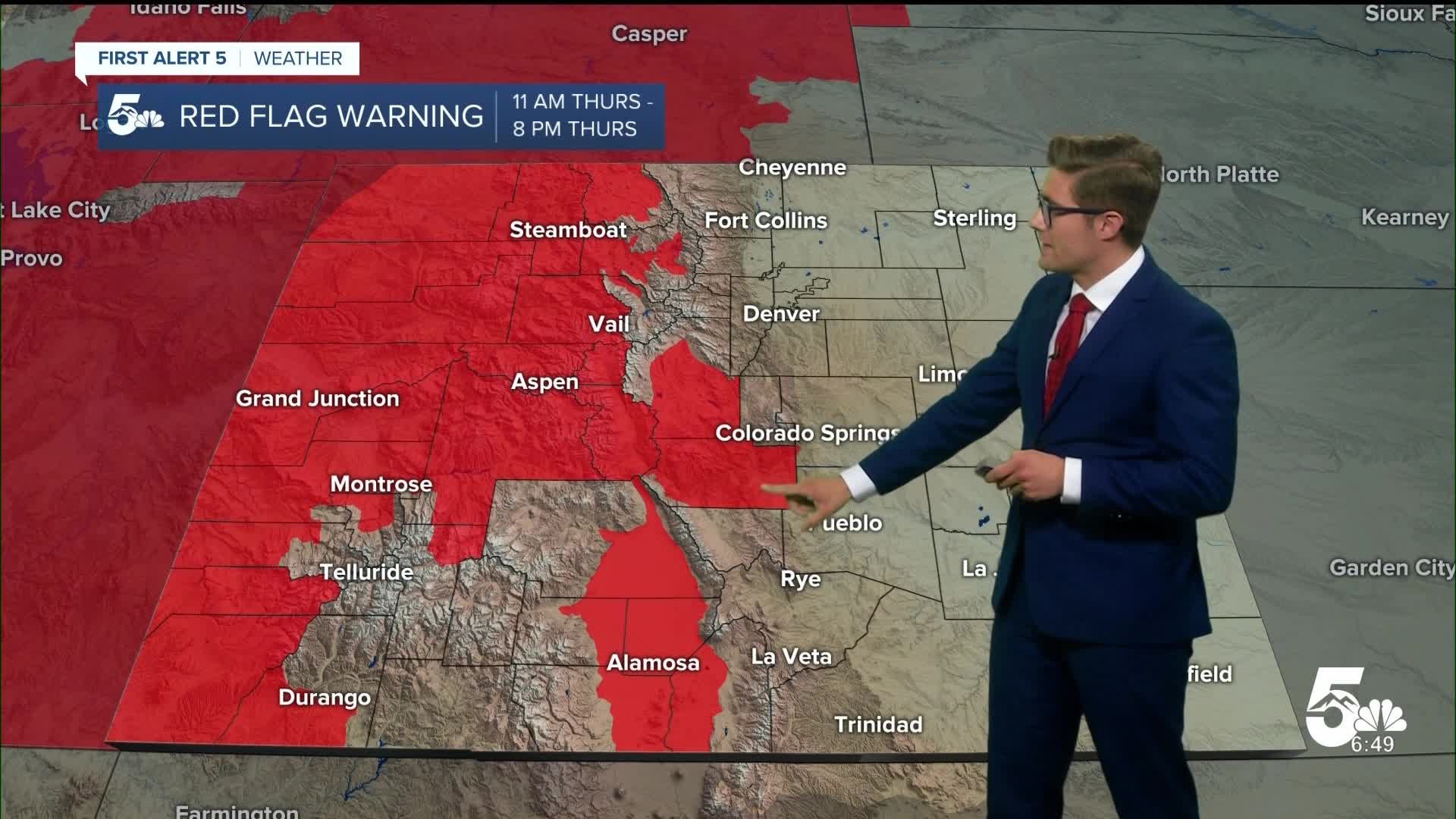
Red Flag Warnings are active today in the San Luis Valley, upper Arkansas River Valley, the central mountains and valleys, and Western Slope. Avoid outdoor burning, secure vehicle chains, and be cautious of anything that could create a spark. We've already seen how easy it's been this week for fires to start and grow quickly in these very dry areas! If heading to the west for an early weekend - keep this in mind.
Colorado Springs forecast: High: 98; Low: 61.
HEAT ADVISORY in effect from 11 AM - 8 PM
Very hot, and hazy today in the Pikes Peak Region. Temperatures into the 90s by 11 AM, they stay there through the afternoon. Moderate air quality impacts from smoke. West winds at 10-15 mph.
Pueblo forecast: High: 104; Low: 62.
HEAT ADVISORY in effect from 11 AM - 8 PM
Record tying heat today in Pueblo - the current record is 104, which is my forecast high. Haze from wildfire smoke. A good indoor day. West winds at 10-20 mph.
Canon City forecast: High: 99; Low: 67.
HEAT ADVISORY in effect from 11 AM - 8 PM
Mostly sunny, very hot, and hazy. West winds at 10-15 mph.
Woodland Park forecast: High: 87; Low: 54.
Mostly sunny and very warm. Haze at times. An isolated storm is possible late this afternoon with the best chance from 3-7 PM. Most likely to produce gusty wind if you see a storm. West winds at 10-15 mph.
Tri-Lakes forecast: High: 90s; Low: 60s.
HEAT ADVISORY in effect from 11 AM - 8 PM
Mostly sunny and very hot. Haze from wildfires.
Plains forecast: High: 100s; Low: 60s.
HEAT ADVISORY in effect from 11 AM - 8 PM
Very hot with haze both above ground and near ground level from wildfire smoke, leading to air quality impacts. Spend time inside if you can and keep windows closed. West winds at 10-20 mph.
Walsenburg and Trinidad forecast: High: 97/98; Low: 64/62.
Hazy and very hot today with west winds at 10-20 mph. Drink plenty of water if you need to be outside for a long time. When you feel thirsty, you're already starting to become dehydrated.
Mountains forecast: High: 80s; Low: 60s/70s.
Mostly sunny this morning with pockets of smoke and haze, thick periodically. Isolated thunderstorms in the afternoon. Storms capable of producing gusty wind.
Extended outlook forecast:
Our heat dome - high pressure - continues to push down on the air Friday leading to highs only a tick down. Record heat is again in my forecast in Colorado Springs, and it'll be a close call in Pueblo. A Heat Advisory returns again from 11 AM - 8 PM in both El Paso and Pueblo counties, and I will not be surprised to see that expanded. Heat Advisories are issued relative to what's "normal" for a given area and also consider things like air conditioning and other factors. In short - Heat Advisories indicate impacts to most people, if outside in the heat for a long enough amount of time...with an elevated risk of heat illnesses like Heat Exhaustion and Heat Stroke. If you have the ability to remain inside, that's your best bet outside of early morning or late evening tomorrow. If your work or other needs require you to be outside, take frequent breaks: 15 minutes per hour if able, to seek shade and drink water.
A cold front arrives Friday night and provides some modest relief Saturday as highs fall about 10 degrees relative to your Friday highs, smoke gets thinner - assuming no new fires start to the northwest which would be blown in by that wind direction change - and isolated afternoon storm chances return. Better storm coverage will return Sunday and we'll be watching for stronger storm potential as well in the afternoon.
Any weekend high country plans - keep in mind you'll be dealing with a combination of smoke, and storms. Fires are burning in almost every direction to our north, west, and south so smoke will be an issue regardless of wind direction. It will be worst when winds are out of the southwest.
By Monday, storms become more isolated again as drier air from Baja California leads to below average moisture across the state once again. The only good news is, it won't be quite as hot. Storm chances should be confined to the mountains again by Tuesday.
____
Curious about the First Alert 5 Weather Storm Impact Scale? Check out our cheatsheet explainer.
Watch KOAA News5 on your time, anytime with our free streaming app available for your Roku, FireTV, AppleTV and Android TV. Just search KOAA News5, download and start watching.
