


Tonight's Forecast:
Thunderstorms will remain possible through sunset this evening, with the main threat for severe weather being across the eastern Plains. The main concerns with any developing thunderstorms will be hail up to 1" in diameter, and 60-70 mph wind gusts. We also can't rule out an isolated virga shower or thunderstorm closer to the interstate, with gusty outflow winds the main concern farther to the west.
As the storms die down, we'll be left with another uncomfortably warm evening. Overnight lows across the Plains aren't likely to cool below the lower to middle 60s.
Colorado Springs forecast: Low: 62; High: 94; A dry, hot and windy start to the work week for the Pikes Peak Region. On top of the potential for another record setting high in Colorado Springs, afternoon wind gusts could top 25-35 mph, with an elevated fire weather risk in the forecast. Current record: 92° (2006).
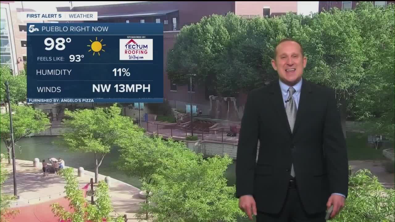
Pueblo forecast: Low: 63; High: 100; We're looking at another potential day with triple digit heat for the Pueblo area. Along with the potential for record heat, it will be windy across the region, with gusts up to 30 mph. Current record: 101° (1981).
Canon City forecast: Low: 64; High: 95; With another day of unseasonably hot temperatures, we're looking at a hot and windy start to the work week in the Canon City area. With afternoon wind gusts to 35 mph, fire danger will also be elevated across the region.
Woodland Park forecast: Low: 54; High: 82; A mostly sunny, warm and windy start to the week for Teller County, with peak afternoon wind gusts 25-35 mph.
Tri-Lakes forecast: Low: 50s/60s; High: 80s/90s; Monday will be the last day of our current stretch of super hot weather before some mid-week changes arrive. On top of the heat, it will also be much more gusty across the Palmer Divide tomorrow.
Plains forecast: Low: 60s/70s; High: 90s/100s; Hot and windy on Monday, with peak afternoon wind gusts up to 45 mph. This past weekend's severe weather threat will lessen on Monday as drier air attempts to settle into the region for a couple of days.
Walsenburg and Trinidad forecast: Low: 50s/60s; High: 80s/90s; A mild morning will give way to a too hot for mid-June afternoon across the southern I-25 corridor. It will also be windy during the day, with W/SW wind gusts as strong as 35-45 mph.
Mountains forecast: Low: 40s/50s; High: 60s/70s; If you're looking for some relief from these sizzling hot temperatures, head to the mountains for a nice taste of cooler weather. While temperatures will be comfortable in the mountains on Monday, it will be windy, with gusts to 45 mph.
Extended outlook forecast:
A cold front on Tuesday will bring some relief to our forecast, along with breezy to gusty winds. High temperatures through the middle of the week will be around 5-10 degrees cooler than what we saw today. By Friday, the monsoon flow will begin to spread moisture into the Four Corners Region, with some of that deeper moisture likely to reach western parts of Colorado. I've introduced rain chances into Teller County and the mountains on Friday, with some of that moisture expected to spread east throughout the weekend.
____
Curious about the First Alert 5 Weather Storm Impact Scale? Check out our cheatsheet explainer.
Watch KOAA News5 on your time, anytime with our free streaming app available for your Roku, FireTV, AppleTV and Android TV. Just search KOAA News5, download and start watching.
