



COLORADO SPRINGS, Colo (KOAA) — Today’s Forecast:
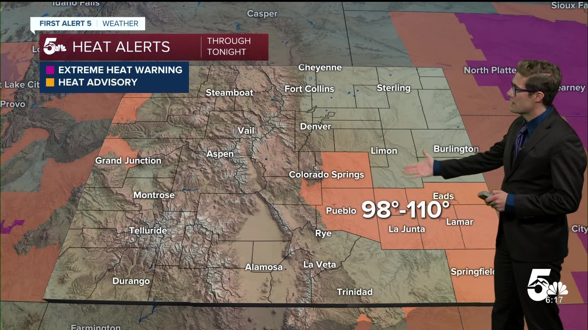
Scorching, sizzling, roasting, record-shattering...whatever term you want to use, Sunday was HOT across southern and eastern Colorado. Colorado Springs and Pueblo both broke daily high temperature records with Pueblo at a roasting 107, obliterating the prior record of 103...and Lamar hit 111!
And this morning we've broken more records, as lows stayed quite warm overnight. In Pueblo, if the morning low of 77 holds through tonight, it will be your warmest low EVER on record.
That was the top of the temperature roller coaster, and today's highs won't be quite as hot. But, that's relative and you will still need to take heat precautions today.
Heat Advisories return today in El Paso and Pueblo counties, and parts of the eastern plains from 10:00 AM - 9:00 PM.
Scattered thunderstorms will form in the mountains this afternoon and then drift into the plains in the late afternoon.
Colorado Springs forecast: High: 97; Low: 65.
HEAT ADVISORY in effect from 10:00 AM - 9:00 PM
After a scorcher of a Sunday...we're right back at it again today. My forecast high of 97 would tie today's high temperature record, which was set all the way back in 1960. You'll notice the clouds out the door...they've kept temperatures quite warm overnight in the 70s. You'll also notice the humidity in the air with dew points in the 50s. This afternoon, monsoon storms will drift off the mountains into the area. Within the Pikes Peak Region, the Palmer Divide and Pikes Peak itself should see the earliest storms. Other parts of the area could see storms closer to dinner time.
Pueblo forecast: High: 103; Low: 68.
HEAT ADVISORY in effect from 10:00 AM - 9:00 PM
Partly cloudy this morning, a few brief peaks of sun in the late morning and roasting this afternoon. My forecast high of 103 would tie the current record high for today. Isolated storms are possible this afternoon, but your best storm chances will arrives Tuesday and Wednesday.
Canon City forecast: High: 100; Low: 70.
HEAT ADVISORY in effect from 10:00 AM - 9:00 PM
The roast continues today! Seek shade when you can, take frequent breaks out of the sun, and drink plenty of water. Mostly sunny this morning, and mostly cloudy this afternoon with isolated afternoon thunderstorms. Today's chance is 30%.
Woodland Park forecast: High: 84; Low: 56.
Partly cloudy becoming mostly cloudy with isolated afternoon thunderstorms, the chance continuing into the early evening. Notably humid by Teller County standards.
Tri-Lakes forecast: High: 90s; Low: 60s.
HEAT ADVISORY in effect from 10:00 AM - 9:00 PM
Partly cloudy today with isolated thunderstorms after 12:00 PM. Storm timing over the Palmer Divide will be earlier today compared to other parts of the Pikes Peak Region. Heavy rain is possible with any storm today. But, if you get a storm it'll provide a nice break from the heat!
Plains forecast: High: 100s; Low: 60s/70s.
HEAT ADVISORY in effect from 10:00 AM - 9:00 PM for the Arkansas River Valley
Continuing to sizzle today with highs back to the 105-110 degree range under mostly sunny skies. Increasing clouds late this afternoon with a stray thunderstorm or two possible this evening.
Walsenburg and Trinidad forecast: High: 99/103; Low: 67.
Mostly sunny this morning with increasing clouds through the day, and very hot. Isolated afternoon thunderstorms, which will be slow moving and capable of heavy rainfall.
Mountains forecast: High: 80s/90s; Low: 60s.
Expect another good round of afternoon thunderstorms today. They should form as early as noon over the mountains - and will then slowly become more numerous and drift toward I-25 in the mid to late afternoon. Be off the high summits early, as is always the case during monsoon season.
Extended outlook forecast:
The best storm chances of the week in southern Colorado will arrive Tuesday and Wednesday. A weak front will move through early Tuesday, and weak upper level energy will be present too as an upper ridge shifts south. Scattered thunderstorms are likely Tuesday afternoon across parts of the Front Range with heavy rain, frequent lightning, small hail, and gusty wind all possible. North of highway 50, a couple of storms could be marginally severe with quarter sized hail and 60 mph wind gusts.
The increased cloud cover on Tuesday will turn off the blow torch with highs in the upper 80s to upper 90s on the plains depending on your elevation.
Storms remain fairly widespread Wednesday before becoming more isolated Thursday and Friday afternoons. Expect partly cloudy skies in the morning, with isolated slow moving afternoon thunderstorms. Highs will be back in the low 90s.
We will dry out again this weekend.
____
Curious about the First Alert 5 Weather Storm Impact Scale? Check out our cheatsheet explainer.
Watch KOAA News5 on your time, anytime with our free streaming app available for your Roku, FireTV, AppleTV and Android TV. Just search KOAA News5, download and start watching.
