


Tonight's Forecast:
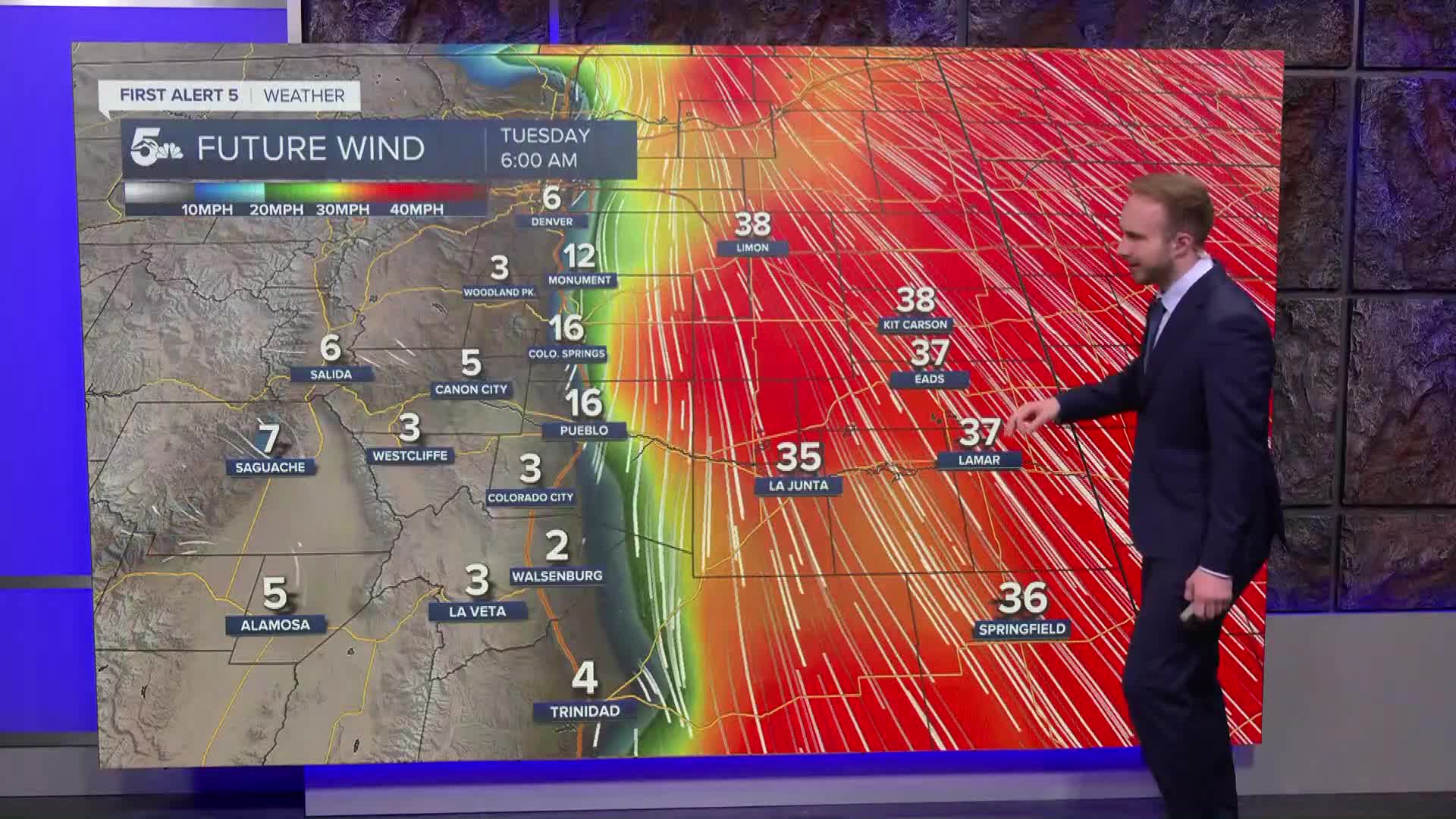
Brisk north winds continue overnight as skies slowly clear. A few lingering showers could redevelop overnight along the Palmer Divide and near the Kansas border, mixing with or changing over to light snow around Monument and Black Forest with minimal accumulation. Lows tonight drop into the upper 20s to mid-30s for lower elevations and teens to 20s for mountain valleys. Flood warnings and high river flows remain an ongoing concern along the Conejos River and Rio Grande in the San Luis Valley into mid-week.
Colorado Springs forecast: Low: 32; High: 53;
Sunny to partly cloudy on Tuesday, but staying cool and breezy. Gusty north winds up to 30 mph in the morning will gradually ease through the afternoon, with highs reaching the lower 50s.
Pueblo forecast: Low: 34; High: 58;
Mostly sunny and breezy on Tuesday with highs topping out in the upper 50s. North winds gusting over 30 mph early in the day will taper off by late afternoon, staying dry through the evening.
Canon City forecast: Low: 33; High: 56;
Highs in Canon City reach the mid-50s on Tuesday under mostly sunny skies. Breezy conditions in the morning will give way to lighter winds into the afternoon.
Woodland Park forecast: Low: 24; High: 45;
Woodland Park will see highs in the mid-40s on Tuesday. Sunshine returns alongside partly cloudy skies, remaining cool with a slight breeze over the higher terrain.
Extended outlook forecast:
High winds and lingering moisture wrap up Tuesday before a weak mid-week system brings another quick round of mountain snow and valley rain.
Wednesday – Thursday: A weak upper-level wave brings scattered, light rain and mountain snow showers late Wednesday into Wednesday night. Snow levels drop near 7,000 feet by Thursday morning, bringing a quick 1 to 2 inches of snow to higher terrain before drying out Thursday afternoon. Not much rain will fall across the PPR.
Friday – Monday: Dry and mild conditions return Friday before a brief wave brings spotty mountain snow showers Friday night. The weekend looks mostly dry, warmer, and pleasant as a ridge builds over the region, sending temperatures back near or slightly above seasonal averages.
____
Curious about the First Alert 5 Weather Storm Impact Scale? Check out our cheatsheet explainer.
Watch KOAA News5 on your time, anytime with our free streaming app available for your Roku, FireTV, AppleTV and Android TV. Just search KOAA News5, download and start watching.
