

Tonight's Forecast:
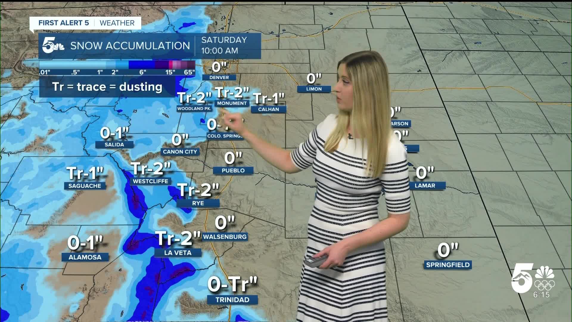
Overnight, rain and snow showers will move through southern Colorado. The rain-snow line may drop as low as 6,500 feet in elevation. Some rain showers could have enough energy for lightning. Temperatures will remain above freezing in the plains and drop to the 20s in the mountains.
Colorado Springs forecast: Low: 34; High: 54;
It will begin partly cloudy in the morning on Saturday, then clouds will clear. Wind will be breezy in the morning from the NNW at 10-15 mph, decreasing to less than 10 mph in the afternoon.
Pueblo forecast: Low: 36; High: 61;
Clouds will decrease throughout the day on Saturday. Winds will be breezy from the N at 10 mph, gusting to 25 mph.
Canon City forecast: Low: 36; High: 59;
Saturday becomes mostly sunny after some lingering morning clouds. Winds will be light out of the NE at 5-10 mph, gusting to 15 mph.
Woodland Park forecast: Low: 26; High: 46;
Saturday becomes mostly sunny after beginning cloudy. Wind will be out of the NNW at 5-10 mph, gusting to 20 mph.
Tri-Lakes forecast: Low: 30; High: 50;
It will be cloudy in the morning, then the clouds clear out, leaving a sunny afternoon on Saturday. Wind will be breezy from the N at 10 mph, gusting to 25 mph.
Plains forecast: Low: 30s; High: 50s-60s;
Spotty rain showers linger in the plains until about noon, then the sky gradually clears. Wind will be breezy from the NNE at 10-15 mph, gusting to 30 mph.
Walsenburg and Trinidad forecast: Low: 34/32; High: 52/54;
It will be cloudy in the morning and sunny in the afternoon on Saturday. Winds will be breezy out of the NNE at 10 mph, gusting 25-30 mph.
Mountains forecast: Low: 20s; High: 40s-50s;
It will be partly cloudy on Saturday with clearing conditions after Friday night's snow showers. Wind will be light in general, at 5-15 mph, gusting 15-20 mph.
Extended outlook forecast:
Sunday is trending even warmer, with 50s and 60s expected regionwide.
Next week remains warm as well, but it becomes windy. Expect to feel gusty wind every day next week, especially on Tuesday and perhaps Wednesday as well. The increase in wind and the dry conditions expected in the plains will lead to high fire danger for multiple days in a row. Bottom line... do not create any sparks or flames outside!
____
Curious about the First Alert 5 Weather Storm Impact Scale? Check out our cheatsheet explainer.
Watch KOAA News5 on your time, anytime with our free streaming app available for your Roku, FireTV, AppleTV and Android TV. Just search KOAA News5, download and start watching.
