


Tonight's Forecast:
Quiet weather and generally clear skies take over across Southern Colorado tonight as shortwave ridging moves in. North winds out east will relax through the evening. Lows tonight will drop into the 30s across much of the plains and the 20s for the San Luis Valley and mountain valleys.
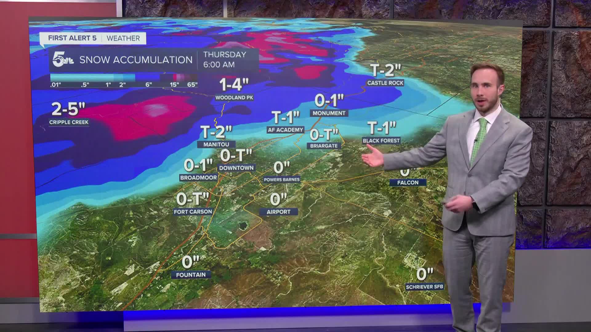
Wednesday's Forecast: Sun gives way to increasing cloudiness through the afternoon as a fast-moving cold front arrives from the north. Highs hit the 50s and low 60s ahead of the front before rain showers develop along the Continental Divide by late afternoon and push south across the eastern plains and I-25 corridor into Wednesday night. High mountain passes will see heavy snow accumulations, while lower elevations stay mostly liquid. Colorado springs could see some flakes fly but accumulation is not expected.
Colorado Springs forecast: Low: 33; High: 51;
Wednesday starts mostly sunny before cloud cover increases through the afternoon ahead of a cold front. Rain showers develop during the evening and spread south overnight, remaining mostly liquid though a few flakes could mix in across northern El Paso County toward the Palmer Divide. Breezy northerly winds arrive with the front.
Pueblo forecast: Low: 35; High: 54;
Pueblo will see a mild start to Wednesday with highs climbing into the mid 50s. A cold front shifts winds to the north by afternoon, bringing increasing clouds and scattered rain showers by Wednesday evening and overnight.
Canon City forecast: Low: 34; High: 54;
Highs in Canon City reach the mid 50s on Wednesday. Expect increasing clouds through the day with rain showers developing during the late afternoon and evening as the cold front banks against the eastern mountains.
Woodland Park forecast: Low: 28; High: 48;
Woodland Park will see highs in the upper 40s on Wednesday. Showers develop by Wednesday afternoon, transitioning to a light rain-snow mix into the evening as temperatures fall into the 20s.
Extended outlook forecast:
A fast-moving storm system brings mountain snow and plains rain Wednesday night into Thursday morning, followed by a brief lull and generally mild conditions through the weekend.
Thursday – Friday: Showers exit early Thursday morning, giving way to clearing skies, dry weather, and high temperatures in the 50s to low 60s for lower elevations. A weak trough approaches Friday afternoon, bringing spotty mountain snow showers to the Central Mountains with minimal impact.
Saturday – Tuesday: Breezy and dry weather returns for the weekend under high pressure. A steady warming trend takes hold into early next week with mostly sunny skies and unseasonably mild highs pushing into the 60s to near 70 across the plains.
____
Curious about the First Alert 5 Weather Storm Impact Scale? Check out our cheatsheet explainer.
Watch KOAA News5 on your time, anytime with our free streaming app available for your Roku, FireTV, AppleTV and Android TV. Just search KOAA News5, download and start watching.
