

Today’s Forecast:
Calm weather can be expected region-wide as we await our well advertised storm! Today's forecast will feature a mild mix of sun and clouds, and a lot less wind compared to the past few days. Highs will warm into the 50s and 60s on the Plains, with 40s for the mountains and Teller County.
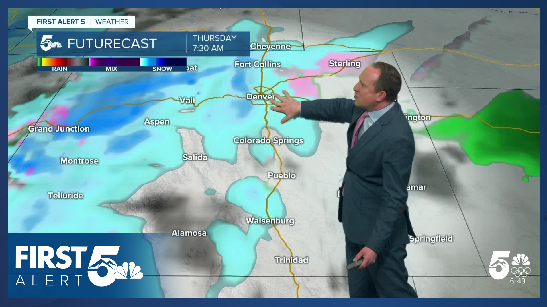
Snow will increase this evening out towards the Continental Divide, with a slight chance for flurries or light snow showers in Teller County and around the Palmer Divide by tomorrow morning. Most other areas should be dry, and impacts to Thursday's commute are not expected at this time.
Colorado Springs forecast: High: 58; Low: 21. Beautiful weather and light wind on Wednesday, with our high in the upper 50s more than 10 degrees above average for this time of the year for Colorado Springs.
Pueblo forecast: High: 62; Low: 31. Below freezing temperatures this morning will give way to a mild high in the lower 60s. Dry skies can be expected for at least the next 12-24 hours.
Canon City forecast: High: 59; Low: 33. Our late week storm won't bring any impacts to our forecast today, with dry skies on Wednesday and afternoon highs in the upper 50s.
Woodland Park forecast: High: 48; Low: 23. Dry skies can be expected during the day on Wednesday. With increasing clouds tonight, we could see a few flurries or light snow showers develop by Thursday morning.
Tri-Lakes forecast: High: 50s; Low: 20s/30s. A dry and mild Wednesday will give way to increasing clouds tonight as lows drop down to the upper 20s and lower 30s. By Thursday morning, a few flurries will be possible up on Monument Hill.
Plains forecast: High: 50s/60s; Low: 30s. Sunshine and light breezes on Wednesday, with highs in the upper 50s and 60s. Clouds will increase tonight, with dry skies expected through Thursday morning.
Walsenburg and Trinidad forecast: High: 50s/60s; Low: 20s/30s. Wednesday will be mild, with partly to mostly cloudy skies. Skies will be dry this afternoon and evening ahead of big changes on Thursday. Winter Storm Watches will go into effect late Thursday afternoon and continue into Friday afternoon.
Mountains forecast: High: 30s/40s; Low: 10s/20s. Clouds will increase across the mountains on Wednesday, with snow expected to increase out west into the Continental Divide late this evening. Snow will spread southward during the day on Thursday, with heavy snow in the southeastern mountains by Thursday night.
Extended outlook forecast:
A chance for flurries or light snow showers will be possible Thursday morning, mainly across Teller County and the northern half of El Paso County. By the afternoon and evening, snow will begin to expand and intensify across the Pikes Peak Region and Southern Colorado, with the potential for moderate and heavy snowfall into Thursday night. Highs on Thursday will be cooling down to the 30s and 40s. Impacts to the Thursday evening commute will be possible, especially north of the Springs from Monument Hill to Castle Rock.
Snow will continue through at least midday Friday, and the commute Friday morning could be pretty nasty. Friday will also be windy and cold, with highs in the 20s and 30s. Snow amounts in the Springs are predicted to be around 3-7", with as much as 6-10" over Monument Hill. These amounts are likely to change as we tighten up the forecast ahead of the storm.
Skies will dry out Friday night, allowing for temperatures to drop all the way down to the single digits and teens. Saturday's highs will be around 40 degrees in Colorado Springs, with middle 40s on Sunday. Snowmelt sunshine can be expected both days this weekend from the foothills to the Plains.
____
Curious about the First Alert 5 Weather Storm Impact Scale? Check out our cheatsheet explainer.
Watch KOAA News5 on your time, anytime with our free streaming app available for your Roku, FireTV, AppleTV and Android TV. Just search KOAA News5, download and start watching.
