

Today’s Forecast:
The first day of April brings active weather to Southern Colorado as a broad area of low pressure moves east from California towards the state, bringing plentiful moisture and energy along with it.
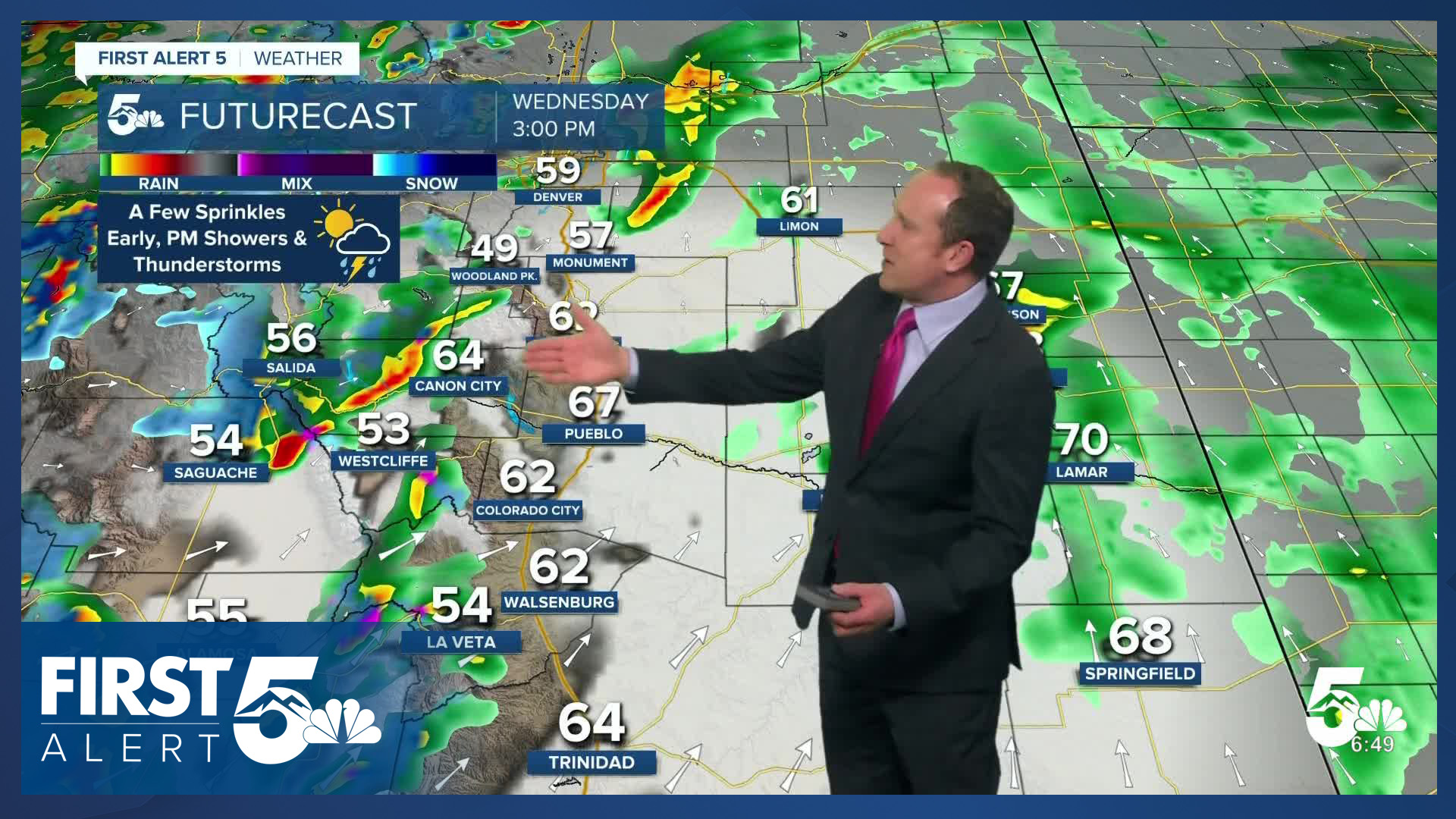
Skies will be partly to mostly cloudy this morning with temperatures in the 30s and 40s. A few early sprinkles are possible along I-25 but the main action will be in the afternoon. The best chance for morning showers is across the southeast Plains, mountains and foothills.
A surface low will pivot east into the Plains late this morning, and thunderstorm energy will be present in the middle atmosphere. Combined, you can expect scattered showers and some rumbles of thunder today mainly after 12:00 PM. The best storm energy is available from around 3:00 PM - 6:00 PM. There may be a few lingering showers early this evening.
This system is delivering beneficial snow to the mountains. The snow level is between 9,000-9,500 feet. The snow type is wet and heavy, with wind gusts of 40-60 mph over mountain passes. Expect difficult travel conditions.
The strong winds will also be in place in the southern mountains and adjacent lower elevation areas, especially south of Highway 50.
Colorado Springs forecast: High: 62; Low: 38. While we are expecting to see similar temperatures to yesterday, today's weather should be more active. An area of low pressure will move from California to Colorado on Wednesday, increasing our chances this afternoon for showers and thunderstorms.
Pueblo forecast: High: 68; Low: 38. Unsettled changes roll into southeastern Colorado on this first day of April, and in Pueblo, this will mean a chance for scattered showers and thunderstorms this afternoon.
Canon City forecast: High: 65; Low: 41. Dry skies this morning will give way to increasing showers and thunderstorms this afternoon. While rain won't be super beneficial, it's a welcome change ahead of increasing fire danger on Thursday.
Woodland Park forecast: High: 54; Low: 31. Wednesday's weather will be unsettled, with increasing chances for rain and snow showers. By the afternoon, increasing instability could bring a few thunderstorms (or thundersnow) into Teller County.
Tri-Lakes forecast: High: 50s; Low: 30s. Generally dry skies this morning will give way to increasing showers this afternoon. With the instability present from today's incoming storm system, a few thunderstorms may also develop.
Plains forecast: High: 60s/70s; Low: 30s/40s. Showers this morning will give way to additional showers and scattered thunderstorms this afternoon. While severe weather is not expected today, some storms could produce frequent lightning and gusty wind. It will also be gusty today.
Walsenburg and Trinidad forecast: High: 50s/60s; Low: 30s/40s. For the southern I-25 corridor, spotty showers this morning will give way to some additional showers and thunderstorms this afternoon. Snow is not expected today. It will also be windy, with gusts to 50 mph.
Mountains forecast: High: 30s/40s; Low: 20s. A windy and unsettled day can be expected on Wednesday across the southeastern mountains. Snow will be heavy at times, and wind gusts could top 60 mph, even at pass level. Snow levels today will be at around 9,000 feet.
Extended outlook forecast:
In classic Colorado fashion, we flip from ice to fire on Thursday as we track enhanced downslope winds across the area. Fire Weather Watches are in place in Southern Colorado from Noon - 8 PM, including Colorado Springs. Thursday's setup involves potent surface low pressure developing across the eastern Plains. This allows wind to easily mix down from the middle atmosphere. Winds will be southwesterly at 15-25 mph, gusting to 40 mph in the afternoon. Higher gusts are possible south of Highway 50 and west of I-25 on Thursday.
The wind will bring in the warmth, with highs in the 60s and 70s.
We track our next weather system on Friday, as a Pacific storm tracks north through Wyoming. This northerly trend reduces overall precipitation impacts in Southern Colorado. The system will still swing a cold front through the area on Friday morning. This provides isolated chances for showers in the Pikes Peak Region, before drier works in during the afternoon and evening hours. Temperatures will be cooler on Friday, warming into the 40s, 50s and low 60s.
The weekend is dry and warm as high pressure returns. Some moisture riding underneath the high will lead to a chance for some mountain showers early next week, with a few of those showers potentially moving into the Plains.
____
Curious about the First Alert 5 Weather Storm Impact Scale? Check out our cheatsheet explainer.
Watch KOAA News5 on your time, anytime with our free streaming app available for your Roku, FireTV, AppleTV and Android TV. Just search KOAA News5, download and start watching.
