


Tonight's Forecast:
The potential for a few passing showers this evening should come to an end within a few hours of sunset. Areas most likely to see a passing shower would include the mountains, Pikes Peak Region, and southern I-25 corridor. Mid-level clouds will disperse after midnight, leaving us with mostly clear to partly cloudy skies by Wednesday morning.
Colorado Springs forecast: Low: 48; High: 78; Mostly sunny to partly cloudy skies and upper 70s on Wednesday, with only a slight chance of a passing afternoon shower for areas closest to the mountains.
Pueblo forecast: Low: 50; High: 83; After a windy and unsettled Tuesday afternoon, a more mellow day can be expected on Wednesday for the Pueblo area.
Canon City forecast: Low: 54; High: 81; Wednesday will bring us a mix and sun and clouds, and above average highs, along with the very small chance of an isolated afternoon shower.
Woodland Park forecast: Low: 40; High: 70; A mostly sunny to partly cloudy day may give way to a few showers and thunderstorms by the afternoon. Chances here in Teller County will be higher than the Plains on Wednesday.
Tri-Lakes forecast: Low: 40s; High: 70s; A bright and pleasant start to our Wednesday will give way to increasing clouds and just a super small chance of an isolated shower or thunderstorm.
Plains forecast: Low: 50s; High: 70s/80s; Wednesday will be a warm and breezy day as high pressure dries out those skies over the eastern Plains of Colorado.
Walsenburg and Trinidad forecast: Low: 40s/50s; High: 70s/80s; A pretty mellow start to our Wednesday morning with sunshine will give way to a few isolated showers by the afternoon along and near the southern I-25 corridor.
Mountains forecast: Low: 30s/40s; High: 50s/60s; Crisp and cool temperatures Wednesday morning will give way to a mild afternoon, with a few isolated showers and thunderstorms possible across the high country.
Extended outlook forecast:
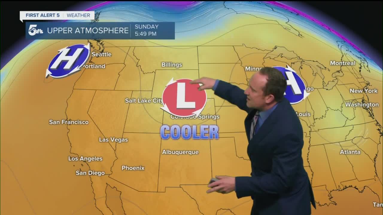
High pressure will continue to influence our weather through Thursday, with warmer than average highs and dry weather conditions. Beginning on Friday, a trough of low pressure will replace high pressure, allowing for a transition to a more active period of weather. After a few isolated storms on Friday, rain chances will increase this weekend, along with cooler, more seasonal temperatures.
____
Curious about the First Alert 5 Weather Storm Impact Scale? Check out our cheatsheet explainer.
Watch KOAA News5 on your time, anytime with our free streaming app available for your Roku, FireTV, AppleTV and Android TV. Just search KOAA News5, download and start watching.
