


Tonight's Forecast:
A Tornado Watch will remain in effect until 9 pm for a large part of the News 5 viewing area. In addition to the threat for tornadoes, these storms will bring the potential for hail up to 2" in diameter, 60-70 mph wind gusts, lightning and heavy rainfall.
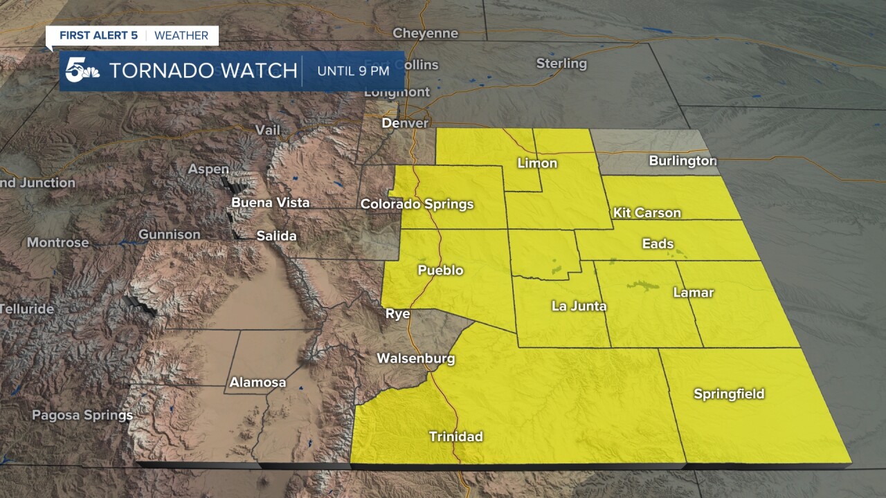
Later tonight as the storms move east, there's the potential for very heavy rainfall across the eastern Plains. Some modeling is advertising between 1-2" of liquid precipitation through Sunday morning.
COLORADO SPRINGS: Low: 50; High: 58. An area low pressure over southeastern Colorado will produce a cool, moist, upslope flow pattern for the next few days. Sunday morning will be your best best for dry weather. By the afternoon, it's likely to be wet, with isolated thunderstorms possible.
PUEBLO: Low: 55; High: 64. Unseasonably cold on Sunday, with rain showers likely by the afternoon. A few isolated thunderstorms may develop, but severe weather is not expected.
CANON CITY: Low: 54; High: 63. Cloudy and cool on Sunday, with highs around 15 to 20 degrees below average. Rain is expected by the afternoon, with the potential for a wet and soggy evening in Canon City.
WOODLAND PARK: Low: 43; High: 54. A rainy and cool Sunday is expected across Teller County. We should see the most persistent period of rainfall from Sunday afternoon into Sunday evening.
TRI-LAKES: Low: 40s; High: 50s. Heavy rainfall and a few isolated thunderstorms will be possible by Sunday afternoon. Rain is likely through Sunday evening, with another soggy and cool day on Memorial Day.
PLAINS: Low: 50s; High: 60s. Cloudy and much cooler on Sunday across the Plains. After a chance of rain in the morning, rain showers and thunderstorms will be much more common by the afternoon and evening hours.
WALSENBURG/TRINIDAD: Low: 40s/50s; High: 60s. Cooler weather for our Sunday, with rain and thunderstorms expected by the afternoon. Severe potential will be lower on Sunday, but not non-existent.
MOUNTAINS: Low: 30s/40s; High: 40s/50s. We'll see a cloudy and unsettled day on Sunday, with rain and isolated thunderstorms. By Sunday night, snow levels will drop down to near 10,000 feet, with a few inches of powder for the higher elevations.
Extended Outlook:
Cool, moist, upslope flow pattern will continue into Memorial Day, with more rain likely as we close out the holiday weekend. With the storm system moving away on Tuesday, we'll see a return to mainly isolated afternoon thunderstorms before drier and warmer weather builds in by the middle of next week.
KOAA News5 on your time, streaming on your Roku, FireTV, AppleTV and AndroidTV.
News5 App | First Alert 5 Weather App | Youtube | Facebook | Instagram | Twitter
