

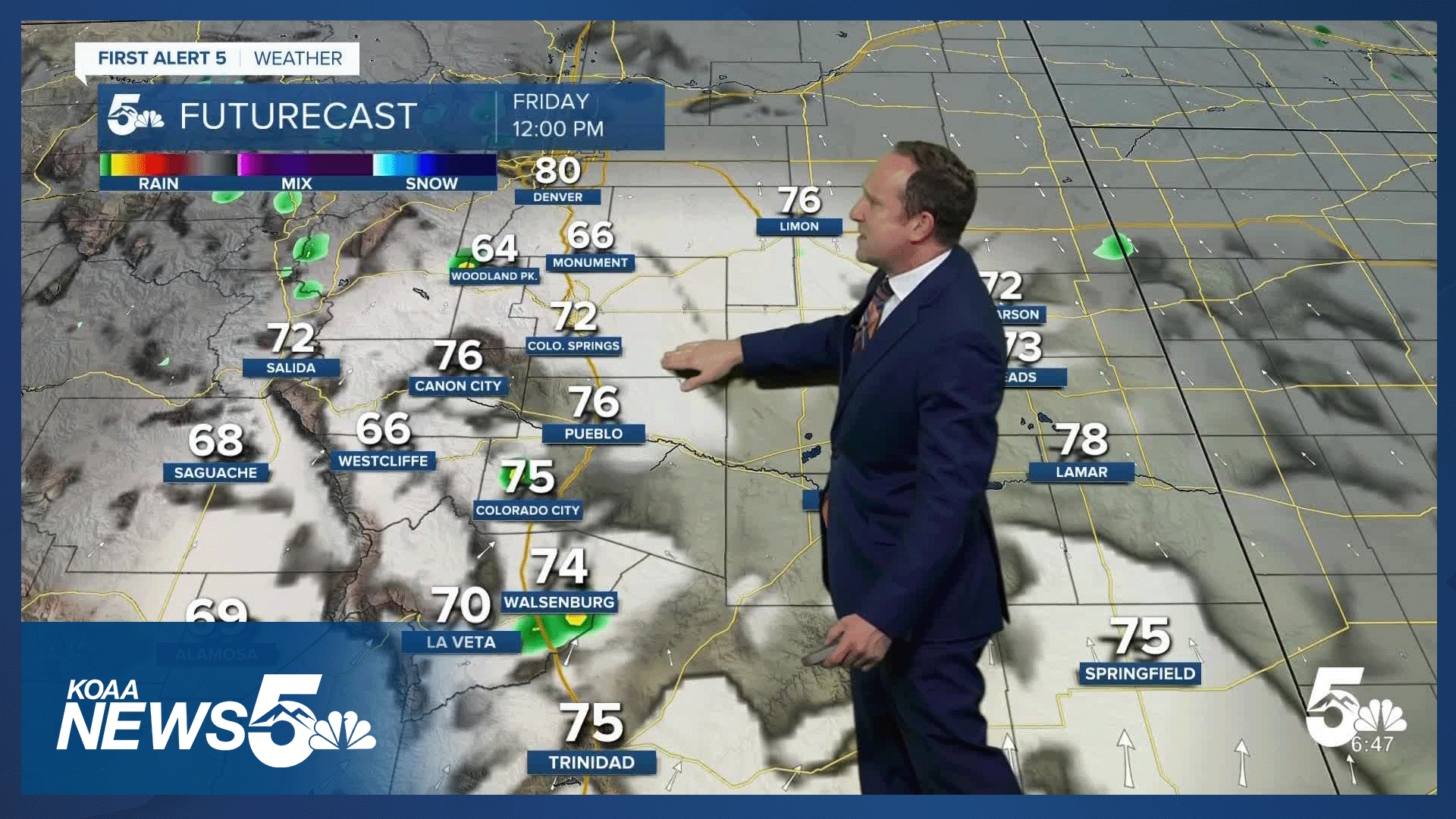


Today’s Forecast:
Areas of low clouds and fog this morning will give way to a mix of sun and clouds this afternoon, with a chance of thunderstorms this afternoon. Storms could pulse up as early as the lunch hour in the mountains and along the Palmer Divide. Storms will spread from southwest to northeast through early this evening, tapering off around sunset. A few storms today could be on the strong to severe side, with 1" hail and wind gusts to 60 mph. These threats will mainly be for areas east of I-25.
Highs today will be around 5-10 degrees warmer than yesterday, with 60s and 70s in Teller County and the mountain valleys, and 70s and 80s on the Plains.
Colorado Springs forecast: High: 77; Low: 46. Low clouds and fog should burn off more efficiently than yesterday, leaving us with a mix of sun, clouds and thunderstorms this afternoon. Our best chances for rain in the Pikes Peak Region today will be between 1-6 pm.
Pueblo forecast: High: 84; Low: 50. As the clouds burn off by mid to late morning, we'll be left with a few hours of sunshine before spotty thunderstorms form. Storms will develop in the mountains and move towards Pueblo County after 1-2 pm.
Canon City forecast: High: 82; Low: 50. Mostly cloudy skies this morning will give way to a mix of sun, clouds and thunderstorms this afternoon. Storms could pulse up as early as the lunch hour in Fremont County.
Woodland Park forecast: High: 68; Low: 41. Areas of fog this morning will give way to a mix of sun, clouds and thunderstorms this afternoon in Teller County. Storms here could fire off by noon, and should wrap up by sunset.
Tri-Lakes forecast: High: 70s; Low: 40s. Foggy skies this morning will turn to sunshine for a few hours ahead of increasing clouds and a chance of thunderstorms early this afternoon. Storms could pulse up as early as 12-1 pm along the Palmer Divide.
Plains forecast: High: 70s/80s; Low: 40s/50s. Rain showers and thunderstorms on the southeastern Plains will wrap up by 8 am. This afternoon, spotty showers and thunderstorms will re-develop, with the potential for a few strong or severe storms on the eastern Plains.
Walsenburg and Trinidad forecast: High: 70s/80s; Low: 40s/50s. Some areas have already seen rain this morning, and in these same locations, we could see some additional showers and thunderstorms this afternoon or evening.
Mountains forecast: High: 60s; Low: 30s/40s. After some lingering rain early this morning, we'll see a brief period of drier skies before we see a return to rain showers and thunderstorms this afternoon. In some areas, rain could develop as early as 11 am to noon.
Extended outlook forecast:
High pressure will expand into Colorado this weekend, leading to warming highs and drying skies. Temperatures will warm into the upper 70s and 80s on Saturday under mostly sunny. Sunday's high will be warmer, topping out near 90 degrees in some areas on the Plains. In Colorado Springs, our high on Sunday is expected to warm to 80 degrees.
An isolated shower or thunderstorm will be possible by Monday afternoon, with increasing chances of thunderstorm chances towards the middle of next week. Highs for the first week of June will warm into the upper 70s and 80s in Colorado Springs.
____
Curious about the First Alert 5 Weather Storm Impact Scale? Check out our cheatsheet explainer.
Watch KOAA News5 on your time, anytime with our free streaming app available for your Roku, FireTV, AppleTV and Android TV. Just search KOAA News5, download and start watching.
