

Today’s Forecast:
Major changes will arrive in Colorado by this evening as an Arctic cold front backs into eastern Colorado. Today is your day to run errands, buy groceries, and prepare for the incoming weather system.
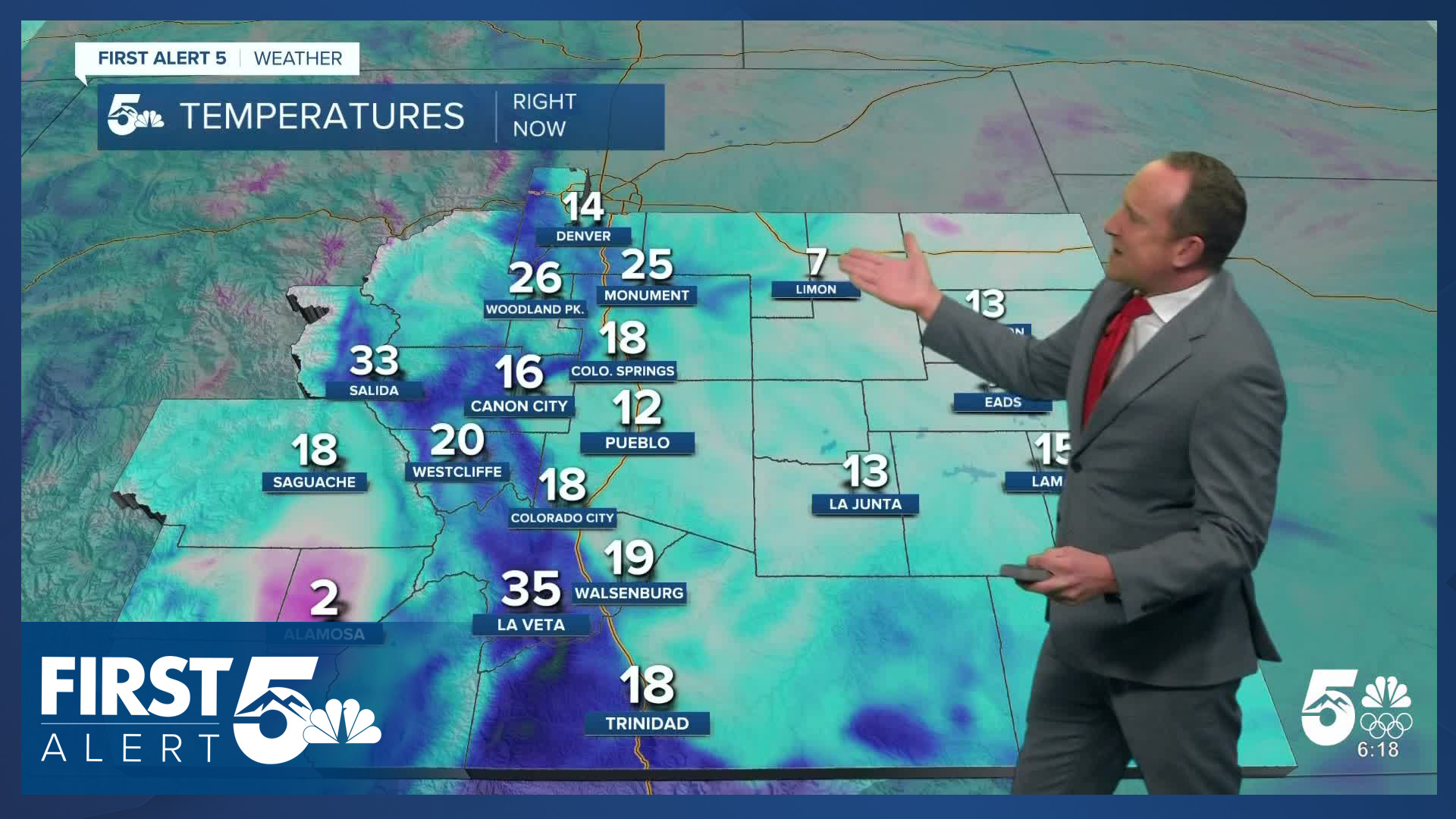
You'll walk outside this morning to mostly clear skies and chilly temperatures. Feels like temps will be in the single digits and teens early today, so grab your winter layers. We'll warm up quickly early today into the 40s by late morning. This will be the best time of the day for any outdoor recreation activities.
Early this afternoon, an Arctic cold front will swing in from the northeast and temperatures will begin to fall as our wind direction shifts upslope out of the east. Cloud cover will also increase this afternoon and evening at multiple levels in the atmosphere.
Colorado Springs forecast: High: 42; Low: 12. Although highs will be slightly below average on Thursday. You'll want to take advantage of today's calm and seasonable weather to take care of any last minute errands before the Arctic air arrives.
Pueblo forecast: High: 45; Low: 13. Scattered high clouds this morning will give way to a partly cloudy and chilly afternoon. Highs today will warm into the 40s, with light easterly winds sustained at 5-10 mph.
Canon City forecast: High: 47; Low: 16. Chilly, near average temperatures can be expected on Thursday ahead of a major case of weather whiplash as Arctic air plunges southward towards the state on Friday.
Woodland Park forecast: High: 42; Low: 10. Today's forecast will bring near average temperatures to Teller County, but today's pleasant weather won't last long as we're tracking a significant cool down this weekend.
Tri-Lakes forecast: High: 30s/40s; Low: 0s/10s. After some warmer weather earlier this week, temperatures will come up a few degrees short of average on Thursday, with the real cold expected to arrive later this evening.
Plains forecast: High: 40s; Low: 0s/10s. After a cold morning on the Plains, highs today will top out in the 40s. By late tonight, the first push of Arctic air will arrive, dropping lows down to the single digits and teens.
Walsenburg and Trinidad forecast: High: 40s/50s; Low: 10s/20s. The southern I-25 corridor will see some of the warmest temperatures region-wide on Thursday, with a few areas warming into the lower 50s. Behind the cold front, lows tonight will drop into the 10s and lower 20s.
Mountains forecast: High: 20s/30s; Low: 10s/20s. Skies will remain dry in the mountains on Thursday, with increasing chances for snow on Friday. Because of the shallow nature of the incoming Arctic air, lows tonight won't be as cold as lower elevation areas to the east.
Extended outlook forecast:
The action begins on Friday. It will be very cold, with high temperatures reached close to midnight and falling throughout the rest of the day. Low clouds will blanket Southern Colorado, and pockets of freezing fog are possible over the Palmer Divide. Upslope easterly flow and moisture will likely wring out light snow showers Friday from mid-morning through mid-afternoon. These should be relatively low impact, with the main accumulating snow still on the way. Wind chills will be bitterly cold on Friday because it will be breezy. It will feel like single digits in the morning and early afternoon, and then wind chills are likely to dip into the negatives by late afternoon. Make sure you cover all exposed skin.
Lows Friday night will fall to the single digits, and wind chills will be below zero across Southern Colorado. Across the eastern Plains, the wind chill may drop to -10 to -20°F or colder, and a Cold Weather Advisory has been issued due to the risk of frostbite. A second Arctic cold front will push south overnight Saturday morning. At the same time, upper level energy and moisture from the southwest will stream into the region, and this will lead to accumulating snow Saturday morning. Temperatures Saturday will likely remain in the teens. Snow will end as energy and moisture move south Saturday evening. Our latest forecast has accumulations in the Pikes Peak Regions of 1-4". Winter Weather Advisories cover most high mountain zones from Friday morning to Sunday morning. Expect winter driving conditions along I-70, U.S. 40, and other roads in the central, southern, southwestern, and northern mountains this weekend.
The Arctic chill continues Saturday night with lows ranging from below zero to the single digits. This is because skies will be clearer, and with snow on the ground, the Arctic airmass will remain in place. This will let energy from the ground escape to space, making an already bitter cold even colder.
The cold lingers Sunday as we warm into the 20s under partly cloudy skies. A stray flurry is possible, though the better chances for any notable snow will be up in the northern mountains.
By Monday, the arctic air shifts east and temperatures climb back to the upper 30s and 40s. This trend continues through mid-week.
____
Curious about the First Alert 5 Weather Storm Impact Scale? Check out our cheatsheet explainer.
Watch KOAA News5 on your time, anytime with our free streaming app available for your Roku, FireTV, AppleTV and Android TV. Just search KOAA News5, download and start watching.
