



Today’s Forecast:
It has been a hot start to the month of August, with 9 of 11 days featuring above average temperatures. The heat will continue for one more day on Wednesday, with cooler changes ahead late this week. Highs this afternoon will cool by a few degrees from yesterday, but remain around 8-12 degrees above average for this time of the year. Temperatures will warm into the 90s and 100s on the Plains, with 70s and 80s for higher terrained areas.
Today will also mark the return of monsoonal moisture into Colorado, with widespread thunderstorms this afternoon in the mountains. Storms will become less numerous as they move east towards the Plains, but should still be more visible today compared to what we have seen so far this week.
Colorado Springs forecast: High: 92; Low: 59. Partly cloudy skies this morning will give way to an uptick in storms this afternoon, with scattered thunderstorms possible anytime after 3 pm. As for the heat, it will remain hot on Wednesday, but cooler changes aren't far behind.
Pueblo forecast: High: 100; Low: 63. If we reach 100 degrees today in Pueblo, and I think we will, it will be our sixth day in a row in the triple digits. A few thunderstorms will be possible this afternoon, which could help to cool us down if you're lucky enough to see a storm where you live.
Canon City forecast: High: 96; Low: 62. August has been hot so far, and today will be no different as highs this afternoon will be around 10 degrees above average. It's also been dry this month so far, but with increasing moisture across the state, storm chances will increase starting this afternoon.
Woodland Park forecast: High: 80; Low: 52. We'll be warming into the 80s once again this afternoon, but this should be it for awhile as highs fall back into the 70s starting tomorrow.
Tri-Lakes forecast: High: 80s/90s; Low: 50s. Still hot today, and turning humid, with scattered thunderstorms in our forecast this afternoon and evening.
Plains forecast: High: 90s/100s; Low: 60s. Today will be a toasty one on the Plains, with temperature as hot as 100-105 degrees. Showers and thunderstorms will pick up in coverage today, with the potential for a few strong to severe thunderstorms north of Highway 50.
Walsenburg and Trinidad forecast: High: 80s/90s; Low: 50s/60s. With the monsoonal moisture pushing into Colorado on Wednesday, it will become more humid this afternoon, with thunderstorms possible across the southern I-25 corridor, favoring Huerfano County.
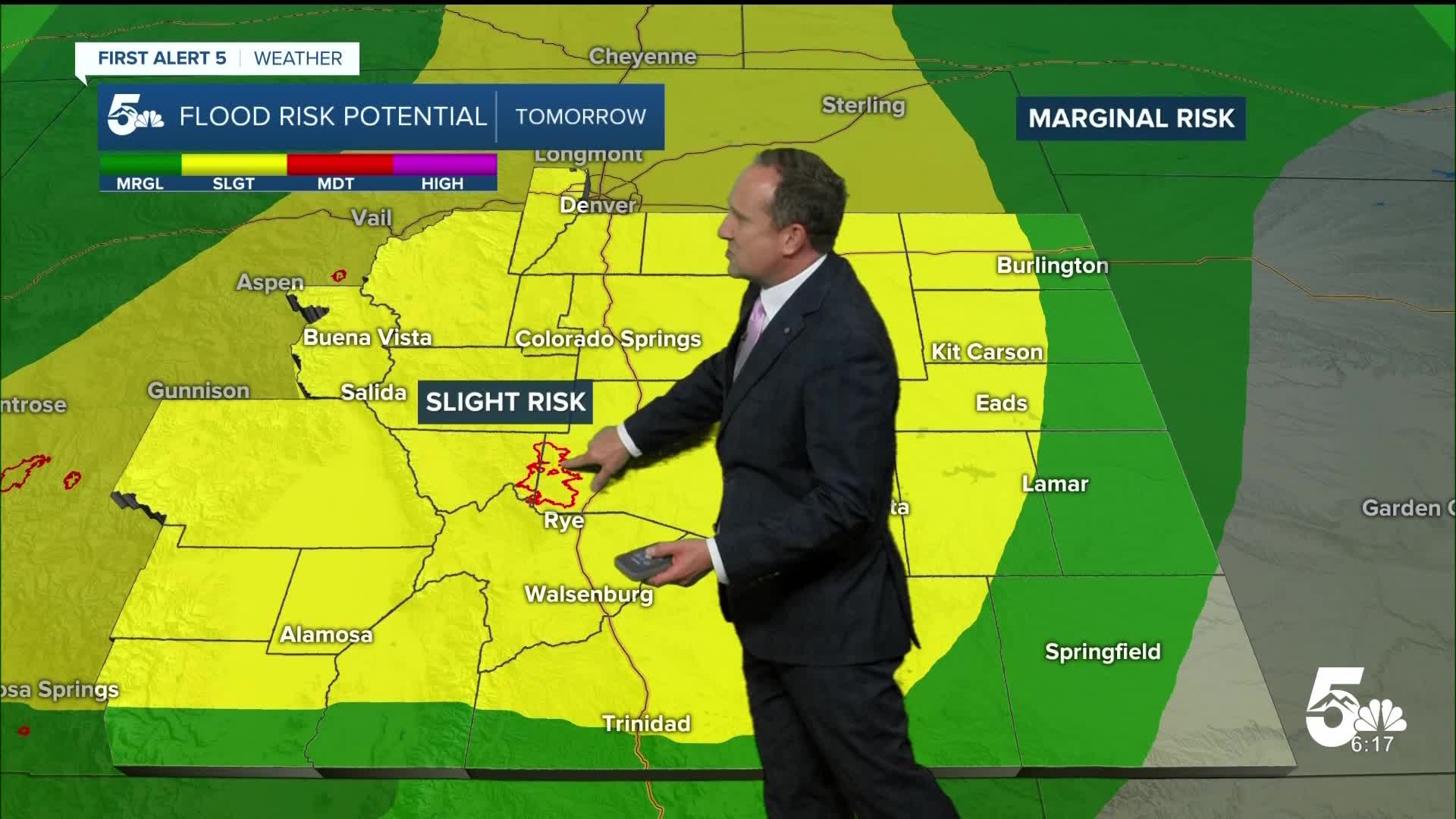
Mountains forecast: High: 60s/70s/80s; Low: 40s/50s. Warm and more humid, with scattered to numerous showers and thunderstorms this afternoon. While the risk for flooding will be low today, it will increase late this week as the monsoon plume turns on high.
Extended outlook forecast:
A late night cold front and increasing monsoonal moisture will allow for better chances for rain late this week. Showers and thunderstorms will be capable of heavy rain and flash flooding from the burn scars to flood prone urban areas. Highs on Thursday will cool down to the mid 80s in Colorado Springs and the lower 90s in Pueblo.
Further cooling can be expected starting on Friday, with a high of around 82 degrees in Colorado Springs. Lower 80s will continue through the weekend, with numerous afternoon showers and thunderstorms each day across the Pikes Peak Region and Southern Colorado.
____
Curious about the First Alert 5 Weather Storm Impact Scale? Check out our cheatsheet explainer.
Watch KOAA News5 on your time, anytime with our free streaming app available for your Roku, FireTV, AppleTV and Android TV. Just search KOAA News5, download and start watching.
