

Today’s Forecast:
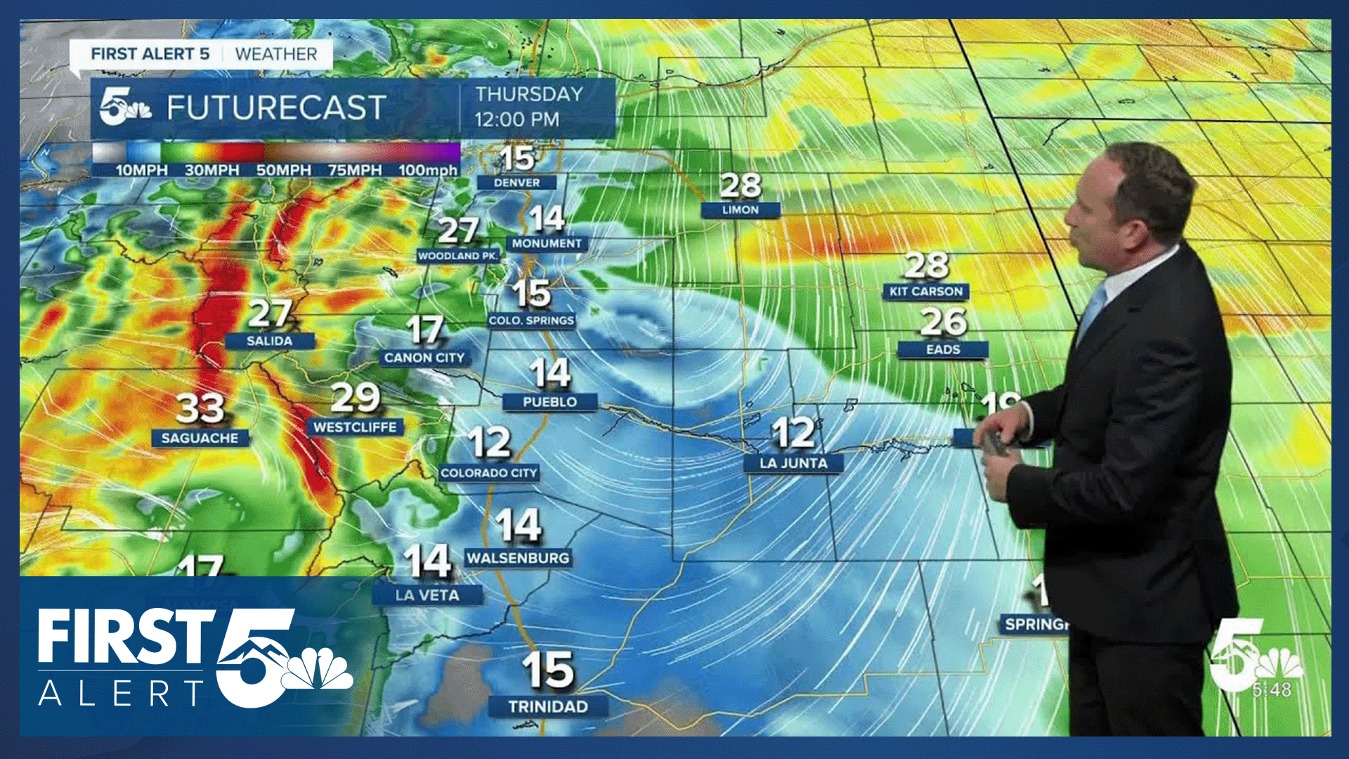
A dry, but potent cold front will continue to sweep southward across Southern Colorado this morning, increasing wind from the north behind the front. Gusts this morning will range between 30-45 mph, and will be strongest east of I-25.
We may see a brief lull in the winds for a few hours around lunch time before the wind increases again this afternoon. With the wind and dry air in place, another Red Flag has been issued on Thursday for the eastern Plains, the upper Arkansas River Valley and the southern I-25 corridor.
The other story today will be the cooler weather. Highs today will be down as much as 8-12 degrees from yesterday, with temperatures topping out in the 70s and 80s.
Colorado Springs forecast: High: 79; Low: 50. A healthy cool down today will come at the hands of a potent, but dry cold front. Peak wind gusts today will be up around 30-35 mph.
Pueblo forecast: High: 85; Low: 52. While our forecast will be much cooler today than yesterday, the wind and high fire danger will remain a concern across Pueblo County, with a Red Flag Warning in effect from 2-8 pm.
Canon City forecast: High: 83; Low: 54. With a healthy drop in temperatures today, highs will be near to slightly below average for this time of the year. However, the wind will remain a factor in the forecast, with a Red Flag Warning in effect from 2 to 8 pm.
Woodland Park forecast: High: 73; Low: 43. A bit of relief will follow a couple of very warm days, with highs this afternoon in the lower 70s. The wind will be variable today across Teller County, with gusts to 35 mph.
Tri-Lakes forecast: High: 70s; Low: 40s/50s. After the passage of a potent cold front, it has been a windy and chilly morning over northern El Paso County. This afternoon will be cooler and gusty, with highs in the 70s.
Plains forecast: High: 70s/80s; Low: 40s/50s. It will be a windy and cooler Thursday, with portions of the Plains under a Red Flag Warning from 11 am to 8 pm. This includes the following counties: Kiowa, Crowley, Bent and Prowers.
Walsenburg and Trinidad forecast: High: 70s/80s; Low: 50s. Windy and dry weather will lead to additional Red Flag Warnings today on the southern I-25 corridor. with today's warnings in effect from 2 pm to 8 pm.
Mountains forecast: High: 60s/70s; Low: 30s/40s. Thursday's forecast will be dry and gusty in the high country, with SW wind gusts this afternoon and evening up around 40 mph in some areas.
Extended outlook forecast:
The wind will shift back out of the W/SW on Friday, leading to a big boost to our highs. Temperatures will climb into the lower 90s in Colorado Springs, with 80s on tap for Monument and Woodland Park.
The first in a series of cold fronts will arrive on Saturday, dropping highs down a few notches to the middle 80s, and allowing for a potential return of spotty showers and thunderstorms by Saturday evening. Temperatures will remain in the 90s on Saturday for the High Plains.
Sunday looks like our wettest and coolest day, with a high in the upper 60s in Colorado Springs. Lower 70s will follow next Monday, with some additional showers still possible ahead of drier and warmer weather towards the middle of next week.
____
Curious about the First Alert 5 Weather Storm Impact Scale? Check out our cheatsheet explainer.
Watch KOAA News5 on your time, anytime with our free streaming app available for your Roku, FireTV, AppleTV and Android TV. Just search KOAA News5, download and start watching.
