

Today’s Forecast:
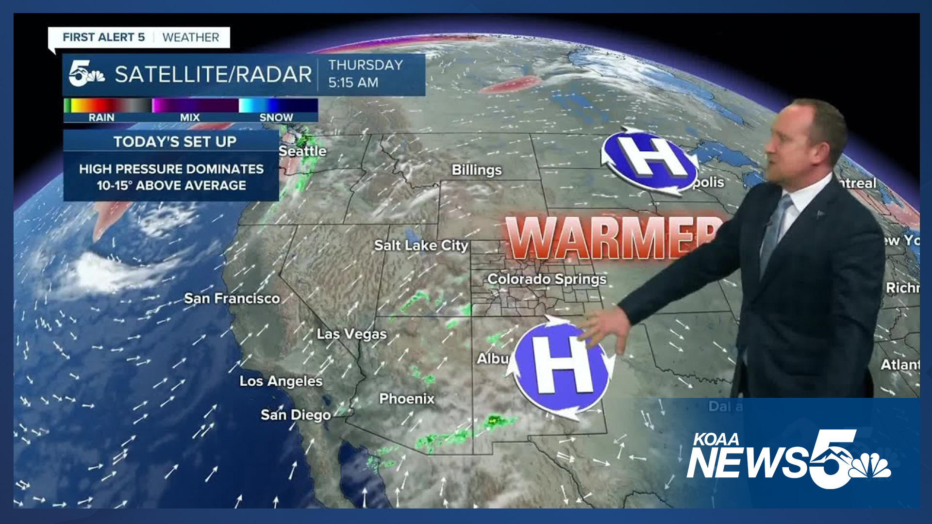
High pressure extending from Colorado to the northern Plains will bring well above average temperatures to the state today, with highs locally running around 10-15 degrees above average.
Skies will clear this morning before turning partly to mostly cloudy this afternoon and evening. Clouds will be increasing from the southwest as moisture from Tropical Storm Priscilla moves into the Four Corners Region. This has prompted Flood Watches for southwestern Colorado as the risk of flooding will remain elevated into the upcoming weekend.
Colorado Springs forecast: High: 81; Low: 51. Lower 80s and sunshine on Thursday will give way to increasing clouds towards the late afternoon and evening hours as sub-tropical moisture expands across the state.
Pueblo forecast: High: 86; Low: 52. With an average high of 73 degrees on October 9, today's high of 86 degrees will be well above that, and close to the current record of 89 (2020).
Canon City forecast: High: 83; Low: 55. After a couple of fall like days earlier this week, summer seems to have a firm grip on our forecast today, with highs this afternoon topping out in the lower to middle 80s.
Woodland Park forecast: High: 70; Low: 45. Bright skies early will give way to a partly cloudy, dry and mild afternoon. Highs in Teller County will range from the 60s in Cripple Creek and Victor to the lower 70s in Woodland Park.
Tri-Lakes forecast: High: 70s; Low: 40s/50s. Clear skies this morning will be followed by increasing clouds this afternoon as sub-tropical moisture increases from the southwest. Highs today will be above average, with slightly cooler highs as we head into the weekend.
Plains forecast: High: 80s; Low: 50s. The fall-like weather that we saw earlier this week will be replaced with a late push of summer as highs today will soar into the middle to upper 80s.
Walsenburg and Trinidad forecast: High: 70s/80s; Low: 40s/50s. Sunshine this morning will give way to increasing cloud cover this afternoon as highs will top out in the upper 70s and 80s along the southern I-25 corridor.
Mountains forecast: High: 60s; Low: 40s. For anyone spending time in the mountains today, we're expecting a nice and mild Thursday, with sunshine early giving way to mostly cloudy skies this afternoon. Rain is not expected today in the Wet Mountains or Sangre de Cristos.
Extended outlook forecast:
Skies on Friday will be fairly overcast as remnants of Tropical Storm Priscilla continues to send sub-tropical moisture into the state. The added cloud cool cover will cool highs back down to the mid-70s in Colorado Springs. While most of rain on Friday will favor the mountains, we can't rule out an isolated shower in the Pikes Peak Region.
Saturday looks quite similar to Friday, with mostly cloudy skies and 70s in Colorado Springs. Much like Friday, heavy rain will continue to impact western Colorado, with only a slight chance of a shower locally. Sunday will be bright, breezy and warm, with peak afternoon wind gusts around 2
____
Curious about the First Alert 5 Weather Storm Impact Scale? Check out our cheatsheet explainer.

Watch KOAA News5 on your time, anytime with our free streaming app available for your Roku, FireTV, AppleTV and Android TV. Just search KOAA News5, download and start watching.
