

Tonight's Forecast:
It will be a mild night in southern Colorado with some spots remaining above freezing. There will be a very light breeze from the west tonight, downsloping off the mountains.
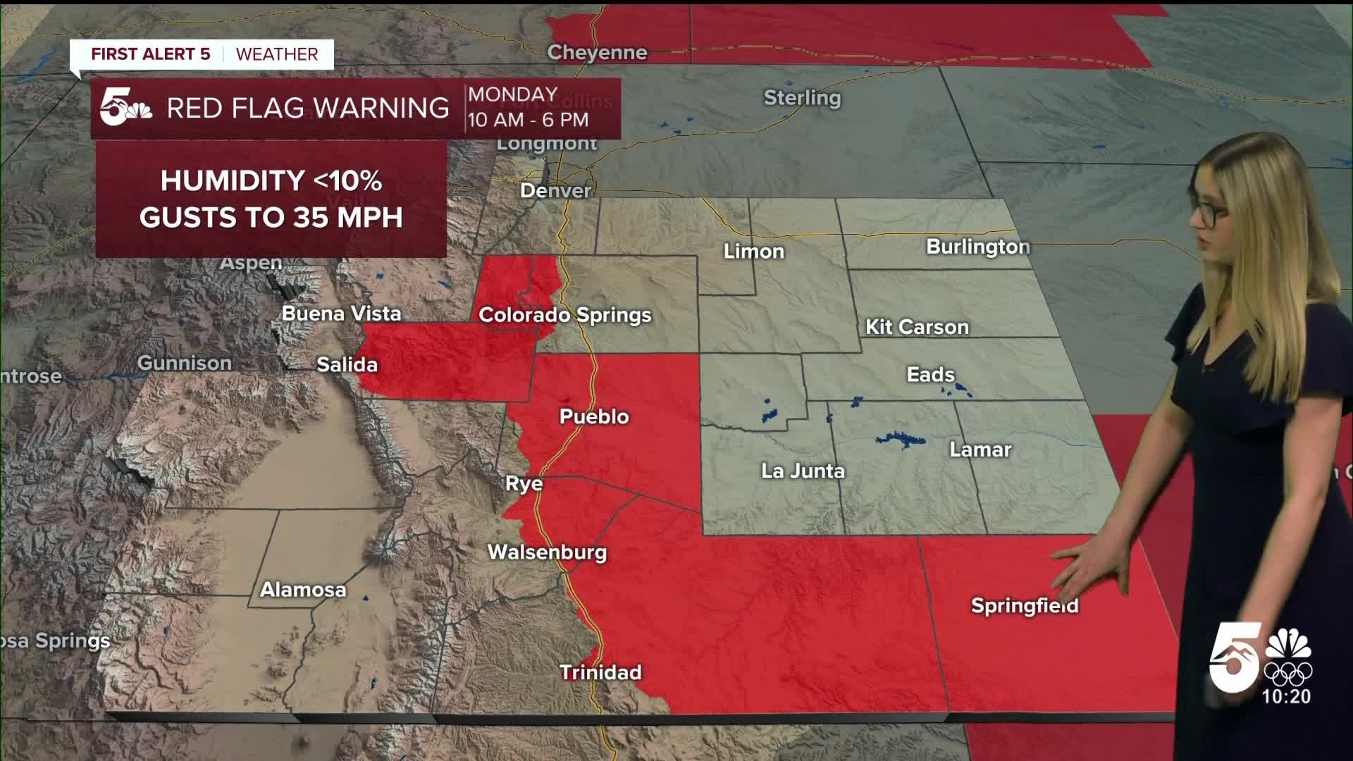
Monday Fire Danger:
After a mild, dry morning, conditions quickly warm up, and winds will increase. A RED FLAG WARNING is in effect for the zones in red, from 10 am until 6 pm. In these areas, relative humidity will drop below 10%, and wind will gust 30-35 mph. Fire danger will be very high; do not create any sparks or flames outside!

Colorado Springs forecast: Low: 32; High: 68;
Monday is looking very warm, with the forecast high getting very close to the daily record high for February 9, which stands at 71° from 1996. It will be partly cloudy with W wind at 10 mph gusting to 25 mph.
Pueblo forecast: Low: 31; High: 73;
RED FLAG WARNING from 10 am until 6 pm. Wind will be out of the W at 10-15 mph, gusting to 25 mph. It will be mostly sunny and warm.
Canon City forecast: Low: 37; High: 70;
RED FLAG WARNING from 10 am until 6 pm. Wind will be out of the W at 10-15 mph, gusting to 30 mph. It will be mostly sunny with warm temperatures.
Woodland Park forecast: Low: 31; High: 59;
RED FLAG WARNING from 10 am until 6 pm. Wind will be out of the W at 10-15 mph, gusting to 30 mph. It will be mostly sunny and mild.
Tri-Lakes forecast: Low: 34; High: 64;
Monday will be partly cloudy and mild with WNW wind at 10 mph gusting to 20 mph.
Plains forecast: Low: 20s-30s; High: 60s-70s;
RED FLAG WARNING from 10 am until 6 pm for Las Animas County and Baca County. Wind will be generally out of the W at 10 mph, gusting 15-25 mph. It will be mostly sunny and warm on Monday with highs in the upper 60s to upper 70s.
Walsenburg and Trinidad forecast: Low: 36/32; High: 68/73;
RED FLAG WARNING from 10 am until 6 pm. It will be gusty with W wind at 10-15 mph, gusting 30-35 mph. Temperatures will be warm, and the sky will be mostly sunny.
Mountains forecast: Low: teens-30s; High: 50s-60s;
The mountain valleys will be mostly sunny and mild on Monday. Winds will be gusty, generally out of the W at 10-15 mph, gusting 25-35 mph.
Extended outlook forecast:
A breezy but dry cold front sweeps through on Tuesday, dropping high temperatures by about 15 degrees. But we boost back up to the 50s and 60s on Wednesday with sunshine. Temperatures begin to fall again on Thursday into Friday to the 40s and 50s as our next storm system arrives. This storm looks to bring some late-week snow to the mountains and rain or a wintry mix to the plains. Showers are possible both Thursday and Friday.
____
Curious about the First Alert 5 Weather Storm Impact Scale? Check out our cheatsheet explainer.
Watch KOAA News5 on your time, anytime with our free streaming app available for your Roku, FireTV, AppleTV and Android TV. Just search KOAA News5, download and start watching.
