



Today’s Forecast:
Thursday's forecast will feature more of the same for Southern Colorado. This will include more hot, dry and breezy weather for the Plains, with the mountain zones seeing continued chances for afternoon and evening showers. Showers will once again be slow moving, and may bring additional threats of heavy rainfall and flash flooding, especially for areas nearby any recent fires.
Some higher resolution modeling also suggests that storms could drift into parts of Teller County this evening. Dry skies are expected in Colorado Springs and Pueblo.
Highs on Thursday will be similar to what we saw on Wednesday. Temperatures will warm into the 80s and and 90s on the Plains, with 70s and lower 80s in the mountains and valleys.
Colorado Springs forecast: High: 88; Low: 59. We won't see any big changes in the forecast department today, with dry skies, breezy SE winds and seasonably warm temperatures.
Pueblo forecast: High: 95; Low: 64. We'll see more of the same on Thursday...dry skies, breezy SE winds and plenty of heat. Highs today will top out in the middle 90s.
Canon City forecast: High: 91; Low: 63. Happy Thursday! Our weather today will be a lot like yesterday, with dry and breezy weather, and near average highs.
Woodland Park forecast: High: 78; Low: 52. Clouds will build into the afternoon hours in Teller County and by late this afternoon or early this evening, it's possible that we could see a few isolated showers drift in from the west.
Tri-Lakes forecast: High: 80s; Low: 50s. Skies will be on the mostly sunny to partly cloudy side today, but rain is not expected in northern El Paso County.
Plains forecast: High: 90s; Low: 60s. Hot and dry, with similar conditions to what we saw yesterday. Southeasterly winds will be be sustained at 10-20 mph, with gusts to 35 mph.
Walsenburg and Trinidad forecast: High: 80s/90s; Low: 50s/60s. After a windy morning in Las Animas County, we will see a warm and breezy day on Thursday. Winds this afternoon will be out of the SE, sustained around 10-20 mph. Closer to the mountains, gusty downslope winds will be possible.
Mountains forecast: High: 60s/70s; Low: 40s/50s. We will continue to see a mixed bag of weather across the state today, with the mountains being ground zero for slow moving storms, capable of heavy rain, flooding, lightning and gusty winds. A few storms today may drift into Teller County and the Pikes Peak Region.
Extended outlook forecast:
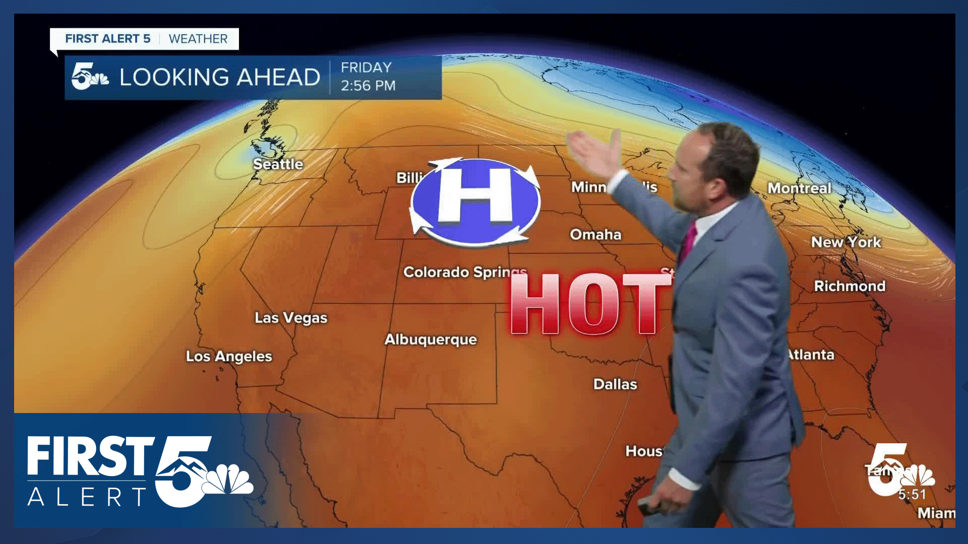
High pressure will drift towards Colorado and the Four Corners Region this weekend, and this will push monsoon moisture farther to our west. Skies from the southeastern mountains into the Plains will be dry, and it will turn hot. Highs will warm into the 90s this weekend in Colorado Springs, with triple digits on the eastern Plains.
Early next week, high pressure will shift east towards Texas. There's still some uncertainty with the exact position of the ridge. However, our current thinking is that the position of the ridge over Texas should open up the door for ample moisture to stream into the state, with better chances for rain and cooler temperatures in the extended forecast.
____
Curious about the First Alert 5 Weather Storm Impact Scale? Check out our cheatsheet explainer.
Watch KOAA News5 on your time, anytime with our free streaming app available for your Roku, FireTV, AppleTV and Android TV. Just search KOAA News5, download and start watching.
