

Tonight's Forecast:
It will be mostly cloudy and still mild compared to average tonight. The plains will be dry, but there will be showers in the mountains, mostly along and west of the Continental Divide.
Winter weather advisories are in effect for the high country tonight, expiring Wednesday at 9 pm.

Colorado Springs forecast: Low: 36; High: 65;
It will be mostly cloudy on Wednesday with a chance of rain and thunderstorms in the afternoon. Showers will be hit or miss. Wind will be out of the SW at 10 mph gusting to 30 mph.
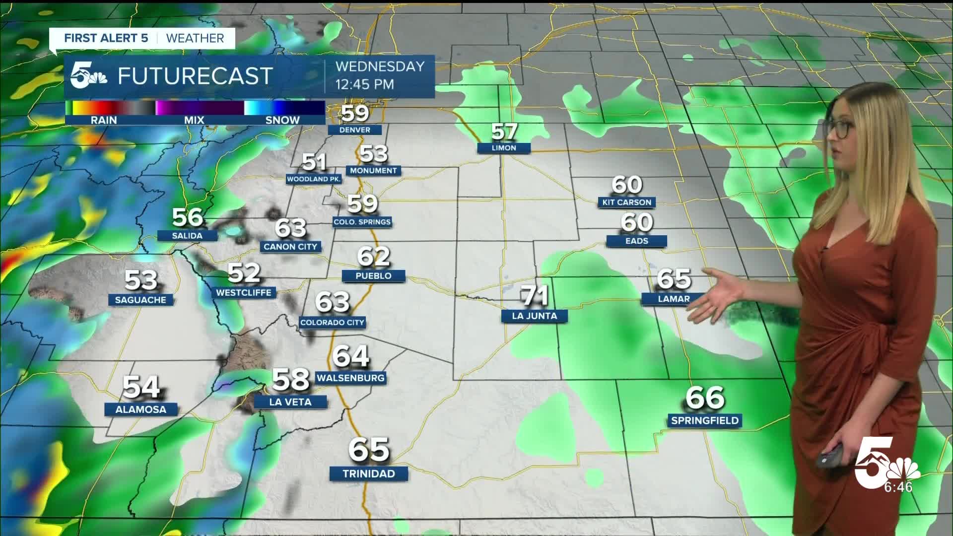
Pueblo forecast: Low: 40; High: 72;
It will be mostly cloudy on Wednesday with an isolated shower or thunderstorm possible in the afternoon. Wind will be gusty out of the SW at 10-15 mph, gusting to 35 mph.
Canon City forecast: Low: 41; High: 68;
Wednesday will be mostly cloudy with a chance of afternoon rain shower or isolated thunderstorm. Wind will be out of the WSW at 10-15 mph, gusting to 40 mph.
Woodland Park forecast: Low: 34; High: 55;
It will be partly cloudy on Wednesday with a chance of spotty rain or a wintry mix, favoring the afternoon. Wind will be gusty out of the WSW at 10-15 mph, gusting to 35 mph.
Tri-Lakes forecast: Low: 35; High: 61;
It will be mostly cloudy on Wednesday with a chance of afternoon rain or an isolated thunderstorm. Wind will be out of the WSW at 10 mph gusting to 30 mph.
Plains forecast: Low: 30s-40s; High: 60s-70s;
It will be mostly cloudy on Wednesday with some sprinkles possible in the morning, and spotty rain and thunderstorms possible in the afternoon and evening. Wind will be out of the SW at 10-15 mph, gusting 35-40 mph.
Walsenburg and Trinidad forecast: Low: 46/47; High: 63/66;
It will be partly to mostly cloudy on Wednesday. An isolated afternoon shower is possible. Wind will be strong, out of the WSW at 15-20 mph, gusting 40-45 mph.
Mountains forecast: Low: 30s; High: 50s;
It will be mostly cloudy with W wind at 10-20 mph gusting 35-45 mph. There will be snow showers over the Sangre De Cristos mountains and the Sawatch Range with some spillover of rain or a wintry mix into the adjacent valleys.
Extended outlook forecast:
Thursday dries out with sunshine and warmer temperatures. Fire danger will quickly return, with gusty winds expected.
Our next cold front arrives on Friday, dropping temperatures to the 40s-60s with a very low chance of precipitation.
____
Curious about the First Alert 5 Weather Storm Impact Scale? Check out our cheatsheet explainer.
Watch KOAA News5 on your time, anytime with our free streaming app available for your Roku, FireTV, AppleTV and Android TV. Just search KOAA News5, download and start watching.
