

Today’s Forecast:
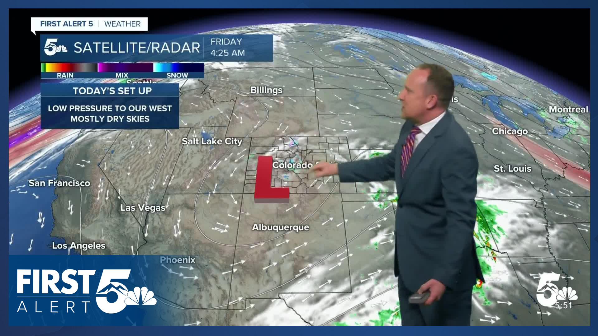
Our well advertised late week storm will continue to spin off to our west this morning before dropping south into New Mexico this afternoon. With the center of the storm over the mountains, that's where we'll see most of the action today. Highs will be the coolest of the week and down a few degrees from what we saw yesterday. Under mostly sunny to partly cloudy skies, highs this afternoon will warm into the 50s and 60s across Southern Colorado.
Colorado Springs forecast: High: 60; Low: 37. Your updated forecast calls for drier skies on Friday as the bulk of the moisture looks to stay just south and west of Colorado Springs.
Pueblo forecast: High: 65; Low: 36. Although a sprinkle or two will be possible on Friday in Pueblo County, most of the rain and snow that we'll see will stay south and west of our area.
Canon City forecast: High: 62; Low: 41. Temperatures will be a few degrees below average on Friday, with a slight chance of rain this morning across parts of eastern Fremont County.
Woodland Park forecast: High: 51; Low: 30. There's a slight chance of a few rain showers or flurries this morning, but as low pressure moves southward into New Mexico this afternoon, skies will clear out across Teller County.
Tri-Lakes forecast: High: 50s; Low: 30s. In northern El Paso County, it looks like we'll miss out on any rain or snow this morning. Through the afternoon hours, sunshine will return as highs climb into the middle to upper 50s.
Plains forecast: High: 60s; Low: 30s/40s. After some early morning showers on the southeastern Plains, most of our day on Friday will be on the mellow side compared to what we saw on Thursday. Temperatures will be cooler today under partly cloudy skies.
Walsenburg and Trinidad forecast: High: 50s/60s; Low: 30s. With low pressure to our west this morning, we may see a shower or thunderstorm drift from the mountains to the southern I-25 corridor today. Rain chances farther east of I-25 will be much lower than for areas that are closest to the Raton Mesa and mountains.
Mountains forecast: High: 40s; Low: 20s/30s. After seeing some snow in the mountains last night and this morning, lingering snow showers will continue to be possible through this afternoon before our skies dry out this weekend. Up to 1" of additional accumulations will be possible in some areas.
Extended outlook forecast:
With low pressure on the way out this weekend and high pressure as the main weather feature in Southern Colorado, we're looking at a dry and warmer forecast. Highs on Saturday will rebound into the upper 60s in Colorado Springs, with lower 70s possible Sunday. Highs in Pueblo will warm into the 70s both days.
Next week's forecast has been trending drier the past few days, and this continues to be the case this morning. Instead of any rain or snow, Sunday to Tuesday will be on the breezy side, with highs expected to cool into the 50 by Tuesday in the Pikes Peak Region. Overall, our forecast will remain very quiet into next week, with no sign through the end of October of our first snowfall of the season for Colorado Springs or Pueblo.
____
Curious about the First Alert 5 Weather Storm Impact Scale? Check out our cheatsheet explainer.
Watch KOAA News5 on your time, anytime with our free streaming app available for your Roku, FireTV, AppleTV and Android TV. Just search KOAA News5, download and start watching.
