

Today’s Forecast:
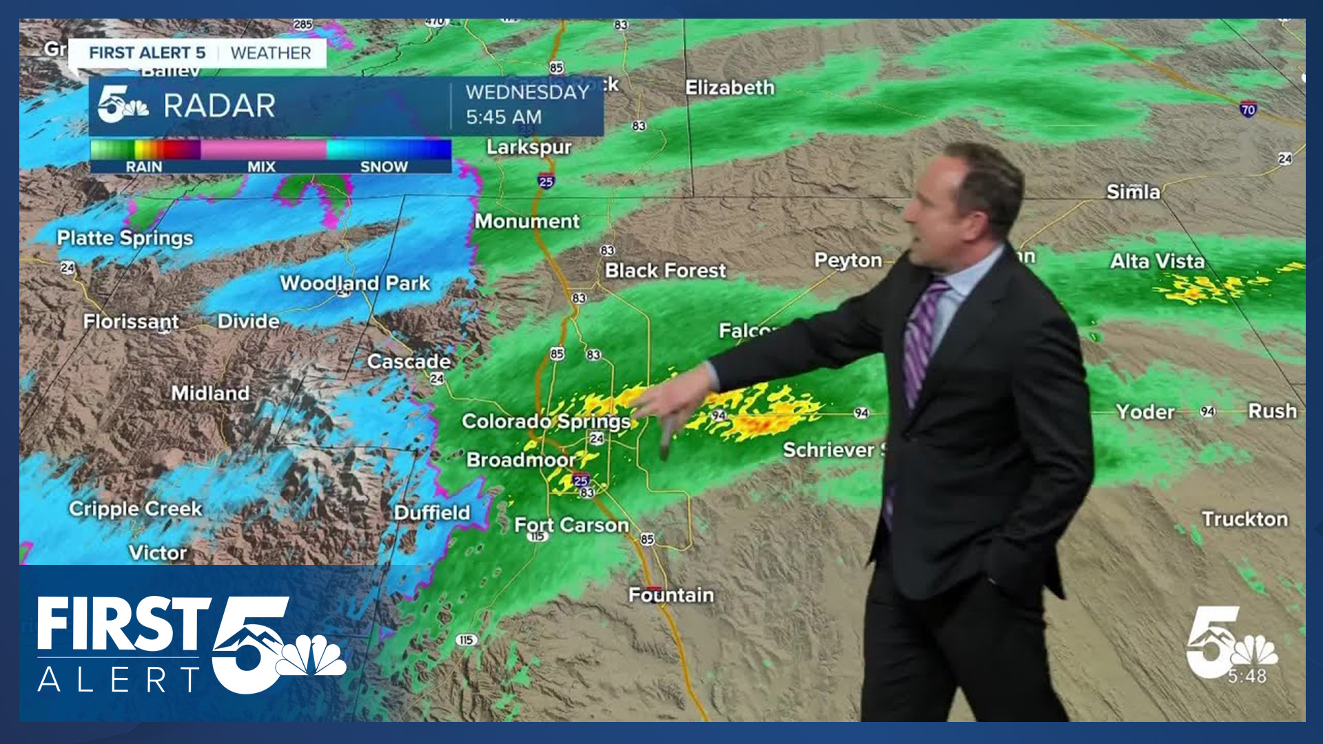
A large upper-level trough (area of low pressure) is moving eastward toward Colorado this morning. Ahead of this trough, mid-level lift is supporting showers across the Pikes Peak Region and parts of Southern Colorado. These are rain showers below about 7,000 feet. Above 7,000 feet over the Palmer Divide, and in Teller County, these showers have transitioned to snow. We have received reports at 9,400 feet in Teller County of 4.5-6" of snow. About 2" of snow has fallen in Woodland Park.
Banded showers will come to an end later this morning across the Pikes Peak Region. The early cloud cover, and evaporative cooling, mean that today starts with a notable chill in the air and it will take time to warm up into the afternoon.
By afternoon, evaporation of the morning precipitation and warming will combine with another batch of mid-level energy to create a chance for scattered thunderstorms. These will be likely after 12:00 PM with the chance continuing through the afternoon. Isolated small hail is possible, mainly east of I-25. Highs today will be in the 50s, 60s and lower 70s across Southern Colorado.
Colorado Springs forecast: High: 59; Low: 40. Rain showers will come to an end a little after sunrise today in Colorado Springs, with a brief lull in the action until we see a chance for scattered showers and thunderstorms this afternoon.
Pueblo forecast: High: 66; Low: 43. After some evening and overnight rain showers, we're waking up to a mix and sun and clouds this morning in Pueblo. Dry skies should continue into the early afternoon ahead of the potential for scattered showers and thunderstorms later today and this evening.
Canon City forecast: High: 63; Low: 45. As showers taper off this morning, we'll see a small break in the action ahead of a chance for showers and thunderstorms this afternoon. Today's highs will be around 15 degrees below average.
Woodland Park forecast: High: 53; Low: 33. A healthy overnight storm brought as much as 2-6" of snow accumulation to northern parts of Teller County and some roads are a mess this morning. Snow will come to an end between 9-11 am, but we're not done with the precip for today, with additional showers and thunderstorms this afternoon and evening.
Tri-Lakes forecast: High: 50s; Low: 30s. It's been another night and morning of beneficial moisture, with rain and snow giving way to a small break in the action for a few hours today ahead of increasing chances for rain and thunderstorms anytime after 1 pm, extending into this evening.
Plains forecast: High: 60s/70s; Low: 40s. Storms that form near the mountains/I-25 interface this afternoon will move east into a more favorable environment for strong to isolated severe thunderstorms on the Plains. Storms today will be capable of brief periods of heavy rainfall, frequent lightning, 1" hail and gusty winds.
Walsenburg and Trinidad forecast: High: 60s/70s; Low: 40s. Rain chances this afternoon will be up around 50%, with rain and thunderstorms for some areas today, but not all.
Mountains forecast: High: 40s/50s; Low: 20s/30s. After snow this morning on Pikes Peak and the northern Sangres, a brief period of dry weather will give way to an additional chance of showers and thunderstorms this afternoon and evening. Rain and snow could return to some mountain zones as early as the lunch hour today.
Extended outlook forecast:
More upper-level energy will move in from the north on Thursday, and there will be another chance for thunderstorms. A few of these storms could be strong to severe, with gusty wind and small hail. The best chances for severe weather on Thursday will be east of I-25.
On Friday, showers and storms will be a bit more concentrated in the mountain areas. Thunderstorm chances will increase again Saturday. While they should be isolated, a few of these storms may again be strong. Highs remain in the 60s and 70s both days on the Plains.
Scattered mountain showers and thunderstorms are possible Memorial Day weekend. Both Saturday and Sunday will have storms that generally form over our high mountain summits. Be off summits before noon if you're hiking Saturday or Sunday. This chance will remain on Monday as well.
Temperatures warm in the Pikes Peak Region on Sunday to the upper 70s as upper-level ridging builds. The warmth will continue next week, with ongoing daily chances for thunderstorms that favor the mountain zones.
____
Curious about the First Alert 5 Weather Storm Impact Scale? Check out our cheatsheet explainer.
Watch KOAA News5 on your time, anytime with our free streaming app available for your Roku, FireTV, AppleTV and Android TV. Just search KOAA News5, download and start watching.
