

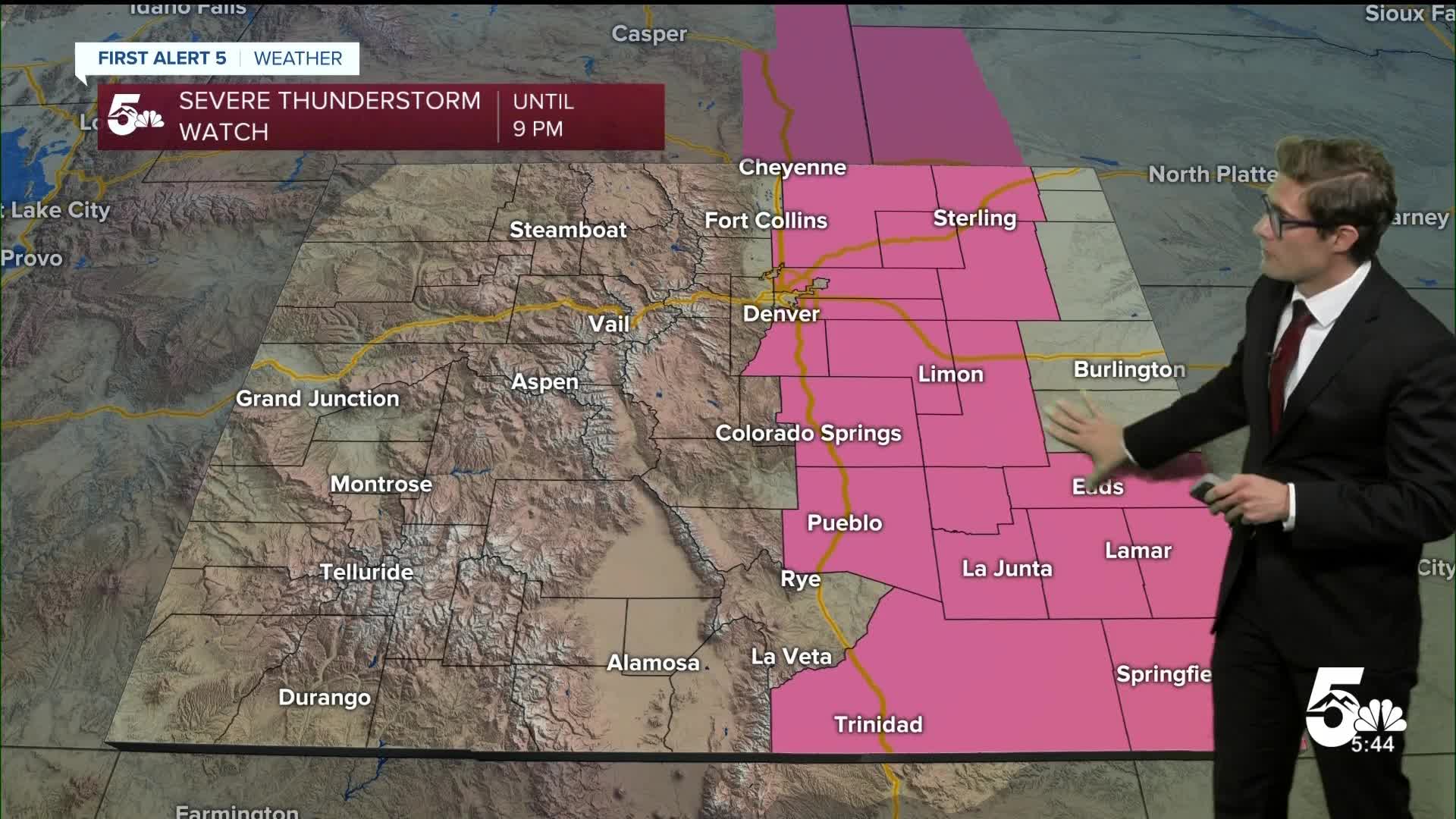

COLORADO SPRINGS, Colo. (KOAA) — Tonight's Forecast:
Severe storms will continue to move to the eastern plains early tonight, with a more isolated and weaker group of showers and storms possible late this evening into the overnight north of highway 50 in response to a secondary cold front and incoming mid-level energy. After 2-3 AM, this potential will decrease and skies clear across southern Colorado.
Colorado Springs forecast: Low: 54; High: 78;
A stray weak shower or storm before 2:00 AM, clearing skies overnight. A bit cooler Sunday with scattered PM thunderstorms.
Pueblo forecast: Low: 60; High: 84;
FLASH FLOOD WATCH in effect for the ASPEN ACRES BURN SCAR from 12:00 PM - 8:00 PM
A weak isolated shower before 1:00 AM, then slowly clearing skies. Sunny Sunday morning with scattered PM storms, a few strong.
Canon City forecast: Low: 61; High: 83;
A shower or two before 1:00 AM, then clearing and mild overnight. Mostly sunny early Sunday with isolated to scattered PM thunderstorms capable of heavy rain.
Woodland Park forecast: Low: 50; High: 72;
Mostly cloudy with an isolated thunderstorm before midnight. Then clearing skies. Mostly sunny Sunday morning with scattered PM thunderstorms.
Tri-Lakes forecast: Low: 50s; High: 70s;
A stray shower before 1:00 AM, then clearing overnight. Storm chances return again Sunday and severe storms will be possible again.
Plains forecast: Low: 60s; High: 80s;
A shower is possible before 3:00 AM, then skies should become partly cloudy overnight and eventually mainly clear. Lower daytime storm chances Sunday, with a few strong late afternoon to evening storms likely.
Walsenburg and Trinidad forecast: Low: 56/57; High: 80/84;
Partly cloudy tonight. Thunderstorms are likely again Sunday.
Mountains forecast: Low: 50s; High: 70s;
FLASH FLOOD WATCH in effect for the ASPEN ACRES BURN SCAR from 12:00 PM - 8:00 PM
Extended outlook forecast:
Strong thunderstorms are possible again on Sunday, with large hail, damaging wind, and heavy rain possible. A reinforcing cold front will provide a bit more upslope support to our environment, but the storm mode is likely to be more cellular...which is to say, if you get a storm, it's likely to be significant, but you're ultimately less likely to see rain compared to Saturday.
It will be a sunnier morning compared to Saturday which will make for a nice time for outdoor hikes, walks, or errands. But, just like Saturday, storms will fire up around noon in the mountains on Sunday and then move through the plains. The strongest storms are likely from 12-7 PM along I-25, and could last after sunset on the plains.
Storm chances drop significantly Monday, but isolated afternoon storms are still possible, particularly over the eastern plains, with a stray shower or storm in the Pikes Peak Region (20% chance). Otherwise expect a warmer day with highs back to seasonal. High pressure swings west into the Four Corners Region next week, with hot conditions in the mid-week, and a cold front arriving Tuesday night.
The extra moisture the front brings in, along with post frontal upslope flow, will combine to bring another chance for storms, a few strong, on Wednesday.
____
Curious about the First Alert 5 Weather Storm Impact Scale? Check out our cheatsheet explainer.
Watch KOAA News5 on your time, anytime with our free streaming app available for your Roku, FireTV, AppleTV and Android TV. Just search KOAA News5, download and start watching.
