



Today’s Forecast:
After near record-breaking heat on Tuesday, highs today will be down around 6-10 degrees after the passage of a strong cold front last night. That front has brought thunderstorms to parts of Southern Colorado this morning. Most of these storms will wrap up by 8-9 am.
An influx of moisture will combine with incoming energy and a soupy upslope flow pattern to allow for more numerous showers and thunderstorms this afternoon. Storms will fire off in the mountains between 1-2 pm, with the bulk of our impacts on the I-25 urban corridor between 2-6 pm. Storms today will be capable of 1" hail, 60 mph, heavy rain, and flooding.
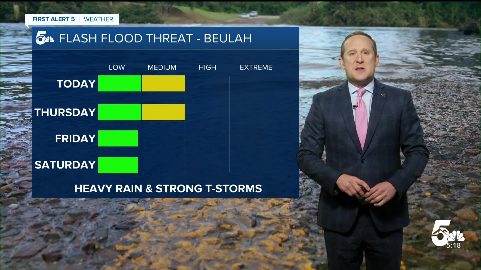
In the Aspen Acres burn scar, a Flash Flood Watch has been issued today from 1-8 pm. If you live in Beulah or near the burn scar, you need to take any Flood Warnings very seriously today.
Colorado Springs forecast: High: 85; Low: 58. After a few early morning thunderstorms, skies will turn mostly sunny to partly cloudy heading towards the lunch hour. Storms will roll off of the mountains anytime after 2 pm, with the threat for rain until the dinner hour.
Pueblo forecast: High: 91; Low: 60. Wednesday will be cooler and more unsettled. Highs will drop down around 6-10 degrees from yesterday, with showers and thunderstorm chances growing by 2-3 pm.
Canon City forecast: High: 89; Low: 62. Yesterday's hot and dry weather will be replaced with humid and stormy weather on Wednesday. Storms will be capable of locally heavy rain this afternoon.
Woodland Park forecast: High: 78; Low: 52. Dry skies this morning will give way to scattered afternoon thunderstorms, with storms developing as early as 1-2 pm in Teller County.
Tri-Lakes forecast: High: 70s/80s; Low: 50s. Outdoor plans this afternoon may get rained out as stronger storms and widespread showers are likely today around the Palmer Divide. Storms could pulse up as early as 1-2 pm.
Plains forecast: High: 80s/90s; Low: 50s/60s. The southeastern Plains will see another risk of severe weather and flooding this afternoon and evening. Storm today will be capable of 1" hail and 60 mph wind gusts. Threats will be highest south of Highway 50.
Walsenburg and Trinidad forecast: High: 80s/90s; Low: 50s/60s. Storms will be more numerous today across the southern I-25 corridor and Raton Mesa region. Any stronger storms that form will be capable of small hail, gusty winds and heavy rainfall.
Mountains forecast: High: 60s/70s/80s; Low: 40s/50s. The mountains and mountain valleys will be ground zero today for heavy rain and flash flooding. Flood threats will increase after 1-2 pm, and with numerous rounds of rain in our forecast today, the risk will remain elevated until this evening. A FLASH FLOOD WATCH will remain in effect today from 1-8 pm.
Extended outlook forecast:
High pressure will remain parked over the Four Corners Region late this this week. This will suppress shower chances in the Pikes Peak Region and eastern Plains, allowing for hotter 90s and lower 100s to return to our forecast. If we do see any rain from Thursday to Friday, it will mainly favor the mountains, foothills, and southern I-25 corridor.
Temperatures will remain in the 90s and lower 100s through the weekend. As high pressure slides off to the east, moisture will increase over the Plains. A few thunderstorms will be possible by Saturday afternoon, with better chances for rain from Sunday into early next week.
____
Curious about the First Alert 5 Weather Storm Impact Scale? Check out our cheatsheet explainer.
Watch KOAA News5 on your time, anytime with our free streaming app available for your Roku, FireTV, AppleTV and Android TV. Just search KOAA News5, download and start watching.
