



Today’s Forecast:
It's been more than 10 days since we've seen measurable precipitation at the Colorado Springs Airport, with our total for July sitting at just 0.17", which to-date is nearly 2" below average for the month.
Today will mark a change to our dry July weather. The North American monsoon will become more activated, allowing for more numerous showers and thunderstorms from the mountains to the Plains. Flash flood threats will be highest to our west today. We're hoping for some good soaking rains today, but can't discount some heavier downpours, which could lead to localized flooding in areas that see heavier rain or stronger storms.
Highs today will remain hot, with temperatures in the 90s and 100s. It will be hottest today south of Highway 50, where rain chances will be lower than surrounding areas.
Colorado Springs forecast: High: 92; Low: 63. After a long period of unseasonably dry weather, our chances for rain will increase today in the Pikes Peak Region, where multiple rounds of showers and thunderstorms will be possible this afternoon and evening.
Pueblo forecast: High: 100; Low: 67. More moisture moves into the state today, increasing our chances for rain and thunderstorms compared to the past few days. The heat remains in spite of the potential for for rain, with our high today up near 100 degrees!
Canon City forecast: High: 96; Low: 65. Hot and turning humid this afternoon, with scattered thunderstorms returning to our forecast today and tomorrow.
Woodland Park forecast: High: 83; Low: 55. Sunny skies this morning will give way to scattered thunderstorms, with multiple rounds of rain possible this afternoon and evening. Storms could fire off as early as 12-1 pm.
Tri-Lakes forecast: High: 80s/90s; Low: 50s/60s. Dry skies this morning will turn unsettled into the afternoon hours, with numerous showers and thunderstorms possible today, and again tomorrow.
Plains forecast: High: 90s/100s; Low: 60s/70s. We'll see a mixed bag of weather across the Plains today, with heat for all and rain for some. The best chances for rain today will be for areas north of Highway 50.
Walsenburg and Trinidad forecast: High: 90s; Low: 50s/60s. While rain chances will be slightly higher than what we saw yesterday, most of us won't see rain on Wednesday. If we do, showers could be briefly heavy, with lightning and gusty winds possible.
Mountains forecast: High: 40s; Low: 20s. Rain showers will start to pulse up in the mountains between 11 am and 1 pm, with the heaviest rain extending from southwestern Colorado into the Continental Divide, and Front Range mountains and foothills. Flood threats in the southeastern mountains will be low today ahead of a Flash Flood Watch issued Thursday for the Aspen Acres burn scar.
Extended outlook forecast:
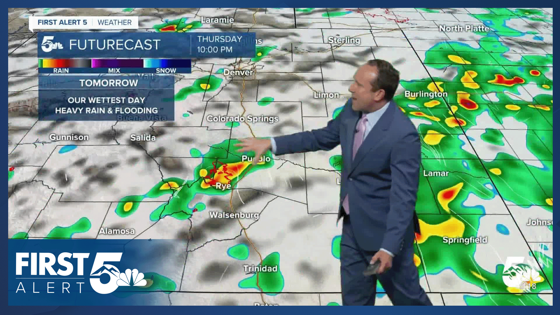
Storms will become better rain producers by Thursday, and flooding will be a concern. While urban areas that are prone to flooding could see some problems on Thursday, the Aspen Acres fire burn scar will also be susceptible to flooding. In this area, a Flash Flood Watch has been issued from Thursday afternoon to late Thursday night.
By Friday, high pressure returns to Colorado and begins to dry us out, with fewer afternoon thunderstorms for the Pikes Peak Region and eastern Plains. Highs on Thursday will cool to the upper 80s before returning to the lower 90s on Friday.
This weekend will be hot and mainly dry, with temperatures rebounding into the middle to upper 90s in Colorado Springs. Highs will warm into the triple digits this weekend in Pueblo.
____
Curious about the First Alert 5 Weather Storm Impact Scale? Check out our cheatsheet explainer.
Watch KOAA News5 on your time, anytime with our free streaming app available for your Roku, FireTV, AppleTV and Android TV. Just search KOAA News5, download and start watching.
