

Today’s Forecast:
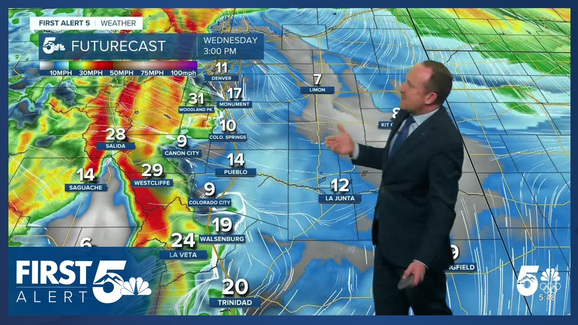
It will be mild today in Southern Colorado and skies will be mainly sunny. It will not be as warm as Tuesday - thanks to a cold front last night - but highs today will still make it into the middle 40s in the Pikes Peak Region. Red Flag Warnings are in place today for the western part of El Paso County, Teller County, Fremont County, and the upper reaches of the Arkansas River Valley. The warnings begin at 11 AM and continue until 6 PM. In these zones, downslope flow will return and winds will gust to 35 mph from late this morning to mid afternoon.
The next dry cold front will arrive tonight.
Colorado Springs forecast: High: 47; Low: 17. The wind will be lighter across the Colorado Springs metro area on Wednesday, with southwesterly breezes turning southeasterly this afternoon. Peak gusts today should stay under 20 mph.
Pueblo forecast: High: 50; Low: 14. Although we will see elevated fire danger in parts of Southern Colorado on Wednesday, fire danger threats will be lower in Pueblo County than what we saw yesterday.
Canon City forecast: High: 53; Low: 25. A Red Flag Warning will go into effect in Fremont County at 11 am, and will continue until 6 pm. Wind gusts to 30 mph and single digit humidities will bring increasing fire danger threats today.
Woodland Park forecast: High: 45; Low: 20. Red Flag Warnings have been issued for Teller County on Wednesday, in effect from 11 am until 6 pm. Wind gusts today could top 35 mph.
Tri-Lakes forecast: High: 40s; Low: 10s/20s. After highs in the 50s on Tuesday, temperatures will cool into the middle to upper 40s this afternoon, with light southerly winds around 5-15 mph
Plains forecast: High: 40s/50s; Low: 10s. Cooler than yesterday, but with less wind and less fire danger. Highs today will warm into the 40s and lower 50s, with further cooling on tap late this week.
Walsenburg and Trinidad forecast: High: 40s/50s; Low: 10s/20s. While not as windy as yesterday, parts of Huerfano County could see gusts today up above 30 mph. Highs today will be cooler than yesterday, topping out in the mid 40s to mid 50s.
Mountains forecast: High: 30s/40s; Low: 10s/20s. Dry skies and sunshine on Wednesday for the southeastern mountains, with gusts this afternoon up around 40 mph. Skies will turn partly cloudy tonight, with partly to mostly cloudy skies tomorrow.
Extended outlook forecast:
Thursday will be cooler, again, due to the next incoming cold front. Skies will start out mostly clear, but clouds will begin to increase by the afternoon - a sign of significant changes to come. High temperatures will ultimately be within a few degrees of today, as the overall airmass and set up remains similar but temperatures will fall more quickly tomorrow afternoon.
By Thursday night, an arctic cold front will blast into Southern Colorado. At the same time, a closed upper-level low will be pivoting into Southern California from the Pacific Ocean, and an upper-level low will be moving in from the north.
On Friday, upslope flow will keep skies overcast in the southeastern tier of the state. It will be dramatically colder, with highs likely reached in the morning and then falling throughout the day. It will also be windy, and the combination of stronger breezes and falling temperatures will lead to significant wind chills at times. These single digit to negative wind chills continue Friday night and during the day on Saturday.
As the northern and southern systems combine, snow will fall in Colorado. On Friday morning, snow begins in the western half of the state, with our parched mountains picking up needed moisture. This snow will continue through the day, and will make travel into the mountains challenging. Light snow is likely in the Pikes Peak Region by mid-day Friday, as upper-level energy overspreads the region combined with upslope flow. The best energy is likely to move in Friday evening into Saturday morning. Additional light snow will continue at times through Saturday.
As the system pivots to our east on Sunday, a few additional flurries will be possible. Overall snow totals in the Pikes Peak Region look to be on the order of a few inches. The extremely cold air will be helpful, as it will create very high rain-to-snow ratios.
This will be a very beneficial storm for the mountains. I expect totals above 1 foot in the San Juans. Much of I-70 and the central mountains are likely to fair similarly with dry powder snow that is excellent for skiing. The snow will come in multiple waves on Friday, Saturday, and into Sunday. This is exactly what we need right now, but will make travel difficult this weekend.
____
Curious about the First Alert 5 Weather Storm Impact Scale? Check out our cheatsheet explainer.
Watch KOAA News5 on your time, anytime with our free streaming app available for your Roku, FireTV, AppleTV and Android TV. Just search KOAA News5, download and start watching.
