

Today’s Forecast:
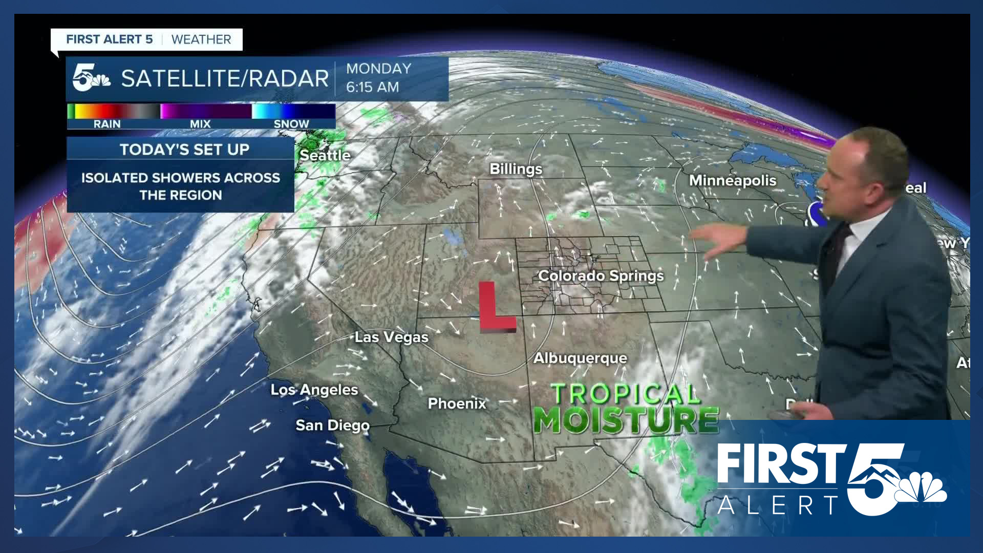
A disturbance moving through Arizona and Utah this morning will bring unsettled skies back to Colorado this afternoon. While showers will favor the mountains today, there will be a slightly better chance of a shower or thunderstorm on the Plains late this afternoon and evening. Storms are not expected to reach severe criteria, with any threats today including heavy downpours, lightning and strong wind gusts.
Highs today will be slightly cooler than the weekend, warming into the 70s and 80s on the Plains, with 60s and 70s for the mountain valleys.
Colorado Springs forecast: High: 76; Low: 47. Late September showers will return to our forecast on Monday, with any threats for rain expected in our area between 3-8 pm.
Pueblo forecast: High: 82; Low: 49. Dry skies this morning will give way to increasing clouds this afternoon and a small chance for showers and thunderstorms. Rain would likely hold off today in the Steel City until after 4-5 pm.
Canon City forecast: High: 79; Low: 52. The work week will begin with warmer than average highs and a chance for showers and thunderstorms. If we do see any rain today, it should wrap up early this evening.
Woodland Park forecast: High: 66; Low: 40. Dry skies this morning will give way to a mild and unsettled afternoon, with scattered showers and thunderstorms anytime after the lunch hour up until early this evening.
Tri-Lakes forecast: High: 60s/70s; Low: 40s. Areas of rain and isolated thunderstorms will move across the Palmer Divide this afternoon as a more active day of weather is expected across Southern Colorado. Storms today will be capable of 45 mph wind gusts, heavy downpours and lightning.
Plains forecast: High: 70s/80s; Low: 40s/50s. After dry skies this weekend, a few showers and isolated thunderstorms will be possible on the Plains on Monday. Grab your umbrella this morning before you head out for the day.
Walsenburg and Trinidad forecast: High: 70s; Low: 40s/50s. A disturbance coming out of Utah and Arizona will bring a chance for rain and thunderstorms to the southern I-25 corridor on Monday, with storms expected to be pretty hit or miss across the region.
Mountains forecast: High: 40s; Low: 20s. Much like what we saw over the weekend, the mountains will see continued chances for rain and thunderstorms this afternoon. Storms could fire up as early as the lunch hour, with storms today capable of heavy downpours, frequent lightning, and strong wind gusts.
Extended outlook forecast:
Starting on Tuesday, drier skies are expected for most of us for the rest of the week. Highs in the Springs will be similar to today, warming into the middle to upper 70s. Highs in Pueblo and Canon City will warm into the lower to middle 80s.
Further warming is expected from Wednesday to Friday as daily highs on the Plains will top out in the 70s and 80s. Another approaching disturbance will bring us breezy southwest winds late this week, with gusts around 20-25 mph. Our next cold front is set to arrive Saturday, with a chance for showers to start the weekend.
____
Curious about the First Alert 5 Weather Storm Impact Scale? Check out our cheatsheet explainer.
Watch KOAA News5 on your time, anytime with our free streaming app available for your Roku, FireTV, AppleTV and Android TV. Just search KOAA News5, download and start watching.
