


Today’s Forecast:
Skies start off partly cloudy again today, due to moisture streaming in from the northwest, as it has for most of the week. A shallow cold front is backing across southern Colorado this morning, which will turn low level winds southeast today. That will tamp down temperatures region-wide. However, due that southeast flow will keep temperatures from climbing as much across southern Colorado - and we'll top out in the low 50s this afternoon. Clouds will clear in the afternoon, and remain mainly clear this evening.
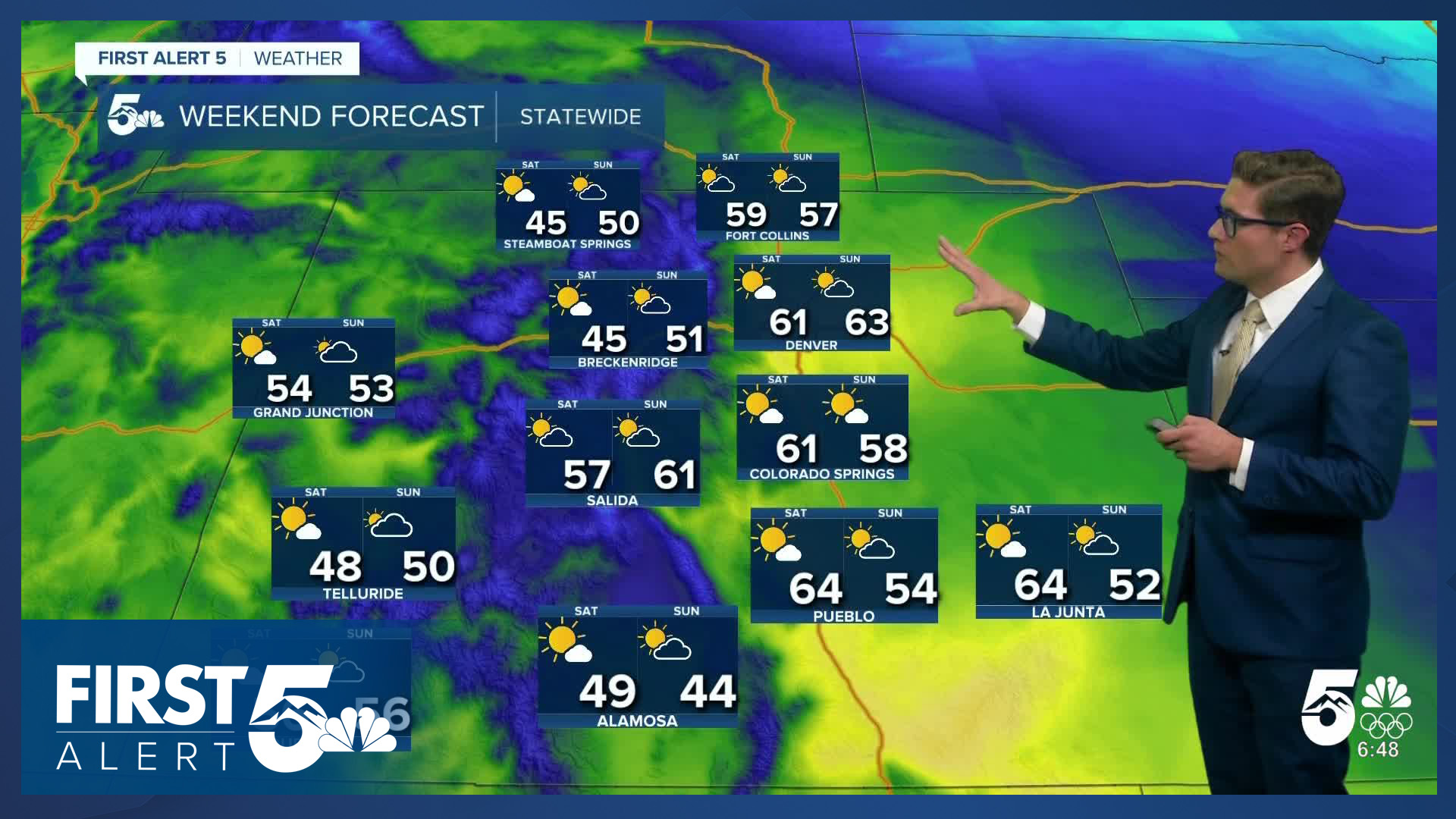
Colorado Springs forecast: High: 52; Low: 32.
Partly cloudy quickly becoming mostly sunny with morning winds out of the southeast, and afternoon winds out of the southwest at 10-15 mph.
Pueblo forecast: High: 55; Low: 28.
Partly cloudy becoming mostly sunny by 9:00 AM with east winds at 5-10 mph, shifting south in the late afternoon.
Canon City forecast: High: 59; Low: 40.
Sunny with highs in the upper 50s, northwest winds at 5-10 mph shifting south in the afternoon.
Woodland Park forecast: High: 50; Low: 32.
Mostly sunny with southwest winds at 10-15 mph.
Tri-Lakes forecast: High: 50s; Low: 30s.
Sunny with southwest winds at 10-15 mph.
Plains forecast: High: 50s; Low: 20s.
Sunny with east winds at 5-10 mph shifting southeast in the afternoon.
Walsenburg and Trinidad forecast: High: 63/65; Low: 39/36.
Sunny with west winds at 10-15 mph.
Mountains forecast: High: 40s; Low: 20s.
Sunny with west winds at 5-10 mph.
Extended outlook forecast:
We'll warm up again Saturday, with yet another backdoor front arriving in the late afternoon. Highs warm to the low 60s and skies stay mainly sunny. The mid-range pattern is similar: warm, mostly sunny to partly cloudy, and periodically breezy. This will lead to periods of elevated fire danger. Saturday will be very dry with single digit humidity values. Winds in gap flow regions may be strong, and they'll need to be watched. More broadly, wind gusts may be elevated but may not reach criteria for warnings.
Sunday is again a bit cooler due to the next weak cold front, but as with all the others this week - it won't do that much.
A weak low will move south of the state late Monday but it lacks moisture, so it won't bring impacts to the area. Temperatures will nudge up with slightly more downsloping on Tuesday, and it will be windy on Wednesday.
____
Curious about the First Alert 5 Weather Storm Impact Scale? Check out our cheatsheet explainer.
Watch KOAA News5 on your time, anytime with our free streaming app available for your Roku, FireTV, AppleTV and Android TV. Just search KOAA News5, download and start watching.
