


Tonight's Forecast:
After a mild afternoon, we're looking at a nice and mellow evening in Southern Colorado. If you're going to be celebrating Valentine's Day tonight instead of on Tuesday, your normal winter jacket should do the trick in helping to keep you warm. Overnight lows mainly cool down to the 20s for the Plains, with a mix of single digits and teens for the mountains and mountain valleys.
Colorado Springs forecast: Low: 28; High: 53; Mostly cloudy skies early will give way to a mild mix of sun and clouds in the Pikes Peak Region by the afternoon, making for a gorgeous end to the weekend.
Pueblo forecast: Low: 25; High: 59; With decreasing clouds expected by the afternoon hours, we should be looking at a pretty nice day for the Steel City on Sunday, with dry skies and above average highs.
Canon City forecast: Low: 33; High: 60; Dry skies and above average highs will make for a gorgeous end to the weekend around Canon City.
Woodland Park forecast: Low: 23; High: 47; After an overcast Saturday, our weather on Sunday should be just as nice temperature wise, with even more sunshine to go around.
Tri-Lakes forecast: Low: 20s/30s; High: 40s/50s; With the potential for a major winter storm in the forecast next week, it'll be tough to complain about the weather on Sunday as we'll see partly cloudy skies and above average temperatures.
Plains forecast: Low: 20s/30s; High: 40s/50s; Not a big change from what we saw today, but a weak cold front dropping into the eastern Plains on Sunday will cool our highs just slightly, with northerly gusts in some areas up near 25 mph.
Walsenburg and Trinidad forecast: Low: 20s/30s; High: 40s/50s; It'll be another really nice day for the southern I-25 corridor on Sunday, with partly cloudy skies, light winds and above average temperatures.
Mountains forecast: Low: 10s/20s; High: 30s/40s; With afternoon highs expected to climb into the 30s and 40s, we're looking at a really nice day in the mountains on Sunday. Get outside and enjoy it because snow returns to our forecast early next week.
Extended outlook forecast:
As we look ahead to next week...not one, but two storms will impact Southern Colorado this coming week. The first storm will be much weaker than the first and with its southerly track, will mostly be a snow maker for the mountains. For the Plains, a light mix of rain and snow showers will be possible Monday afternoon and evening, with overall impacts expected to be fairly limited in the lower elevations.
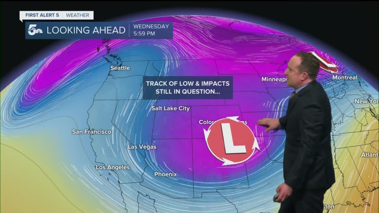
A much larger storm with medium to high impacts is being watched closely for the middle of next week. Snow could start as early as Tuesday evening, with the brunt of the storm expected to impact the Plains and I-25 corridor on Wednesday. While storm specifics are still being worked out, my best advice would be to plan ahead for major travel disruptions on Wednesday due to heavy snow, strong winds, and very cold temperatures.
____
Curious about the First Alert 5 Weather Storm Impact Scale? Check out our cheatsheet explainer.
Watch KOAA News5 on your time, anytime with our free streaming app available for your Roku, FireTV, AppleTV and Android TV. Just search KOAA News5, download and start watching.
