

Today’s Forecast:
Get ready for a beautiful spring day in the Pikes Peak Region and Southern Colorado! After 3 straight days of wind, and various fronts...today is mostly sunny, with highs in the mid-60s to mid-70s on the Plains. You'll want a layer for the first few hours after sunrise this morning! It's been chilly overnight and most of us are beginning our Wednesday with temperatures in the 30s. Take advantage if you can and get outside today - because we're back to active weather over the next two days.
Colorado Springs forecast: High: 66; Low: 38. Today's forecast will hands down be our best day of the week. The wind will be lighter, sunshine will be abundant, and temperatures will be comfortable, topping out in the middle 60s.
Pueblo forecast: High: 73; Low: 37. It's been a dry month so far for the Steel City, and although today will be beautiful, skies won't produce any much needed rain or snow.
Canon City forecast: High: 70; Low: 40. Dry skies, sunshine and light breezes out of the west will make for a beautiful day across eastern Fremont County, with our high today expected to top out near 70 degrees.
Woodland Park forecast: High: 57; Low: 31. Sunshine early will give way to a few fair weather clouds this afternoon, and a beautiful day, with afternoon highs topping out in the upper 50s.
Tri-Lakes forecast: High: 60s; Low: 30s. A break from the wind will feel nice, and might entice you to spend some time outside on this sunny Wednesday. Highs will be a few degrees above average today, topping out in the lower to middle 60s.
Plains forecast: High: 60s/70s; Low: 30s/40s. While it will be breezy in some areas today, gusts should stay under 25 mph. This break from the wind will combine with sunshine and dry skies to deliver a beautiful Wednesday in southeastern Colorado.
Walsenburg and Trinidad forecast: High: 60s; Low: 30s. We can expect sunshine and mild temperatures on Wednesday, along with breezy westerly winds during the afternoon hours. Sustained winds will be around 10-20 mph, with higher gusts in wind prone areas.
Mountains forecast: High: 40s/50s; Low: 20s/30s. Bright, breezy and mild weather on Wednesday will give way to increasing wind and fire threats on Thursday. Friday's forecast will bring snow back to the mountains, with the highest impacts expected north of Highway 50.
Extended outlook forecast:
Our calm weather is short lived as we return to high fire danger on Thursday. April is typically Southern Colorado's gustiest, highest fire danger month. We'll again start with temperatures in the 30s but we'll warm up into the 70s and 80s during the afternoon due to the downslope wind.
Between 12-6 PM, we'll see wind gusts in the 30-45 mph range. Some stronger gusts in the San Luis Valley, and Wet Mountain Valley, are possible.
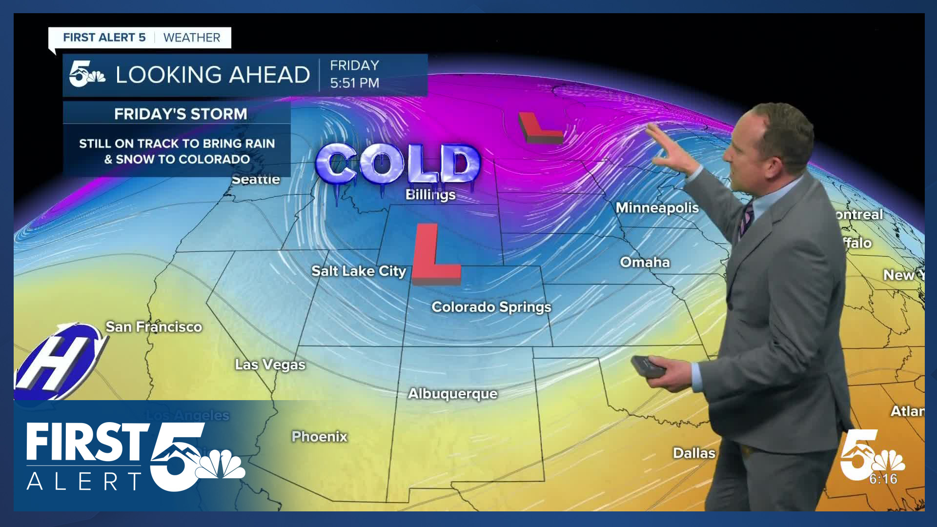
Heading into Friday, an incoming system will split into two pieces, with the northern piece sending a front into Southern Colorado. We'll track increasing chances for showers during the afternoon and evening hours with rain changing to snow. This snow wraps up on Saturday morning.
A HARD FREEZE is expected on both Friday and Saturday nights. If you have started using your sprinkler system, you'll need to drain it before then. If you have started gardening and have sensitive plants, you'll need to bring them inside as well. As a reminder, the average last freeze in Colorado Springs is in early May.
Through the rest of the weekend, skies will be mainly sunny. Saturday will be cool with post frontal air keeping highs near 50 in Colorado Springs. On Sunday, downslope wind return and we warm to near 70 degrees.
____
Curious about the First Alert 5 Weather Storm Impact Scale? Check out our cheatsheet explainer.
Watch KOAA News5 on your time, anytime with our free streaming app available for your Roku, FireTV, AppleTV and Android TV. Just search KOAA News5, download and start watching.
