

Today’s Forecast:
A wet spring storm is on the way to Colorado, as the Pineapple Express funnels moisture into Colorado. At the same time, northern energy and cold air are pushing south. These systems collide over Colorado, producing rain and snow.
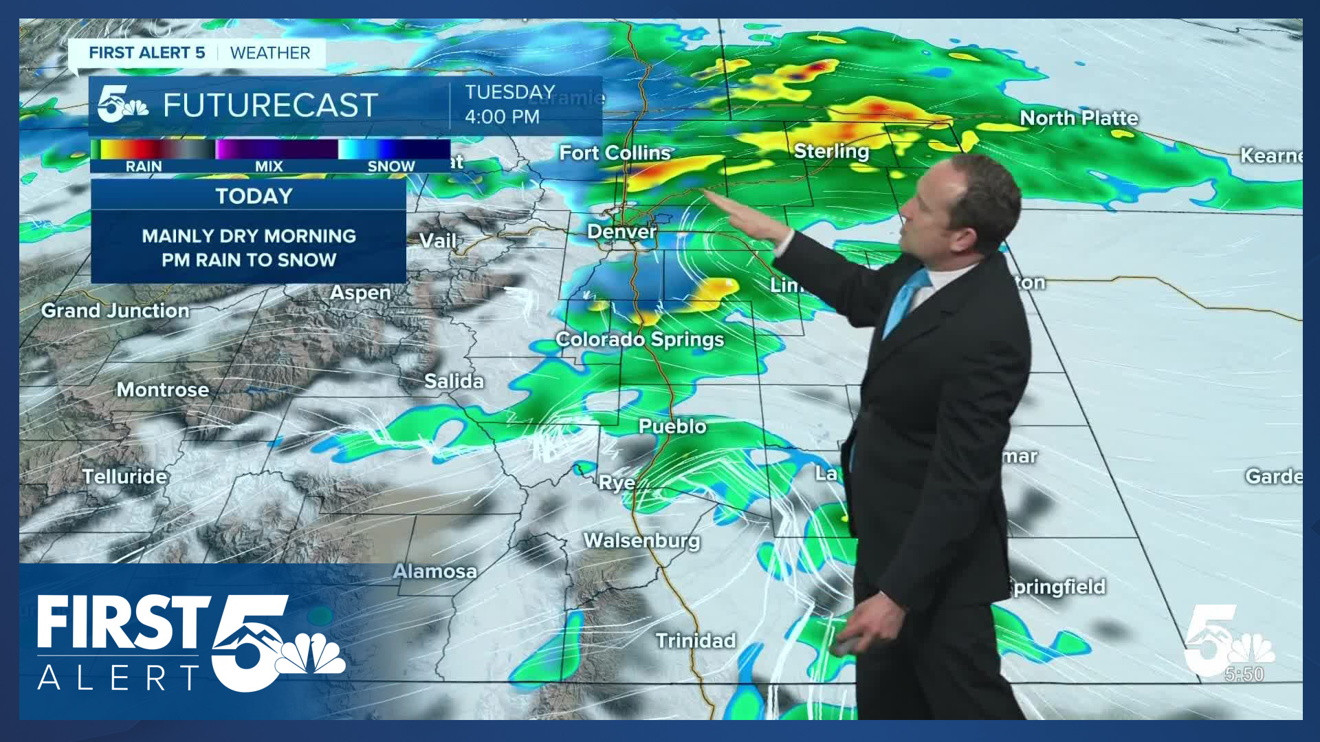
A cold front has already pushed south this morning, and if you're a long-time reader, you know that means we're tracking upslope flow across the area. This will increase moisture and lift heading into the middle of the day. Expect cloudy skies this morning with pockets of fog over the Palmer Divide, with rain showers developing this afternoon. The rain will be moderate in intensity at times later today. Bring the umbrella.
Rain will quickly transition to snow this afternoon over the Palmer Divide, remaining as rain over Colorado Springs until the evening.
Highs today will be similar to the temperatures you walk outside the door to, as we top out in the 40s and 50s.
Colorado Springs forecast: High: 47; Low: 29. A slight chance of showers this morning will give way to the potential for more widespread rain this afternoon and evening. As the cold air arrives after sunset, a changeover to snow will take place, with snow likely into midday Wednesday.
Pueblo forecast: High: 53; Low: 31. Most of the morning hours will be dry, with rain expected to increase late this afternoon and evening. As cold air plunges south, a wintry mix and snow will be possible in Pueblo by Wednesday morning.
Canon City forecast: High: 51; Low: 32. Skies will remain mostly cloudy on Tuesday, with temperatures holding steady in the upper 40s and lower 50s throughout the day. Rain showers will begin to increase this afternoon before mixing in with snow late this evening and Wednesday morning.
Woodland Park forecast: High: 41; Low: 22. Dry skies this morning will give way to increasing snow snow showers by late morning to early afternoon, with that snow becoming heavy at times later tonight into midday Wednesday. A WINTER STORM WARNING will remain in effect in Teller County from noon today to midnight Wednesday night.
Tri-Lakes forecast: High: 40s; Low: 20s. Areas of fog, low clouds and drizzle this morning will give way to increasing rain and snow showers by late morning to early afternoon. This should quickly changeover to snow this evening, with a WINTER STORM WARNING in effect from 6 pm today until 6 pm Wednesday.
Plains forecast: High: 40s/50s; Low: 30s. Rain on the Plains likely won't fill in across Southern Colorado until this afternoon or evening, with a wintry mix or changeover to snow for areas above 5,000 feet later tonight and Wednesday morning. Parts of the I-70 corridor will be under a Winter Weather Advisory from 8 pm tonight to 3 pm Wednesday.
Walsenburg and Trinidad forecast: High: 50s/60s; Low: 20s/30s. Dry skies this morning will give way to increasing rain and snow showers this evening. Overnight showers will continue with perhaps the most impactful part of the storm not expected until Wednesday.
Mountains forecast: High: 30s/40s; Low: 10s/20s. Winter Weather Advisories will go into effect in the southeastern mountains at noon, continuing until midnight tomorrow night. For Pikes Peak, a Winter Storm Warning will go into effect starting at noon today, lasting until midnight tomorrow night. The worst of the weather in our region will occur from late tonight into midday Wednesday.
Extended outlook forecast:
As we approach the evening hours, snow levels will drop steadily, and rain will transition to snow in Colorado Springs. Initially, this snow will just accumulate on your roof, the grass, and on the trees in downtown Colorado Springs, while accumulating on pavement more easily over the Palmer Divide. Later in the evening, you can expect the snow level to drop further, and snow will accumulate on the roads region-wide.
There may be a few overnight breaks in the snow, with additional snow showers developing Wednesday morning. Expect impacts to your Wednesday morning commute. This will be a heavy, wet, dense spring snow. Great for snowball and snowman making, but be careful if shoveling. Treat it like a workout: drink water, and stretch beforehand, take frequent breaks, and listen to your body. The heavy wet snow will also weigh down branches and power lines and may cause sporadic power outages.
Snow continues through midday Wednesday. Through the morning hours, an increase in dry northerly flow will begin, and this will turn off the snow tap in the afternoon. Expect snow to compact quickly.
We expect 2-4" in Colorado Springs downtown, with the potential for 5-10" over Monument Hill, 4-8" at the Air Force Academy, 5-7" in Manitou, 3-5" in Broadmoor, and as much as 6-12" in Woodland Park. Amounts will also be quite high in the southeastern mountains. These are will be under a Winter Weather Advisory during the storm.
A Winter Storm Warning is in effect for N. El Paso County from 6:00 PM tonight - 6:00 PM on Wednesday, and in Teller County from 12:00 PM today to Midnight Wednesday night.

A Hard Freeze will follow this system, with a Freeze Watch in effect from Midnight - 8:00 AM Thursday. Protect your plants now before the snow arrives.
High pressure returns to round out the week with snowmelt sunshine Thursday and Friday. Shower and thunderstorm chances return this weekend.
____
Curious about the First Alert 5 Weather Storm Impact Scale? Check out our cheatsheet explainer.
Watch KOAA News5 on your time, anytime with our free streaming app available for your Roku, FireTV, AppleTV and Android TV. Just search KOAA News5, download and start watching.
